
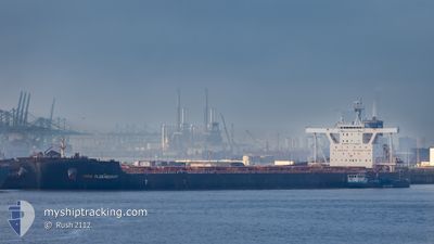
MINA OLDENDORFF
Bulk Carrier
Current Trip
MUNDRA INDIA
| Time Travelled | 45 days |
|---|---|
| Remaining Time | --- |
| Distance Travelled | 11294.04 морская миля |
| Remaining Distance | --- |
| AVG Speed | 10.8 Узлы |
| MAX Speed | 16.3 Узлы |
| AVG Wind | 10.9 knots |
| MAX Wind | 32 knots |
| MIN Temp | 15.9°C / 60.62°F |
| MAX Temp | 31.5°C / 88.7°F |
| Осадка | 17.5 м |
| Позиция Получена | 7 d тому назад |
Current Position
| Долгота | 18.11147° |
|---|---|
| Широта | -34.74782° |
| Статус | Under way using engine |
| Скорость | 10.3 Узлы |
| Курс | 264.1° |
| Район | South Atlantic Ocean |
| Станция | T-AIS |
| Позиция Получена | 7 d тому назад |
Info
Information
The current position of MINA OLDENDORFF is in South Atlantic Ocean with coordinates -34.74782° / 18.11147° as reported on 2024-05-16 17:14 by AIS to our vessel tracker app. The vessel's current speed is 10.3 Узлы
The vessel MINA OLDENDORFF (IMO: 9678795, MMSI: 636016034) is a Bulk Carrier that was built in 2013 ( 11 лет ). It's sailing under the flag of [LR] Liberia.
In this page you can find informations about the vessels current position, last detected port calls, and current voyage information. If the vessels is not in coverage by AIS you will find the latest position.
The current position of MINA OLDENDORFF is detected by our AIS receivers and we are not responsible for the reliability of the data. The last position was recorded while the vessel was in Coverage by the Ais receivers of our vessel tracking app.
The current draught of MINA OLDENDORFF as reported by AIS is 17.5 meters
Weather
| Temperature | 20.8°C / 69.44°F |
|---|---|
| Wind Speed | 21 knots |
| Direction | 88° E |
| Pressure | 1021.9 hPa |
| Humidity | 85.8 % |
| Cloud Coverage | 38 % |
Featured Company
Last Port Calls
| Port | Arrival | Departure | Time In Port |
|---|---|---|---|
| 2024-04-07 03:00 | 2024-04-08 14:16 | 1 d | |
| 2024-03-22 20:16 | 2024-03-26 06:48 | 3 d |
Most Visited Ports (Last year)
| Port | Arrivals | |
|---|---|---|
| 2 | ||
| 1 | ||
| 1 | ||
| 1 | ||
| 1 | ||
| 1 |
Last Trips
| Origin | Departure | Destination | Arrival | Distance | |
|---|---|---|---|---|---|
| 2024-03-26 06:48 | 2024-04-07 03:00 | 2387.01 морская миля | |||
| 2024-02-03 13:50 | 2024-03-22 20:16 | 11555.17 морская миля |
Events
| Время | Событие | Детали | Позиция / Направление | Информация |
|---|---|---|---|---|
| 2024-05-16 17:19 | Статус изменился | Default Under way using engine |
-34.74833 / 18.09166
MUNDRA INDIA
|
Скорость: 10.3 kn Курс: 264.1° |
| 2024-05-16 17:14 | Статус изменился | Under way using engine Default |
-34.74782 / 18.11147
MUNDRA INDIA
|
Скорость: 9 kn Курс: 262° |
| 2024-05-16 17:14 | Вне покрытия |
-34.74782 / 18.11147
South Atlantic Ocean
|
Скорость: 10.3 kn Курс: 264.1° |
|
| 2024-05-16 16:45 | Статус изменился | Default Under way using engine |
-34.74740 / 18.21086
MUNDRA INDIA
|
Скорость: 10.3 kn Курс: 280.6° |
| 2024-05-16 16:17 | Статус изменился | Under way using engine Default |
-34.76162 / 18.30832
MUNDRA INDIA
|
Скорость: 10.5 kn Курс: 281° |
| 2024-05-16 16:13 | Статус изменился | Default Under way using engine |
-34.76366 / 18.32107
MUNDRA INDIA
|
Скорость: 10.4 kn Курс: 280.4° |
| 2024-05-16 15:19 | Изменение морского района | South African part of the South Atlantic Ocean Indian part of the Laccadive Sea |
-34.79635 / 18.50492
South Atlantic Ocean
|
Скорость: 10.2 kn Курс: 286.1° |
| 2024-05-16 15:19 | Статус изменился | Under way using engine Default |
-34.79645 / 18.50543
MUNDRA INDIA
|
Скорость: 10.7 kn Курс: 281° |
| 2024-05-16 15:19 | В покрытии |
-34.79635 / 18.50492
South Atlantic Ocean
|
Скорость: 10.2 kn Курс: 286.1° |