
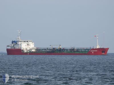
MILLEROVO
Oil Products Tanker
Current Trip
| Time Travelled | 9 days |
|---|---|
| Remaining Time | --- |
| Distance Travelled | 608.97 морская миля |
| Remaining Distance | --- |
| AVG Speed | 7.2 Узлы |
| MAX Speed | 19.9 Узлы |
| AVG Wind | 7.1 knots |
| MAX Wind | 17.6 knots |
| MIN Temp | 21.3°C / 70.34°F |
| MAX Temp | 26.5°C / 79.7°F |
| Осадка | 3.6 м |
| Позиция Получена | 8 d тому назад |
Current Position
| Долгота | 29.63082° |
|---|---|
| Широта | 41.34415° |
| Статус | Under way using engine |
| Скорость | 9.2 Узлы |
| Курс | 86° |
| Район | Black Sea |
| Станция | T-AIS |
| Позиция Получена | 8 d тому назад |
Info
Information
The current position of MILLEROVO is in Black Sea with coordinates 41.34415° / 29.63082° as reported on 2024-08-31 11:20 by AIS to our vessel tracker app. The vessel's current speed is 9.2 Узлы and is heading at the port of TERNEUZEN. The estimated time of arrival as calculated by MyShipTracking vessel tracking app is 2024-09-04 18:00 LT
The vessel MILLEROVO (IMO: 9035541, MMSI: 273351980) is a Oil Products Tanker that was built in 1997 ( 27 лет ). It's sailing under the flag of [RU] Russia.
In this page you can find informations about the vessels current position, last detected port calls, and current voyage information. If the vessels is not in coverage by AIS you will find the latest position.
The current position of MILLEROVO is detected by our AIS receivers and we are not responsible for the reliability of the data. The last position was recorded while the vessel was in Coverage by the Ais receivers of our vessel tracking app.
The current draught of MILLEROVO as reported by AIS is 3.6 meters
Weather
| Temperature | 23.8°C / 74.84°F |
|---|---|
| Wind Speed | 13 knots |
| Direction | 59° ENE |
| Pressure | 1011.8 hPa |
| Humidity | 79.6 % |
| Cloud Coverage | 100 % |
Featured Company
Events
| Время | Событие | Детали | Позиция / Направление | Информация |
|---|---|---|---|---|
| 2024-08-31 11:24 | Статус изменился | Default Under way using engine |
41.34518 / 29.64605
FOR ORDER
|
Скорость: 9.2 kn Курс: 86° |
| 2024-08-31 10:54 | Статус изменился | Under way using engine Default |
41.33897 / 29.54446
FOR ORDER
|
Скорость: 8.6 kn Курс: 69° |
| 2024-08-31 09:56 | Статус изменился | Default Under way using engine |
41.29171 / 29.37212
FOR ORDER
|
Скорость: 8.7 kn Курс: 71.7° |
| 2024-08-31 09:56 | Вне покрытия |
41.29118 / 29.37020
Black Sea
FOR ORDER
|
Скорость: 8.7 kn Курс: 71.7° |
|
| 2024-08-31 08:41 | Изменение морского района | Turkish part of the Black Sea Turkish part of the Sea of Marmara |
41.22995 / 29.15408
Black Sea
FOR ORDER
|
Скорость: 7.7 kn Курс: 47.6° |
| 2024-08-31 03:37 | Начало движения | 11.52 nm, South West of MALTEPE |
40.78028 / 28.94835
FOR ORDER
|
Скорость: 3.3 kn Курс: 358° |
| 2024-08-30 21:26 | Осадка изменилась | 3.6 4.2 |
40.77103 / 28.89153
FOR ORDER
|
Скорость: Курс: 47° |
| 2024-08-30 21:26 | ETA изменился | 2024/09/04 18:00 2024/08/27 18:00 |
40.77103 / 28.89153
FOR ORDER
|
Скорость: Курс: 47° |
| 2024-08-30 17:31 | Окончание движения | 10.66 nm, South of YESILKOY |
40.77913 / 28.85673
FOR ORDER
|
Скорость: Курс: 85° |
| 2024-08-30 15:57 | Начало движения | 2.61 nm, West of YESILKOY |
40.95970 / 28.76850
FOR ORDER
|
Скорость: 3.2 kn Курс: 181° |