
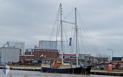
MEANDER
Sailing
Current Trip
LONGYEARBYEN
| Time Travelled | 12 days |
|---|---|
| Remaining Time | --- |
| Distance Travelled | 630.88 морская миля |
| Remaining Distance | --- |
| AVG Speed | 6.9 Узлы |
| MAX Speed | 7.5 Узлы |
| AVG Wind | 7.1 knots |
| MAX Wind | 16.1 knots |
| MIN Temp | -4.3°C / 24.26°F |
| MAX Temp | 3.9°C / 39.02°F |
| Осадка | 2.7 м |
| Позиция Получена | 14 h, 31 m тому назад |
Current Position
| Долгота | 12.01763° |
|---|---|
| Широта | 78.43019° |
| Статус | Under way using engine |
| Скорость | 5.1 Узлы |
| Курс | 89.3° |
| Район | Greenland Sea |
| Станция | T-AIS |
| Позиция Получена | 14 h, 31 m тому назад |
Info
Information
The current position of MEANDER is in Greenland Sea with coordinates 78.43019° / 12.01763° as reported on 2024-05-15 20:17 by AIS to our vessel tracker app. The vessel's current speed is 5.1 Узлы
The vessel MEANDER (MMSI: 244630128) is a Sailing It's sailing under the flag of [NL] Netherlands.
In this page you can find informations about the vessels current position, last detected port calls, and current voyage information. If the vessels is not in coverage by AIS you will find the latest position.
The current position of MEANDER is detected by our AIS receivers and we are not responsible for the reliability of the data. The last position was recorded while the vessel was in Coverage by the Ais receivers of our vessel tracking app.
The current draught of MEANDER as reported by AIS is 2.7 meters
Weather
| Temperature | -2.5°C / 27.5°F |
|---|---|
| Wind Speed | 16 knots |
| Direction | 329° NNW |
| Pressure | 1014.7 hPa |
| Humidity | 75 % |
| Cloud Coverage | 100 % |
Featured Company
Last Port Calls
| Port | Arrival | Departure | Time In Port |
|---|---|---|---|
| 2024-05-03 09:07 | 2024-05-03 11:21 | 2 h | |
| 2024-05-02 19:12 | 2024-05-03 08:57 | 13 h | |
| 2024-04-30 18:14 | 2024-05-01 16:02 | 21 h | |
| 2024-04-24 19:47 | 2024-04-25 18:05 | 22 h | |
| 2024-04-16 09:16 | |||
| 2024-04-06 16:32 | 2024-04-08 08:19 | 1 d | |
| 2024-03-28 07:26 | |||
| 2024-03-19 16:14 | 2024-03-25 00:18 | 5 d | |
| 2024-03-15 03:47 | 2024-03-16 09:40 | 1 d | |
| 2024-03-05 13:03 | 2024-03-12 12:32 | 6 d |
Last Trips
| Origin | Departure | Destination | Arrival | Distance | |
|---|---|---|---|---|---|
| 2024-05-03 10:57 | 2024-05-03 11:07 | 0.57 морская миля | |||
| 2024-05-01 18:02 | 2024-05-02 21:12 | 179.49 морская миля | |||
| 2024-04-25 20:05 | 2024-04-30 20:14 | 211.38 морская миля | |||
| 2024-04-16 11:16 | 2024-04-24 21:47 | 93.30 морская миля | |||
| 2024-03-28 08:26 | 2024-04-06 18:32 | 179.03 морская миля | |||
| 2024-03-16 10:40 | 2024-03-19 17:14 | 521.15 морская миля | |||
| 2024-03-12 13:32 | 2024-03-15 04:47 | 472.60 морская миля | |||
| 2024-03-05 11:35 | 2024-03-05 14:03 | 13.23 морская миля |
Events
| Время | Событие | Детали | Позиция / Направление | Информация |
|---|---|---|---|---|
| 2024-05-15 20:17 | Вне покрытия |
78.43019 / 12.01763
Greenland Sea
|
Скорость: 5.1 kn Курс: 89.3° |
|
| 2024-05-15 20:13 | В покрытии |
78.43338 / 11.98921
Greenland Sea
|
Скорость: 7.2 kn Курс: 126.6° |
|
| 2024-05-14 03:00 | Вне покрытия |
78.92861 / 11.93581
Greenland Sea
|
Скорость: Курс: 511° |
|
| 2024-05-14 02:57 | В покрытии |
78.92861 / 11.93584
Greenland Sea
|
Скорость: Курс: 511° |
|
| 2024-05-12 16:29 | Вне покрытия |
78.77574 / 11.38635
Greenland Sea
|
Скорость: 7.4 kn Курс: 347.4° |
|
| 2024-05-12 15:29 | В покрытии |
78.69416 / 11.29082
Greenland Sea
|
Скорость: 5.5 kn Курс: 335.1° |
|
| 2024-05-11 15:18 | Вне покрытия |
78.13492 / 14.85821
Greenland Sea
|
Скорость: 5.7 kn Курс: 275.8° |
|
| 2024-05-11 15:09 | В покрытии |
78.13309 / 14.92095
Greenland Sea
|
Скорость: 5.4 kn Курс: 275.1° |