

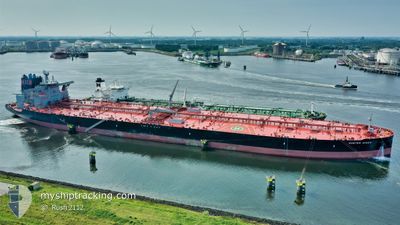
MARAN MARS
Tanker

Current Trip
| Time Travelled | 27 days |
|---|---|
| Remaining Time | 4 days |
| Distance Travelled | 5084.55 морская миля |
| Remaining Distance | 1639.16 морская миля |
| AVG Speed | 10.3 Узлы |
| MAX Speed | 15.5 Узлы |
| AVG Wind | 8 knots |
| MAX Wind | 22 knots |
| MIN Temp | 24.4°C / 75.92°F |
| MAX Temp | 29.5°C / 85.1°F |
| Осадка | 11 м |
| Позиция Получена | 17 d тому назад |
Current Position
| Долгота | --- |
|---|---|
| Широта | --- |
| Статус | Under way using engine |
| Скорость | 10.4 Узлы |
| Курс | 323.8° |
| Район | Laccadive Sea |
| Станция | T-AIS |
| Позиция Получена | 17 d тому назад |
Information
The current position of MARAN MARS is in Laccadive Sea with coordinates 8.53689° / 75.69776° as reported on 2025-03-10 13:18 by AIS to our vessel tracker app. The vessel's current speed is 10.4 Узлы and is heading at the port of RAS TANURA. The estimated time of arrival as calculated by MyShipTracking vessel tracking app is 2025-04-01 13:49 LT
The vessel MARAN MARS (IMO: 9858046, MMSI: 538008423) is a Tanker It's sailing under the flag of [MH] Marshall Is.
In this page you can find informations about the vessels current position, last detected port calls, and current voyage information. If the vessels is not in coverage by AIS you will find the latest position.
The current position of MARAN MARS is detected by our AIS receivers and we are not responsible for the reliability of the data. The last position was recorded while the vessel was in Coverage by the Ais receivers of our vessel tracking app.
The current draught of MARAN MARS as reported by AIS is 11 meters
Weather
| Temperature | 29.1°C / 84.38°F |
|---|---|
| Wind Speed | 11 knots |
| Direction | 337° NNW |
| Pressure | 1009.2 hPa |
| Humidity | 72.9 % |
| Cloud Coverage | 2 % |


Featured Company
Last Port Calls
| Port | Arrival | Departure | Time In Port |
|---|---|---|---|
| 2025-02-26 04:26 | 2025-02-28 07:01 | 2 d | |
| 2025-02-08 01:13 | 2025-02-09 01:23 | 1 d |
Most Visited Ports (Last year)
| Port | Arrivals | |
|---|---|---|
| 2 | ||
| 1 | ||
| 1 | ||
| 1 |
Last Trips
| Origin | Departure | Destination | Arrival | Distance | |
|---|---|---|---|---|---|
| 2025-02-09 01:23 | 2025-02-26 04:26 | 4601.94 морская миля |
Events
| Время | Событие | Детали | Позиция / Направление | Информация |
|---|---|---|---|---|
| 2025-03-23 21:05 | Начало движения | 3.29 nm, North of MINA AL FAHL |
23.69060 / 58.52529
SA RTA
|
Скорость: 3.4 kn Курс: 4° |
| 2025-03-21 07:17 | Окончание движения | 3.74 nm, North East of MINA AL FAHL |
23.68863 / 58.54824
SA RTA
|
Скорость: 0.1 kn Курс: 115° |
| 2025-03-21 05:58 | Начало движения | 6.11 nm, North West of MINA AL FAHL |
23.71677 / 58.43854
SA RTA
|
Скорость: 3.5 kn Курс: 149° |
| 2025-03-20 19:20 | Окончание движения | 6.29 nm, North West of MINA AL FAHL |
23.72077 / 58.43853
SA RTA
|
Скорость: 0.3 kn Курс: 82° |
| 2025-03-19 20:14 | Начало движения |
22.95130 / 62.05235
SA RTA
|
Скорость: 4 kn Курс: 358° |
|
| 2025-03-18 18:09 | Окончание движения |
22.59527 / 61.63518
SA RTA
|
Скорость: 0.3 kn Курс: 200° |
|
| 2025-03-18 14:34 | Начало движения |
22.89271 / 61.90282
SA RTA
|
Скорость: 3.4 kn Курс: 147° |
|
| 2025-03-17 23:57 | Окончание движения |
22.61443 / 61.61720
SA RTA
|
Скорость: 0.3 kn Курс: 204° |
|
| 2025-03-17 21:39 | Начало движения |
22.86234 / 61.77856
SA RTA
|
Скорость: 4.8 kn Курс: 200° |