
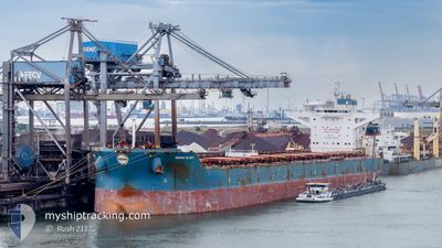
MARAN GLORY
Bulk Carrier
Current Trip
| Time Travelled | 6 days |
|---|---|
| Remaining Time | --- |
| Distance Travelled | 1444.15 морская миля |
| Remaining Distance | --- |
| AVG Speed | 9.9 Узлы |
| MAX Speed | 11.5 Узлы |
| AVG Wind | 4.8 knots |
| MAX Wind | 12 knots |
| MIN Temp | 26.1°C / 78.98°F |
| MAX Temp | 30.4°C / 86.72°F |
| Осадка | 18.3 м |
| Позиция Получена | 6 d тому назад |
Current Position
| Долгота | --- |
|---|---|
| Широта | --- |
| Статус | Under way using engine |
| Скорость | 10.4 Узлы |
| Курс | 3° |
| Район | Indian Ocean |
| Станция | T-AIS |
| Позиция Получена | 6 d тому назад |
Info
Information
The current position of MARAN GLORY is in Indian Ocean with coordinates -19.93568° / 118.46023° as reported on 2025-03-11 16:27 by AIS to our vessel tracker app. The vessel's current speed is 10.4 Узлы and is heading at the port of QINGDAO. The estimated time of arrival as calculated by MyShipTracking vessel tracking app is 2025-03-25 04:00 LT
The vessel MARAN GLORY (IMO: 9434383, MMSI: 241149000) is a Bulk Carrier that was built in 2012 ( 13 лет ). It's sailing under the flag of [GR] Greece.
In this page you can find informations about the vessels current position, last detected port calls, and current voyage information. If the vessels is not in coverage by AIS you will find the latest position.
The current position of MARAN GLORY is detected by our AIS receivers and we are not responsible for the reliability of the data. The last position was recorded while the vessel was in Coverage by the Ais receivers of our vessel tracking app.
The current draught of MARAN GLORY as reported by AIS is 18.3 meters
Weather
| Temperature | 27.4°C / 81.32°F |
|---|---|
| Wind Speed | 9 knots |
| Direction | 348° NNW |
| Pressure | 1008 hPa |
| Humidity | 80.4 % |
| Cloud Coverage | 86 % |
Featured Company
Last Port Calls
| Port | Arrival | Departure | Time In Port |
|---|---|---|---|
| 2025-03-10 17:47 | 2025-03-11 21:41 | 1 d | |
| 2025-02-21 12:37 | 2025-02-26 07:05 | 4 d | |
| 2025-01-21 22:59 | 2025-01-26 11:27 | 4 d |
Most Visited Ports (Last year)
| Port | Arrivals | |
|---|---|---|
| 1 | ||
| 1 | ||
| 1 | ||
| 1 | ||
| 1 | ||
| 1 |
Last Trips
| Origin | Departure | Destination | Arrival | Distance | |
|---|---|---|---|---|---|
| 2025-02-26 07:05 | 2025-03-10 17:47 | 2474.35 морская миля | |||
| 2025-01-26 11:27 | 2025-02-21 12:37 | 2703.54 морская миля | |||
| 2024-12-02 22:02 | 2025-01-21 22:59 | 11870.04 морская миля |
Events
| Время | Событие | Детали | Позиция / Направление | Информация |
|---|---|---|---|---|
| 2025-03-11 16:32 | Статус изменился | Default Under way using engine |
-19.92202 / 118.45718
CN QDG
|
Скорость: 10.4 kn Курс: 3° |
| 2025-03-11 16:27 | Вне покрытия |
-19.93568 / 118.46023
Indian Ocean
CN QDG
|
Скорость: 10.4 kn Курс: 3° |
|
| 2025-03-11 16:13 | Статус изменился | Under way using engine Default |
-19.97622 / 118.44588
CN QDG
|
Скорость: 10.7 kn Курс: 23° |
| 2025-03-11 16:02 | Статус изменился | Default Under way using engine |
-20.00463 / 118.43255
CN QDG
|
Скорость: 10.3 kn Курс: 23° |
| 2025-03-11 15:32 | Статус изменился | Under way using engine Default |
-20.08418 / 118.43668
CN QDG
|
Скорость: 10.7 kn Курс: 305° |
| 2025-03-11 15:29 | Статус изменился | Default Under way using engine |
-20.08938 / 118.44448
CN QDG
|
Скорость: 10.7 kn Курс: 306° |
| 2025-03-11 13:41 | ПОРТ ОТПРАВЛЕНИЯ |
|
-20.30313 / 118.57988
CN QDG
|
Скорость: 5.9 kn Курс: 44° |
| 2025-03-11 13:21 | Начало движения |
-20.32525 / 118.57077
[AU] PORT HEDLAND
|
Скорость: 3.1 kn Курс: 24° |
|
| 2025-03-11 12:45 | Пункт назначения изменился | CN QDG PHE PBG |
-20.32700 / 118.56728
[AU] PORT HEDLAND
|
Скорость: Курс: 37° |
| 2025-03-11 12:45 | ETA изменился | 2025/03/24 20:00 2025/03/10 09:00 |
-20.32700 / 118.56728
[AU] PORT HEDLAND
|
Скорость: Курс: 37° |