
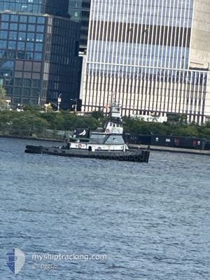
MADDIE K
Tug
Current Trip
US^108N>0KV1
Unknown Port
ETA*
---
| Time Travelled | 5 h, 33 mins |
|---|---|
| Remaining Time | --- |
| Distance Travelled | 26.80 морская миля |
| Remaining Distance | --- |
| AVG Speed | 4.6 Узлы |
| MAX Speed | 8.7 Узлы |
| AVG Wind | 3.1 knots |
| MAX Wind | 5 knots |
| MIN Temp | 3.2°C / 37.76°F |
| MAX Temp | 6.3°C / 43.34°F |
| Осадка | 0 м |
| Позиция Получена | 1 m тому назад |
Current Position
| Долгота | --- |
|---|---|
| Широта | --- |
| Статус | Pushing Ahead - Towing |
| Скорость | 0.1 Узлы |
| Курс | --- |
| Район | North Atlantic Ocean |
| Станция | T-AIS |
| Позиция Получена | 1 m тому назад |
Info
info
Information
The current position of MADDIE K is in North Atlantic Ocean with coordinates 41.04168° / -73.54542° as reported on 2026-01-08 19:30 by AIS to our vessel tracker app. The vessel's current speed is 0.1 Узлы
The vessel MADDIE K (MMSI: 366998820) is a Tug It's sailing under the flag of [US] USA.
In this page you can find informations about the vessels current position, last detected port calls, and current voyage information. If the vessels is not in coverage by AIS you will find the latest position.
The current position of MADDIE K is detected by our AIS receivers and we are not responsible for the reliability of the data. The last position was recorded while the vessel was in Coverage by the Ais receivers of our vessel tracking app.
Weather
| Temperature | 6.3°C / 43.34°F |
|---|---|
| Wind Speed | 3 knots |
| Direction | 295° WNW |
| Pressure | 1022.8 hPa |
| Humidity | 69.4 % |
| Cloud Coverage | 3 % |
Featured Company
Limited time offer - Install a base station receiver to your area and list your company on MyShipTracking Free forever!
Last Port Calls
| Port | Arrival | Departure | Time In Port |
|---|---|---|---|
| 2026-01-06 22:19 | 2026-01-08 08:58 | 1 d | |
| 2026-01-03 20:38 | 2026-01-06 19:51 | 2 d | |
| 2025-12-27 21:34 | 2026-01-03 19:18 | 6 d | |
| 2025-12-27 13:20 | 2025-12-27 19:30 | 6 h | |
| 2025-12-21 13:19 | 2025-12-27 11:58 | 5 d | |
| 2025-12-19 21:28 | 2025-12-20 09:59 | 12 h | |
| 2025-12-19 14:59 | 2025-12-19 17:52 | 2 h | |
| 2025-12-19 00:28 | 2025-12-19 11:36 | 11 h | |
| 2025-12-18 12:11 | 2025-12-18 15:23 | 3 h | |
| 2025-12-16 13:40 | 2025-12-17 08:57 | 19 h |
Most Visited Ports (Last year)
| Port | Arrivals | |
|---|---|---|
| 107 | ||
| 43 | ||
| 34 | ||
| 27 | ||
| 25 | ||
| 12 |
Last Trips
| Origin | Departure | Destination | Arrival | Distance | |
|---|---|---|---|---|---|
| 2026-01-06 19:51 | 2026-01-06 22:19 | 15.48 морская миля | |||
| 2026-01-03 19:18 | 2026-01-03 20:38 | 9.17 морская миля | |||
| 2025-12-27 19:30 | 2025-12-27 21:34 | 15.76 морская миля | |||
| 2025-12-27 11:58 | 2025-12-27 13:20 | 9.36 морская миля | |||
| 2025-12-20 09:59 | 2025-12-21 13:19 | 85.83 морская миля | |||
| 2025-12-19 17:52 | 2025-12-19 21:28 | 13.26 морская миля | |||
| 2025-12-19 11:36 | 2025-12-19 14:59 | 8.02 морская миля | |||
| 2025-12-18 15:23 | 2025-12-19 00:28 | 36.55 морская миля | |||
| 2025-12-17 08:57 | 2025-12-18 12:11 | 105.03 морская миля | |||
| 2025-12-16 04:03 | 2025-12-16 13:40 | 39.84 морская миля |
Events
| Время | Событие | Детали | Позиция / Направление | Информация |
|---|---|---|---|---|
| 2026-01-08 18:58 | Окончание движения | 16.97 nm, North East of KINGS POINT |
41.04055 / -73.54511
US^108N>0KV1
|
Скорость: 0.3 kn Курс: 511° |
| 2026-01-08 18:31 | Начало движения | 16.23 nm, North East of KINGS POINT |
41.02041 / -73.53739
US^108N>0KV1
|
Скорость: 4.4 kn Курс: 11.3° |
| 2026-01-08 18:20 | Окончание движения | 16.12 nm, North East of KINGS POINT |
41.01873 / -73.53832
US^108N>0KV1
|
Скорость: 0.2 kn Курс: 511° |
| 2026-01-08 17:29 | Пункт назначения изменился | US^108N>0KV1 EAST CHESTER CREEK |
40.97386 / -73.58645
US^108N>0KV1
|
Скорость: 4.4 kn Курс: 33.1° |
| 2026-01-08 16:57 | В покрытии |
40.95508 / -73.61713
North Atlantic Ocean
|
Скорость: 2 kn Курс: 4° |
|
| 2026-01-08 16:56 | Статус изменился | Pushing Ahead - Towing Default |
40.95399 / -73.61777
EAST CHESTER CREEK
|
Скорость: 6.1 kn Курс: 57° |
| 2026-01-08 14:04 | Статус изменился | Default Pushing Ahead - Towing |
40.78091 / -73.92385
EAST CHESTER CREEK
|
Скорость: 7.7 kn Курс: 93.1° |
| 2026-01-08 14:01 | Статус изменился | Pushing Ahead - Towing Default |
40.77950 / -73.93108
EAST CHESTER CREEK
|
Скорость: 5.8 kn Курс: -1° |
| 2026-01-08 14:01 | Вне покрытия |
40.77950 / -73.93108
North Atlantic Ocean
|
Скорость: 7.7 kn Курс: 93.1° |
|
| 2026-01-08 13:58 | ПОРТ ОТПРАВЛЕНИЯ |
|
40.77832 / -73.93715
EAST CHESTER CREEK
|
Скорость: 7 kn Курс: -1° |