
LEYLA KALKAVAN
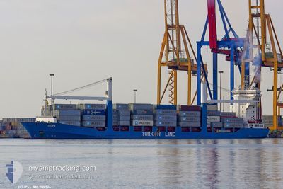
Container Ship
Current Trip
GEPTI
| Time Travelled | 1 day |
|---|---|
| Remaining Time | --- |
| Distance Travelled | 368.63 морская миля |
| Remaining Distance | --- |
| AVG Speed | 14.4 Узлы |
| MAX Speed | 15.3 Узлы |
| AVG Wind | 9.7 knots |
| MAX Wind | 16.5 knots |
| MIN Temp | 6.7°C / 44.06°F |
| MAX Temp | 12°C / 53.6°F |
| Осадка | 8.2 м |
| Позиция Получена | 6 d тому назад |
Current Position
| Долгота | --- |
|---|---|
| Широта | --- |
| Статус | Under way using engine |
| Скорость | 14.1 Узлы |
| Курс | 61.8° |
| Район | Black Sea |
| Станция | T-AIS |
| Позиция Получена | 6 d тому назад |
Info
Information
The current position of LEYLA KALKAVAN is in Black Sea with coordinates 41.26967° / 29.22261° as reported on 2025-12-30 21:55 by AIS to our vessel tracker app. The vessel's current speed is 14.1 Узлы
The vessel LEYLA KALKAVAN (IMO: 9126924, MMSI: 271044978) is a Container Ship that was built in 1997 ( 29 лет ). It's sailing under the flag of [TR] Turkey.
In this page you can find informations about the vessels current position, last detected port calls, and current voyage information. If the vessels is not in coverage by AIS you will find the latest position.
The current position of LEYLA KALKAVAN is detected by our AIS receivers and we are not responsible for the reliability of the data. The last position was recorded while the vessel was in Coverage by the Ais receivers of our vessel tracking app.
The current draught of LEYLA KALKAVAN as reported by AIS is 8.2 meters
Weather
| Temperature | 11.6°C / 52.88°F |
|---|---|
| Wind Speed | 11 knots |
| Direction | 99° E |
| Pressure | 1018.5 hPa |
| Humidity | 81.4 % |
| Cloud Coverage | 100 % |
Featured Company
Last Port Calls
| Port | Arrival | Departure | Time In Port |
|---|---|---|---|
| 2026-01-04 00:33 | 2026-01-04 23:52 | 23 h | |
| 2025-12-28 17:34 | 2025-12-29 00:27 | 6 h | |
| 2025-12-26 17:34 | 2025-12-27 09:23 | 15 h | |
| 2025-12-23 08:39 | 2025-12-24 01:20 | 16 h | |
| 2025-12-19 17:29 | 2025-12-20 23:06 | 1 d | |
| 2025-12-13 08:59 | 2025-12-13 19:53 | 10 h | |
| 2025-12-12 05:50 | 2025-12-12 19:44 | 13 h | |
| 2025-12-09 02:17 | 2025-12-09 15:36 | 13 h | |
| 2025-12-05 16:33 | 2025-12-06 23:49 | 1 d | |
| 2025-11-29 21:37 | 2025-11-30 05:44 | 8 h |
Last Trips
| Origin | Departure | Destination | Arrival | Distance | |
|---|---|---|---|---|---|
| 2025-12-29 00:27 | 2026-01-04 00:33 | 761.00 морская миля | |||
| 2025-12-27 09:23 | 2025-12-28 17:34 | 11.09 морская миля | |||
| 2025-12-24 01:20 | 2025-12-26 17:34 | 58.66 морская миля | |||
| 2025-12-20 23:06 | 2025-12-23 08:39 | 661.13 морская миля | |||
| 2025-12-13 19:53 | 2025-12-19 17:29 | 619.64 морская миля | |||
| 2025-12-12 19:44 | 2025-12-13 08:59 | 8.04 морская миля | |||
| 2025-12-09 15:36 | 2025-12-12 05:50 | 56.93 морская миля | |||
| 2025-12-06 23:49 | 2025-12-09 02:17 | 652.68 морская миля | |||
| 2025-11-30 05:44 | 2025-12-05 16:33 | 618.60 морская миля | |||
| 2025-11-29 03:09 | 2025-11-29 21:37 | 13.13 морская миля |
Events
| Время | Событие | Детали | Позиция / Направление | Информация |
|---|---|---|---|---|
| 2026-01-04 19:52 | ПОРТ ОТПРАВЛЕНИЯ |
|
42.16286 / 41.64295
GEPTI
|
Скорость: 6.4 kn Курс: 340° |
| 2026-01-04 19:49 | Начало движения |
42.15798 / 41.64859
[GE] POTI
|
Скорость: 6.4 kn Курс: 340° |
|
| 2026-01-03 20:57 | Окончание движения |
42.15174 / 41.65379
[GE] POTI
|
Скорость: 0.1 kn Курс: 277° |
|
| 2026-01-03 20:33 | Порт |
|
42.15754 / 41.64867
[GE] POTI
|
Скорость: 5.2 kn Курс: 118° |
| 2026-01-03 19:57 | Начало движения | 2.16 nm, West of POTI |
42.16649 / 41.60274
GEPTI
|
Скорость: 3.7 kn Курс: 53° |
| 2026-01-03 09:24 | Окончание движения | 2.33 nm, West of POTI |
42.16179 / 41.59765
GEPTI
|
Скорость: 0.2 kn Курс: 110° |
| 2026-01-02 17:36 | Начало движения |
42.16882 / 41.01673
GEPTI
|
Скорость: 6.8 kn Курс: 67° |
|
| 2026-01-02 05:51 | Окончание движения |
42.20072 / 40.92139
GEPTI
|
Скорость: 0.3 kn Курс: 222° |
|
| 2026-01-01 20:37 | Начало движения |
42.37441 / 41.03136
GEPTI
|
Скорость: 5.9 kn Курс: 41° |
|
| 2026-01-01 20:17 | Окончание движения |
42.37522 / 41.01691
GEPTI
|
Скорость: 0.2 kn Курс: 323° |