
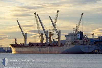
LADY SACHA
Bulk Carrier
Current Trip
| Time Travelled | 12 days |
|---|---|
| Remaining Time | 16 h, 19 mins |
| Distance Travelled | 1791.74 морская миля |
| Remaining Distance | 212.44 морская миля |
| AVG Speed | 11.7 Узлы |
| MAX Speed | 16.4 Узлы |
| AVG Wind | 12.1 knots |
| MAX Wind | 25 knots |
| MIN Temp | 19.1°C / 66.38°F |
| MAX Temp | 27.3°C / 81.14°F |
| Осадка | 5.4 м |
| Позиция Получена | 1 m тому назад |
Current Position
| Долгота | 25.47023° |
|---|---|
| Широта | 39.22318° |
| Статус | Under way using engine |
| Скорость | 12.5 Узлы |
| Курс | 24.5° |
| Район | Aegean Sea |
| Станция | T-AIS |
| Позиция Получена | 1 m тому назад |
Info
Information
The current position of LADY SACHA is in Aegean Sea with coordinates 39.22318° / 25.47023° as reported on 2024-09-17 18:04 by AIS to our vessel tracker app. The vessel's current speed is 12.5 Узлы and is heading at the port of ISTANBUL. The estimated time of arrival as calculated by MyShipTracking vessel tracking app is 2024-09-18 10:25 LT
The vessel LADY SACHA (IMO: 9299460, MMSI: 314542000) is a Bulk Carrier that was built in 2004 ( 20 лет ). It's sailing under the flag of [BB] Barbados.
In this page you can find informations about the vessels current position, last detected port calls, and current voyage information. If the vessels is not in coverage by AIS you will find the latest position.
The current position of LADY SACHA is detected by our AIS receivers and we are not responsible for the reliability of the data. The last position was recorded while the vessel was in Coverage by the Ais receivers of our vessel tracking app.
The current draught of LADY SACHA as reported by AIS is 5.4 meters
Weather
| Temperature | 24.3°C / 75.74°F |
|---|---|
| Wind Speed | 15 knots |
| Direction | 17° NNE |
| Pressure | 1014.9 hPa |
| Humidity | 69.8 % |
| Cloud Coverage | 31 % |
Featured Company
Last Port Calls
| Port | Arrival | Departure | Time In Port |
|---|---|---|---|
| 2024-09-05 03:28 | 2024-09-05 04:03 | 35 m | |
| 2024-08-24 16:51 | 2024-08-27 15:05 | 2 d | |
| 2024-08-05 05:41 | 2024-08-16 05:00 | 10 d | |
| 2024-07-20 08:29 | |||
| 2024-07-16 11:57 | 2024-07-18 11:57 | 1 d | |
| 2024-07-12 10:20 | 2024-07-16 11:54 | 4 d |
Most Visited Ports (Last year)
| Port | Arrivals | |
|---|---|---|
| 6 | ||
| 5 | ||
| 3 | ||
| 3 | ||
| 2 | ||
| 1 |
Last Trips
| Origin | Departure | Destination | Arrival | Distance | |
|---|---|---|---|---|---|
| 2024-08-27 18:05 | 2024-09-05 05:28 | 2325.12 морская миля | |||
| 2024-08-16 08:00 | 2024-08-24 19:51 | 803.68 морская миля | |||
| 2024-07-18 13:57 | 2024-07-20 11:29 | 525.98 морская миля | |||
| 2024-07-16 13:54 | 2024-07-16 13:57 | 0.64 морская миля |
Events
| Время | Событие | Детали | Позиция / Направление | Информация |
|---|---|---|---|---|
| 2024-09-17 16:33 | Статус изменился | Under way using engine Default |
38.93042 / 25.30192
TR IST
|
Скорость: 12.9 kn Курс: 27° |
| 2024-09-17 16:26 | Статус изменился | Default Under way using engine |
38.90902 / 25.28804
TR IST
|
Скорость: 13 kn Курс: 27.5° |
| 2024-09-17 15:27 | Статус изменился | Under way using engine Default |
38.71432 / 25.16409
TR IST
|
Скорость: 13.1 kn Курс: 25° |
| 2024-09-17 15:20 | Статус изменился | Default Under way using engine |
38.69053 / 25.14962
TR IST
|
Скорость: 13.1 kn Курс: 25° |
| 2024-09-17 02:11 | Изменение морского района | Greek part of the Aegean Sea Greek part of the Mediterranean Sea - Eastern Basin |
36.40579 / 23.05633
Aegean Sea
TR IST
|
Скорость: 13.8 kn Курс: 101° |
| 2024-09-17 02:01 | Статус изменился | Under way using engine Default |
36.41017 / 23.00924
TR IST
|
Скорость: 13.6 kn Курс: 82° |
| 2024-09-17 01:42 | Статус изменился | Default Under way using engine |
36.41133 / 22.92257
TR IST
|
Скорость: 13.5 kn Курс: 81.2° |
| 2024-09-17 01:11 | Статус изменился | Under way using engine Default |
36.38680 / 22.78013
TR IST
|
Скорость: 13.6 kn Курс: 68° |
| 2024-09-17 01:11 | В покрытии |
36.38746 / 22.78218
Mediterranean Sea - Eastern Basin
TR IST
|
Скорость: 13.3 kn Курс: 68.1° |
|
| 2024-09-16 23:59 | Вне покрытия |
36.34377 / 22.45479
Mediterranean Sea - Eastern Basin
TR IST
|
Скорость: 13.6 kn Курс: 90.1° |