
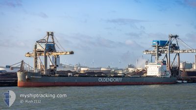
KIRSTEN OLDENDORFF
Cargo
Current Trip
| Time Travelled | 10 days |
|---|---|
| Remaining Time | --- |
| Distance Travelled | 3133.50 морская миля |
| Remaining Distance | --- |
| AVG Speed | 12.5 Узлы |
| MAX Speed | 18.5 Узлы |
| AVG Wind | 13.6 knots |
| MAX Wind | 31.9 knots |
| MIN Temp | 1.8°C / 35.24°F |
| MAX Temp | 11.4°C / 52.52°F |
| Осадка | 8.6 м |
| Позиция Получена | 8 d тому назад |
Current Position
| Долгота | -4.47160° |
|---|---|
| Широта | 58.72013° |
| Статус | Under way using engine |
| Скорость | 12.8 Узлы |
| Курс | 270.6° |
| Район | North Atlantic Ocean |
| Станция | T-AIS |
| Позиция Получена | 8 d тому назад |
Info
Information
The current position of KIRSTEN OLDENDORFF is in North Atlantic Ocean with coordinates 58.72013° / -4.47160° as reported on 2024-04-29 20:42 by AIS to our vessel tracker app. The vessel's current speed is 12.8 Узлы and is heading at the port of NEWPORT. The estimated time of arrival as calculated by MyShipTracking vessel tracking app is 2024-05-10 05:00 LT
The vessel KIRSTEN OLDENDORFF (IMO: 9863091, MMSI: 636019972) is a Cargo It's sailing under the flag of [LR] Liberia.
In this page you can find informations about the vessels current position, last detected port calls, and current voyage information. If the vessels is not in coverage by AIS you will find the latest position.
The current position of KIRSTEN OLDENDORFF is detected by our AIS receivers and we are not responsible for the reliability of the data. The last position was recorded while the vessel was in Coverage by the Ais receivers of our vessel tracking app.
The current draught of KIRSTEN OLDENDORFF as reported by AIS is 8.6 meters
Weather
| Temperature | 9.5°C / 49.1°F |
|---|---|
| Wind Speed | 4 knots |
| Direction | 313° NW |
| Pressure | 1007.4 hPa |
| Humidity | 89.1 % |
| Cloud Coverage | 70 % |
Featured Company
Last Port Calls
| Port | Arrival | Departure | Time In Port |
|---|---|---|---|
| 2024-04-22 02:19 | 2024-04-27 22:44 | 5 d | |
| 2024-03-28 22:09 | 2024-03-31 10:37 | 2 d | |
| 2024-03-28 17:28 | 2024-03-28 17:43 | 14 m | |
| 2024-03-13 16:22 | 2024-03-19 21:20 | 6 d |
Last Trips
| Origin | Departure | Destination | Arrival | Distance | |
|---|---|---|---|---|---|
| 2024-03-31 10:37 | 2024-04-22 04:19 | 3360.32 морская миля | |||
| 2024-03-28 17:43 | 2024-03-28 22:09 | 1.06 морская миля | |||
| 2024-03-19 21:20 | 2024-03-28 17:28 | 1706.62 морская миля | |||
| 2024-01-29 03:55 | 2024-03-13 16:22 | 2620.61 морская миля |
Events
| Время | Событие | Детали | Позиция / Направление | Информация |
|---|---|---|---|---|
| 2024-04-29 20:57 | Статус изменился | Default Under way using engine |
58.72031 / -4.57147
NEWPORT USA
|
Скорость: 12.8 kn Курс: 270.6° |
| 2024-04-29 20:42 | Вне покрытия |
58.72013 / -4.47160
North Atlantic Ocean
NEWPORT USA
|
Скорость: 12.8 kn Курс: 270.6° |
|
| 2024-04-29 20:33 | Статус изменился | Under way using engine Default |
58.72003 / -4.40460
NEWPORT USA
|
Скорость: 13 kn Курс: 270° |
| 2024-04-29 20:17 | Статус изменился | Default Under way using engine |
58.71923 / -4.29606
NEWPORT USA
|
Скорость: 13.3 kn Курс: 271.8° |
| 2024-04-29 18:20 | Изменение морского района | United Kingdom part of the North Atlantic Ocean United Kingdom part of the North Sea |
58.72368 / -3.42670
North Atlantic Ocean
NEWPORT USA
|
Скорость: 15.2 kn Курс: 270.4° |
| 2024-04-29 16:16 | Статус изменился | Under way using engine Default |
58.47846 / -2.61727
NEWPORT USA
|
Скорость: 13 kn Курс: 314° |
| 2024-04-29 16:16 | В покрытии |
58.48058 / -2.62159
North Sea
NEWPORT USA
|
Скорость: 13.1 kn Курс: 313.3° |
|
| 2024-04-29 12:14 | Статус изменился | Default Under way using engine |
57.90116 / -1.42418
NEWPORT USA
|
Скорость: 12.4 kn Курс: 312.4° |
| 2024-04-29 12:08 | Вне покрытия |
57.88660 / -1.39491
North Sea
NEWPORT USA
|
Скорость: 12.4 kn Курс: 312.4° |
|
| 2024-04-29 11:41 | Пункт назначения изменился | NEWPORT USA STADE |
57.82054 / -1.26183
NEWPORT USA
|
Скорость: 12.9 kn Курс: 310.7° |