
IRIS
Tanker
Current Trip
SG PJSB
| Time Travelled | 8 days |
|---|---|
| Remaining Time | --- |
| Distance Travelled | 2584.79 морская миля |
| Remaining Distance | --- |
| AVG Speed | 12 Узлы |
| MAX Speed | 15.1 Узлы |
| AVG Wind | 7.8 knots |
| MAX Wind | 17 knots |
| MIN Temp | 13.1°C / 55.58°F |
| MAX Temp | 30.3°C / 86.54°F |
| Осадка | 11.1 м |
| Позиция Получена | 1 m тому назад |
Current Position
| Долгота | 104.08039° |
|---|---|
| Широта | 1.29992° |
| Статус | At anchor |
| Скорость | |
| Курс | 57° |
| Район | Singapore Strait |
| Станция | T-AIS |
| Позиция Получена | 1 m тому назад |
Info
Information
The current position of IRIS is in Singapore Strait with coordinates 1.29992° / 104.08039° as reported on 2024-05-16 12:40 by AIS to our vessel tracker app. The vessel's current speed is 0 Узлы
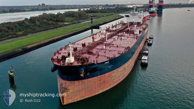
The vessel IRIS (IMO: 9529968, MMSI: 205663000) is a Tanker It's sailing under the flag of [BE] Belgium.
In this page you can find informations about the vessels current position, last detected port calls, and current voyage information. If the vessels is not in coverage by AIS you will find the latest position.
The current position of IRIS is detected by our AIS receivers and we are not responsible for the reliability of the data. The last position was recorded while the vessel was in Coverage by the Ais receivers of our vessel tracking app.
The current draught of IRIS as reported by AIS is 11.1 meters
Weather
| Temperature | 28.2°C / 82.76°F |
|---|---|
| Wind Speed | 4 knots |
| Direction | 190° S |
| Pressure | 1009.3 hPa |
| Humidity | 77.6 % |
| Cloud Coverage | 100 % |
Featured Company
Last Port Calls
| Port | Arrival | Departure | Time In Port |
|---|---|---|---|
| 2024-05-05 04:36 | 2024-05-07 15:31 | 2 d | |
| 2024-05-01 01:36 | 2024-05-03 05:00 | 2 d | |
| 2024-03-15 04:10 | 2024-03-19 02:04 | 3 d |
Most Visited Ports (Last year)
| Port | Arrivals | |
|---|---|---|
| 1 | ||
| 1 | ||
| 1 | ||
| 1 | ||
| 1 | ||
| 1 |
Last Trips
| Origin | Departure | Destination | Arrival | Distance | |
|---|---|---|---|---|---|
| 2024-05-03 13:00 | 2024-05-05 12:36 | 169.50 морская миля | |||
| 2024-03-18 23:04 | 2024-05-01 09:36 | 7725.30 морская миля | |||
| 2023-12-27 13:16 | 2024-03-15 01:10 | 10886.90 морская миля |
Events
| Время | Событие | Детали | Позиция / Направление | Информация |
|---|---|---|---|---|
| 2024-05-16 09:13 | Статус изменился | At anchor Default |
1.30221 / 104.08015
SG PJSB
|
Скорость: Курс: 115° |
| 2024-05-16 09:10 | Статус изменился | Default At anchor |
1.30233 / 104.08021
SG PJSB
|
Скорость: Курс: 120° |
| 2024-05-16 08:37 | Статус изменился | At anchor Default |
1.30382 / 104.08156
SG PJSB
|
Скорость: Курс: 155° |
| 2024-05-16 08:35 | Статус изменился | Default At anchor |
1.30389 / 104.08171
SG PJSB
|
Скорость: Курс: 160° |
| 2024-05-16 07:59 | Статус изменился | At anchor Under way using engine |
1.30306 / 104.08450
SG PJSB
|
Скорость: 0.2 kn Курс: 221° |
| 2024-05-16 07:51 | Окончание движения | 4.05 nm, East of TANAH MERAH |
1.30241 / 104.08453
SG PJSB
|
Скорость: 0.3 kn Курс: 219° |
| 2024-05-16 05:10 | Осадка изменилась | 11.1 20.2 |
1.30557 / 104.27263
SG PJSB
|
Скорость: 7.3 kn Курс: 261.2° |
| 2024-05-16 05:10 | Пункт назначения изменился | SG PJSB SG SIN>CN DJK |
1.30557 / 104.27263
SG PJSB
|
Скорость: 7.3 kn Курс: 261.2° |
| 2024-05-16 05:10 | ETA изменился | 2024/05/16 06:45 2024/04/30 10:00 |
1.30557 / 104.27263
SG PJSB
|
Скорость: 7.3 kn Курс: 261.2° |
| 2024-05-16 04:53 | Статус изменился | Under way using engine Default |
1.31215 / 104.30926
SG SIN>CN DJK
|
Скорость: 8.7 kn Курс: 256° |