
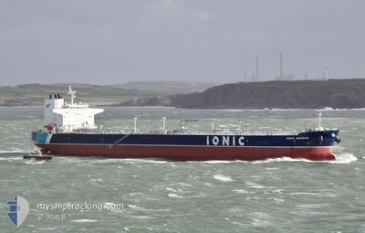
IONIC ANASSA
Tanker
Current Trip
| Time Travelled | 19 days |
|---|---|
| Remaining Time | 1 day |
| Distance Travelled | 5277.01 морская миля |
| Remaining Distance | 646.05 морская миля |
| AVG Speed | 13.3 Узлы |
| MAX Speed | 16 Узлы |
| AVG Wind | 14.9 knots |
| MAX Wind | 29.4 knots |
| MIN Temp | 15.2°C / 59.36°F |
| MAX Temp | 26.7°C / 80.06°F |
| Осадка | 12.9 м |
| Позиция Получена | 1 d тому назад |
Current Position
| Долгота | -3.22665° |
|---|---|
| Широта | 36.12923° |
| Статус | Under way using engine |
| Скорость | 12.4 Узлы |
| Курс | 86.2° |
| Район | Alboran Sea |
| Станция | T-AIS |
| Позиция Получена | 1 d тому назад |
Info
Information
The current position of IONIC ANASSA is in Alboran Sea with coordinates 36.12923° / -3.22665° as reported on 2024-05-20 07:06 by AIS to our vessel tracker app. The vessel's current speed is 12.4 Узлы and is heading at the port of MILAZZO. The estimated time of arrival as calculated by MyShipTracking vessel tracking app is 2024-05-23 03:14 LT
The vessel IONIC ANASSA (IMO: 9779795, MMSI: 538006696) is a Tanker It's sailing under the flag of [MH] Marshall Is.
In this page you can find informations about the vessels current position, last detected port calls, and current voyage information. If the vessels is not in coverage by AIS you will find the latest position.
The current position of IONIC ANASSA is detected by our AIS receivers and we are not responsible for the reliability of the data. The last position was recorded while the vessel was in Coverage by the Ais receivers of our vessel tracking app.
The current draught of IONIC ANASSA as reported by AIS is 12.9 meters
Weather
| Temperature | 19.2°C / 66.56°F |
|---|---|
| Wind Speed | 16 knots |
| Direction | 250° WSW |
| Pressure | 1015.2 hPa |
| Humidity | 71.8 % |
| Cloud Coverage | --- |
Featured Company
Last Port Calls
| Port | Arrival | Departure | Time In Port |
|---|---|---|---|
| 2024-04-29 18:40 | 2024-05-01 13:56 | 1 d | |
| 2024-04-18 14:12 | 2024-04-20 14:16 | 2 d |
Most Visited Ports (Last year)
| Port | Arrivals | |
|---|---|---|
| 4 | ||
| 4 | ||
| 1 | ||
| 1 | ||
| 1 | ||
| 1 |
Last Trips
| Origin | Departure | Destination | Arrival | Distance | |
|---|---|---|---|---|---|
| 2024-04-20 10:16 | 2024-04-29 13:40 | 2170.89 морская миля | |||
| 2024-02-24 16:04 | 2024-04-18 10:12 | 7586.87 морская миля |
Events
| Время | Событие | Детали | Позиция / Направление | Информация |
|---|---|---|---|---|
| 2024-05-20 07:13 | Статус изменился | Default Under way using engine |
36.13097 / -3.19409
ITMLZ
|
Скорость: 12.4 kn Курс: 86.2° |
| 2024-05-20 07:06 | Вне покрытия |
36.12923 / -3.22665
Alboran Sea
ITMLZ
|
Скорость: 12.4 kn Курс: 86.2° |
|
| 2024-05-20 06:45 | Статус изменился | Under way using engine Default |
36.12289 / -3.31379
ITMLZ
|
Скорость: 12.5 kn Курс: 82° |
| 2024-05-20 06:41 | Статус изменился | Default Under way using engine |
36.12103 / -3.33333
ITMLZ
|
Скорость: 12.7 kn Курс: 81.5° |
| 2024-05-20 06:35 | Статус изменился | Under way using engine Default |
36.11843 / -3.35680
ITMLZ
|
Скорость: 12.7 kn Курс: 82° |
| 2024-05-20 06:29 | Статус изменился | Default Under way using engine |
36.11485 / -3.38396
ITMLZ
|
Скорость: 12.7 kn Курс: 81.1° |
| 2024-05-20 06:25 | Статус изменился | Under way using engine Default |
36.11280 / -3.40051
ITMLZ
|
Скорость: 12.6 kn Курс: 81° |
| 2024-05-20 06:21 | Статус изменился | Default Under way using engine |
36.11081 / -3.41630
ITMLZ
|
Скорость: 12.5 kn Курс: 80.6° |
| 2024-05-20 06:15 | Статус изменился | Under way using engine Default |
36.10742 / -3.44403
ITMLZ
|
Скорость: 12.6 kn Курс: 81° |
| 2024-05-20 06:10 | Статус изменился | Default Under way using engine |
36.10461 / -3.46511
ITMLZ
|
Скорость: 12.7 kn Курс: 81.3° |