
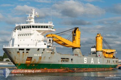
HILKE
General Cargo
Current Trip
| Time Travelled | 23 h, 45 mins |
|---|---|
| Remaining Time | --- |
| Distance Travelled | 191.15 морская миля |
| Remaining Distance | 126.58 морская миля |
| AVG Speed | 8.8 Узлы |
| MAX Speed | 15.1 Узлы |
| AVG Wind | 14.3 knots |
| MAX Wind | 17.9 knots |
| MIN Temp | 22.8°C / 73.04°F |
| MAX Temp | 24.9°C / 76.82°F |
| Осадка | 6.5 м |
| Позиция Получена | 2 d тому назад |
Current Position
| Долгота | -97.23604° |
|---|---|
| Широта | 27.85152° |
| Статус | Under way using engine |
| Скорость | |
| Курс | 157° |
| Район | South Atlantic Ocean |
| Станция | T-AIS |
| Позиция Получена | 2 d тому назад |
Info
Information
The current position of HILKE is in South Atlantic Ocean with coordinates 27.85152° / -97.23604° as reported on 2024-05-01 01:45 by AIS to our vessel tracker app. The vessel's current speed is 0 Узлы and is heading at the port of CORPUS CHRISTI.
The vessel HILKE (IMO: 9501875, MMSI: 305533000) is a General Cargo that was built in 2010 ( 14 лет ). It's sailing under the flag of [AG] Antigua Barbuda.
In this page you can find informations about the vessels current position, last detected port calls, and current voyage information. If the vessels is not in coverage by AIS you will find the latest position.
The current position of HILKE is detected by our AIS receivers and we are not responsible for the reliability of the data. The last position was recorded while the vessel was in Coverage by the Ais receivers of our vessel tracking app.
The current draught of HILKE as reported by AIS is 6.5 meters
Weather
| Temperature | 23°C / 73.4°F |
|---|---|
| Wind Speed | 15 knots |
| Direction | 113° ESE |
| Pressure | 1011.5 hPa |
| Humidity | 86.2 % |
| Cloud Coverage | 100 % |
Featured Company
Last Port Calls
| Port | Arrival | Departure | Time In Port |
|---|---|---|---|
| 2024-04-30 15:10 | 2024-05-02 13:38 | 1 d | |
| 2024-04-18 19:55 | 2024-04-20 11:37 | 1 d | |
| 2024-03-05 05:44 | 2024-03-07 00:25 | 1 d | |
| 2024-03-02 21:44 |
Most Visited Ports (Last year)
| Port | Arrivals | |
|---|---|---|
| 3 | ||
| 2 | ||
| 2 | ||
| 2 | ||
| 1 | ||
| 1 |
Last Trips
| Origin | Departure | Destination | Arrival | Distance | |
|---|---|---|---|---|---|
| 2024-04-20 08:37 | 2024-04-30 10:10 | 3551.30 морская миля | |||
| 2024-03-07 09:25 | 2024-04-18 16:55 | 12703.04 морская миля | |||
| 2024-03-03 06:44 | 2024-03-05 14:44 | 685.42 морская миля |
Events
| Время | Событие | Детали | Позиция / Направление | Информация |
|---|---|---|---|---|
| 2024-05-03 12:14 | Окончание движения | 12.39 nm, East of BOLIVAR |
29.30571 / -94.55198
US CRP
|
Скорость: 0.2 kn Курс: 111° |
| 2024-05-02 13:38 | ПОРТ ОТПРАВЛЕНИЯ |
|
27.81699 / -97.21886
US CRP
|
Скорость: 8.3 kn Курс: 158° |
| 2024-05-02 13:26 | Начало движения |
27.84399 / -97.23507
[US] INGLESIDE
|
Скорость: 8 kn Курс: 156° |
|
| 2024-05-01 01:50 | Статус изменился | Default Under way using engine |
27.85152 / -97.23606
[US] INGLESIDE
|
Скорость: Курс: 157° |
| 2024-05-01 01:45 | Вне покрытия |
27.85152 / -97.23604
South Atlantic Ocean
[US] INGLESIDE
|
Скорость: Курс: 66.4° |
|
| 2024-05-01 01:05 | Осадка изменилась | 6.5 7.2 |
27.85150 / -97.23605
[US] INGLESIDE
|
Скорость: Курс: 157° |
| 2024-05-01 01:05 | Пункт назначения изменился | US CRP BR VDC |
27.85150 / -97.23605
[US] INGLESIDE
|
Скорость: Курс: 157° |
| 2024-05-01 01:05 | ETA изменился | 2025/04/30 08:00 2024/04/16 14:00 |
27.85150 / -97.23605
[US] INGLESIDE
|
Скорость: Курс: 157° |
| 2024-05-01 00:28 | Статус изменился | Under way using engine Default |
27.85151 / -97.23604
[US] INGLESIDE
|
Скорость: Курс: 157° |
| 2024-05-01 00:26 | Статус изменился | Default Under way using engine |
27.85152 / -97.23606
[US] INGLESIDE
|
Скорость: Курс: 157° |