
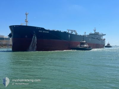
HAI SHANG
Tanker
Current Trip
| Time Travelled | 3 days |
|---|---|
| Remaining Time | --- |
| Distance Travelled | 791.41 морская миля |
| Remaining Distance | --- |
| AVG Speed | 12.6 Узлы |
| MAX Speed | 16.1 Узлы |
| AVG Wind | 14.2 knots |
| MAX Wind | 21.5 knots |
| MIN Temp | 23.6°C / 74.48°F |
| MAX Temp | 28.5°C / 83.3°F |
| Осадка | 8.3 м |
| Позиция Получена | 3 h, 0 m тому назад |
Current Position
| Долгота | -92.72388° |
|---|---|
| Широта | 21.53085° |
| Статус | Under way using engine |
| Скорость | 13.2 Узлы |
| Курс | 342.2° |
| Район | Gulf of Mexico |
| Станция | T-AIS |
| Позиция Получена | 3 h, 0 m тому назад |
Info
Information
The current position of HAI SHANG is in Gulf of Mexico with coordinates 21.53085° / -92.72388° as reported on 2024-05-08 04:16 by AIS to our vessel tracker app. The vessel's current speed is 13.2 Узлы and is heading at the port of ANCHORAGE.
The vessel HAI SHANG (IMO: 9792852, MMSI: 636020804) is a Tanker It's sailing under the flag of [LR] Liberia.
In this page you can find informations about the vessels current position, last detected port calls, and current voyage information. If the vessels is not in coverage by AIS you will find the latest position.
The current position of HAI SHANG is detected by our AIS receivers and we are not responsible for the reliability of the data. The last position was recorded while the vessel was in Coverage by the Ais receivers of our vessel tracking app.
The current draught of HAI SHANG as reported by AIS is 8.3 meters
Weather
| Temperature | 26.5°C / 79.7°F |
|---|---|
| Wind Speed | 17 knots |
| Direction | 106° ESE |
| Pressure | 1005.1 hPa |
| Humidity | 88.2 % |
| Cloud Coverage | 100 % |
Featured Company
Last Port Calls
| Port | Arrival | Departure | Time In Port |
|---|---|---|---|
| 2024-04-30 20:58 | 2024-05-04 07:47 | 3 d | |
| 2024-04-15 19:03 | 2024-04-15 20:12 | 1 h | |
| 2024-04-08 05:39 | 2024-04-09 23:16 | 1 d | |
| 2024-03-09 04:58 | 2024-03-10 18:32 | 1 d |
Most Visited Ports (Last year)
| Port | Arrivals | |
|---|---|---|
| 4 | ||
| 4 | ||
| 2 | ||
| 2 | ||
| 2 | ||
| 1 |
Last Trips
| Origin | Departure | Destination | Arrival | Distance | |
|---|---|---|---|---|---|
| 2024-04-15 15:12 | 2024-04-30 15:58 | 1422.21 морская миля | |||
| 2024-04-09 18:16 | 2024-04-15 14:03 | 74.15 морская миля | |||
| 2024-03-10 14:32 | 2024-04-08 00:39 | 2752.38 морская миля | |||
| 2024-01-23 09:13 | 2024-03-09 00:58 | 5742.95 морская миля |
Events
| Время | Событие | Детали | Позиция / Направление | Информация |
|---|---|---|---|---|
| 2024-05-08 04:22 | Статус изменился | Default Under way using engine |
21.55089 / -92.73085
US HOU ANCHORAGE
|
Скорость: 13.2 kn Курс: 342.2° |
| 2024-05-08 04:16 | Вне покрытия |
21.53085 / -92.72388
Gulf of Mexico
|
Скорость: 13.2 kn Курс: 342.2° |
|
| 2024-05-08 04:14 | Изменение морского района | Mexican part of the Gulf of Mexico United States part of the Gulf of Mexico |
21.52144 / -92.72067
Gulf of Mexico
|
Скорость: 13.2 kn Курс: 342.6° |
| 2024-05-08 04:12 | Статус изменился | Under way using engine Default |
21.51618 / -92.71889
US HOU ANCHORAGE
|
Скорость: 13.2 kn Курс: 342° |
| 2024-05-08 04:06 | В покрытии |
21.52144 / -92.72067
Gulf of Mexico
|
Скорость: 13.2 kn Курс: 342.6° |
|
| 2024-05-06 21:06 | Окончание движения |
19.60438 / -92.29815
US HOU ANCHORAGE
|
Скорость: 0.2 kn Курс: 118° |
|
| 2024-05-05 07:46 | Статус изменился | Default Under way using engine |
26.87525 / -94.34695
US HOU ANCHORAGE
|
Скорость: 12.6 kn Курс: 175.6° |
| 2024-05-05 07:42 | Вне покрытия |
26.88897 / -94.34803
Gulf of Mexico
|
Скорость: 12.6 kn Курс: 175.6° |
|
| 2024-05-05 07:34 | Статус изменился | Under way using engine Default |
26.91609 / -94.35028
US HOU ANCHORAGE
|
Скорость: 12.6 kn Курс: 175° |
| 2024-05-05 07:18 | Статус изменился | Default Under way using engine |
26.97189 / -94.35484
US HOU ANCHORAGE
|
Скорость: 12.5 kn Курс: 176.9° |