
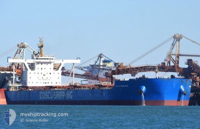
GUANG HENG HAI
Cargo
Current Trip
BOFFA
| Time Travelled | 8 days |
|---|---|
| Remaining Time | --- |
| Distance Travelled | 2337.60 морская миля |
| Remaining Distance | --- |
| AVG Speed | 11.6 Узлы |
| MAX Speed | 13.9 Узлы |
| AVG Wind | 8.3 knots |
| MAX Wind | 24.2 knots |
| MIN Temp | 14.4°C / 57.92°F |
| MAX Temp | 30.2°C / 86.36°F |
| Осадка | 9.5 м |
| Позиция Получена | 4 d тому назад |
Current Position
| Долгота | 120.74620° |
|---|---|
| Широта | 20.85100° |
| Статус | Under way using engine |
| Скорость | 12.7 Узлы |
| Курс | 216.4° |
| Район | South China Sea |
| Станция | T-AIS |
| Позиция Получена | 4 d тому назад |
Info
Information
The current position of GUANG HENG HAI is in South China Sea with coordinates 20.85100° / 120.74620° as reported on 2024-04-29 17:31 by AIS to our vessel tracker app. The vessel's current speed is 12.7 Узлы
The vessel GUANG HENG HAI (IMO: 9758650, MMSI: 477010200) is a Cargo It's sailing under the flag of [HK] Hong Kong.
In this page you can find informations about the vessels current position, last detected port calls, and current voyage information. If the vessels is not in coverage by AIS you will find the latest position.
The current position of GUANG HENG HAI is detected by our AIS receivers and we are not responsible for the reliability of the data. The last position was recorded while the vessel was in Coverage by the Ais receivers of our vessel tracking app.
The current draught of GUANG HENG HAI as reported by AIS is 9.5 meters
Weather
| Temperature | 29.6°C / 85.28°F |
|---|---|
| Wind Speed | 6 knots |
| Direction | 17° NNE |
| Pressure | 1009.4 hPa |
| Humidity | 74 % |
| Cloud Coverage | 100 % |
Featured Company
Most Visited Ports (Last year)
| Port | Arrivals | |
|---|---|---|
| 1 | ||
| 1 | ||
| 1 | ||
| 1 |
Last Trips
| Origin | Departure | Destination | Arrival | Distance |
|---|
Events
| Время | Событие | Детали | Позиция / Направление | Информация |
|---|---|---|---|---|
| 2024-04-29 17:36 | Статус изменился | Default Under way using engine |
20.83647 / 120.73476
BOFFA
|
Скорость: 12.7 kn Курс: 216.4° |
| 2024-04-29 17:31 | Вне покрытия |
20.85100 / 120.74620
South China Sea
|
Скорость: 12.7 kn Курс: 216.4° |
|
| 2024-04-29 16:50 | Статус изменился | Under way using engine Default |
20.96896 / 120.83890
BOFFA
|
Скорость: 12.6 kn Курс: 216° |
| 2024-04-29 16:49 | Статус изменился | Default Under way using engine |
20.97328 / 120.84225
BOFFA
|
Скорость: 12.2 kn Курс: 214.7° |
| 2024-04-29 16:40 | Изменение морского района | Philippines part of the South China Sea Taiwanese part of the South China Sea |
20.99617 / 120.85956
South China Sea
|
Скорость: 12.2 kn Курс: 214° |
| 2024-04-29 16:30 | Статус изменился | Under way using engine Default |
21.02393 / 120.87984
BOFFA
|
Скорость: 11.5 kn Курс: 214° |
| 2024-04-29 16:28 | Статус изменился | Default Under way using engine |
21.03015 / 120.88432
BOFFA
|
Скорость: 11.5 kn Курс: 212.2° |
| 2024-04-29 16:13 | Статус изменился | Under way using engine Default |
21.06855 / 120.91186
BOFFA
|
Скорость: 10.9 kn Курс: 214° |
| 2024-04-29 16:11 | Статус изменился | Default Under way using engine |
21.07563 / 120.91719
BOFFA
|
Скорость: 10.8 kn Курс: 213.7° |
| 2024-04-29 14:18 | Статус изменился | Under way using engine Default |
21.36541 / 121.06368
BOFFA
|
Скорость: 11 kn Курс: 212° |