
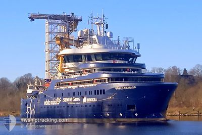
GOELO ENABLER
Other Type
Current Trip
DEHTU
| Time Travelled | 11 h, 40 mins |
|---|---|
| Remaining Time | --- |
| Distance Travelled | 56.38 морская миля |
| Remaining Distance | --- |
| AVG Speed | 7.2 Узлы |
| MAX Speed | 10.3 Узлы |
| AVG Wind | 9.8 knots |
| MAX Wind | 11.9 knots |
| MIN Temp | -1.2°C / 29.84°F |
| MAX Temp | 0.7°C / 33.26°F |
| Осадка | 4.8 м |
| Позиция Получена | Сейчас |
Current Position
| Долгота | --- |
|---|---|
| Широта | --- |
| Статус | Under way using engine |
| Скорость | 7.6 Узлы |
| Курс | 186.6° |
| Район | Kattegat |
| Станция | T-AIS |
| Позиция Получена | Сейчас |
Info
Information
The current position of GOELO ENABLER is in Kattegat with coordinates 55.07561° / 11.02790° as reported on 2025-02-18 02:22 by AIS to our vessel tracker app. The vessel's current speed is 7.6 Узлы
The vessel GOELO ENABLER (IMO: 9914137, MMSI: 257100000) is a Other Type It's sailing under the flag of [NO] Norway.
In this page you can find informations about the vessels current position, last detected port calls, and current voyage information. If the vessels is not in coverage by AIS you will find the latest position.
The current position of GOELO ENABLER is detected by our AIS receivers and we are not responsible for the reliability of the data. The last position was recorded while the vessel was in Coverage by the Ais receivers of our vessel tracking app.
The current draught of GOELO ENABLER as reported by AIS is 4.8 meters
Weather
| Temperature | -0.7°C / 30.74°F |
|---|---|
| Wind Speed | 10 knots |
| Direction | 296° WNW |
| Pressure | 1027.9 hPa |
| Humidity | 65.5 % |
| Cloud Coverage | --- |
Featured Company
Last Port Calls
| Port | Arrival | Departure | Time In Port |
|---|---|---|---|
| 2025-01-13 06:15 | 2025-02-17 14:42 | ||
| 2025-01-06 09:51 | 2025-01-09 00:21 | 2 d | |
| 2024-12-24 22:28 | 2024-12-26 18:02 | 1 d | |
| 2024-12-21 20:36 | 2024-12-23 11:57 | 1 d | |
| 2024-12-10 22:27 | 2024-12-12 02:16 | 1 d | |
| 2024-12-06 21:41 | 2024-12-09 10:35 | 2 d |
Most Visited Ports (Last year)
| Port | Arrivals | |
|---|---|---|
| 20 | ||
| 3 | ||
| 2 | ||
| 1 | ||
| 1 | ||
| 1 |
Last Trips
| Origin | Departure | Destination | Arrival | Distance | |
|---|---|---|---|---|---|
| 2025-01-09 01:21 | 2025-01-13 07:15 | 764.50 морская миля | |||
| 2024-12-26 19:02 | 2025-01-06 10:51 | 328.55 морская миля | |||
| 2024-12-23 12:57 | 2024-12-24 23:28 | 90.25 морская миля | |||
| 2024-12-12 03:16 | 2024-12-21 21:36 | 389.88 морская миля | |||
| 2024-12-09 11:35 | 2024-12-10 23:27 | 94.14 морская миля | |||
| 2024-11-28 18:38 | 2024-12-06 22:41 | 265.30 морская миля |
Events
| Время | Событие | Детали | Позиция / Направление | Информация |
|---|---|---|---|---|
| 2025-02-17 21:03 | Статус изменился | Under way using engine Restricted manoeuverability |
55.65696 / 10.73429
DEHTU
|
Скорость: 6.6 kn Курс: 129.2° |
| 2025-02-17 20:57 | Начало движения | 10.35 nm, South East of KOLBY |
55.66424 / 10.72325
DEHTU
|
Скорость: 5.8 kn Курс: 164° |
| 2025-02-17 20:26 | Окончание движения | 10.25 nm, South East of KOLBY |
55.66573 / 10.72143
DEHTU
|
Скорость: 0.1 kn Курс: 133° |
| 2025-02-17 20:21 | Начало движения | 10.07 nm, South East of KOLBY |
55.66766 / 10.71751
DEHTU
|
Скорость: 4.3 kn Курс: 120° |
| 2025-02-17 19:08 | Окончание движения | 9.96 nm, South East of KOLBY |
55.66884 / 10.71498
DEHTU
|
Скорость: 0.2 kn Курс: 111° |
| 2025-02-17 19:02 | Начало движения | 9.5 nm, South East of KOLBY |
55.67213 / 10.70038
DEHTU
|
Скорость: 3.2 kn Курс: 112° |
| 2025-02-17 17:34 | Окончание движения | 9.38 nm, South East of KOLBY |
55.67232 / 10.69533
DEHTU
|
Скорость: 0.3 kn Курс: 216° |
| 2025-02-17 17:16 | Начало движения | 9.41 nm, South East of KOLBY |
55.67255 / 10.69733
DEHTU
|
Скорость: 3.1 kn Курс: 50° |
| 2025-02-17 16:41 | Статус изменился | Restricted manoeuverability Under way using engine |
55.67184 / 10.69528
DEHTU
|
Скорость: Курс: 85° |
| 2025-02-17 16:32 | Окончание движения | 9.42 nm, South East of KOLBY |
55.67139 / 10.69481
DEHTU
|
Скорость: 0.2 kn Курс: 117° |