
GLORIA CONFIDENCE
Cargo
Current Trip
| Time Travelled | 18 days |
|---|---|
| Remaining Time | --- |
| Distance Travelled | 4384.61 морская миля |
| Remaining Distance | --- |
| AVG Speed | 11.3 Узлы |
| MAX Speed | 14 Узлы |
| AVG Wind | 12.3 knots |
| MAX Wind | 41 knots |
| MIN Temp | 18.6°C / 65.48°F |
| MAX Temp | 31.4°C / 88.52°F |
| Осадка | 11.8 м |
| Позиция Получена | 5 d тому назад |
Current Position
| Долгота | -67.13536° |
|---|---|
| Широта | 18.98670° |
| Статус | Under way using engine |
| Скорость | 12.3 Узлы |
| Курс | 51.1° |
| Район | North Atlantic Ocean |
| Станция | T-AIS |
| Позиция Получена | 5 d тому назад |
Info
Information
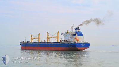
The current position of GLORIA CONFIDENCE is in North Atlantic Ocean with coordinates 18.98670° / -67.13536° as reported on 2024-04-23 02:01 by AIS to our vessel tracker app. The vessel's current speed is 12.3 Узлы and is heading at the port of GIJON. The estimated time of arrival as calculated by MyShipTracking vessel tracking app is 2024-05-05 12:00 LT
The vessel GLORIA CONFIDENCE (IMO: 9883376, MMSI: 636019560) is a Cargo It's sailing under the flag of [LR] Liberia.
In this page you can find informations about the vessels current position, last detected port calls, and current voyage information. If the vessels is not in coverage by AIS you will find the latest position.
The current position of GLORIA CONFIDENCE is detected by our AIS receivers and we are not responsible for the reliability of the data. The last position was recorded while the vessel was in Coverage by the Ais receivers of our vessel tracking app.
The current draught of GLORIA CONFIDENCE as reported by AIS is 11.8 meters
Weather
| Temperature | 18.6°C / 65.48°F |
|---|---|
| Wind Speed | 25 knots |
| Direction | 147° SSE |
| Pressure | 1018.7 hPa |
| Humidity | 84.6 % |
| Cloud Coverage | 100 % |
Featured Company
Last Port Calls
| Port | Arrival | Departure | Time In Port |
|---|---|---|---|
| 2024-04-04 03:48 | 2024-04-09 23:01 | 5 d | |
| 2024-03-24 01:31 | 2024-03-31 21:44 | 7 d |
Most Visited Ports (Last year)
| Port | Arrivals | |
|---|---|---|
| 3 | ||
| 2 | ||
| 2 | ||
| 1 | ||
| 1 | ||
| 1 |
Last Trips
| Origin | Departure | Destination | Arrival | Distance | |
|---|---|---|---|---|---|
| 2024-03-31 15:44 | 2024-04-03 21:48 | 872.05 морская миля | |||
| 2024-01-26 07:05 | 2024-03-23 19:31 | 8969.36 морская миля |
Events
| Время | Событие | Детали | Позиция / Направление | Информация |
|---|---|---|---|---|
| 2024-04-23 02:03 | Статус изменился | Default Under way using engine |
18.99069 / -67.13013
ESGIJ! PANAMA
|
Скорость: 12.3 kn Курс: 51.1° |
| 2024-04-23 02:01 | Вне покрытия |
18.98670 / -67.13536
North Atlantic Ocean
ESGIJ! PANAMA
|
Скорость: 12.3 kn Курс: 51.1° |
|
| 2024-04-23 02:00 | Статус изменился | Under way using engine Default |
18.98457 / -67.13810
ESGIJ! PANAMA
|
Скорость: 12.5 kn Курс: 51° |
| 2024-04-23 02:00 | В покрытии |
18.98670 / -67.13536
North Atlantic Ocean
ESGIJ! PANAMA
|
Скорость: 12.3 kn Курс: 51.1° |
|
| 2024-04-23 00:53 | Статус изменился | Default Under way using engine |
18.83094 / -67.32498
ESGIJ! PANAMA
|
Скорость: 12.9 kn Курс: 48.6° |
| 2024-04-23 00:48 | Вне покрытия |
18.81817 / -67.33994
North Atlantic Ocean
ESGIJ! PANAMA
|
Скорость: 12.9 kn Курс: 48.6° |
|
| 2024-04-23 00:42 | Статус изменился | Under way using engine Default |
18.80458 / -67.35590
ESGIJ! PANAMA
|
Скорость: 12.7 kn Курс: 49° |
| 2024-04-23 00:12 | Статус изменился | Default Under way using engine |
18.73428 / -67.43964
ESGIJ! PANAMA
|
Скорость: 12.9 kn Курс: 49.4° |
| 2024-04-23 00:04 | Изменение морского района | Puerto Rican part of the North Atlantic Ocean Panamanian part of the Caribbean Sea |
18.71335 / -67.46485
North Atlantic Ocean
ESGIJ! PANAMA
|
Скорость: 12.8 kn Курс: 49° |
| 2024-04-23 00:03 | Статус изменился | Under way using engine Default |
18.71299 / -67.46528
ESGIJ! PANAMA
|
Скорость: 12.7 kn Курс: 50° |