

GH MAESTRO
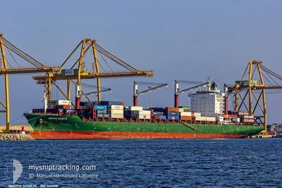
Container Ship

Current Trip
| Time Travelled | 4 days |
|---|---|
| Remaining Time | --- |
| Distance Travelled | 1462.89 морская миля |
| Remaining Distance | --- |
| AVG Speed | 14.8 Узлы |
| MAX Speed | 18.1 Узлы |
| AVG Wind | 14.7 knots |
| MAX Wind | 22 knots |
| MIN Temp | 17°C / 62.6°F |
| MAX Temp | 27°C / 80.6°F |
| Осадка | 12.9 м |
| Позиция Получена | 7 h, 0 m тому назад |
Current Position
| Долгота | --- |
|---|---|
| Широта | --- |
| Статус | Under way using engine |
| Скорость | 14.5 Узлы |
| Курс | 34.8° |
| Район | North Atlantic Ocean |
| Станция | T-AIS |
| Позиция Получена | 7 h, 0 m тому назад |
Information
The current position of GH MAESTRO is in North Atlantic Ocean with coordinates 28.13676° / -13.62533° as reported on 2025-02-28 12:07 by AIS to our vessel tracker app. The vessel's current speed is 14.5 Узлы and is heading at the port of NASSIT. The estimated time of arrival as calculated by MyShipTracking vessel tracking app is 2025-02-19 07:00 LT
The vessel GH MAESTRO (IMO: 9449118, MMSI: 538009277) is a Container Ship that was built in 2012 ( 13 лет ). It's sailing under the flag of [MH] Marshall Is.
In this page you can find informations about the vessels current position, last detected port calls, and current voyage information. If the vessels is not in coverage by AIS you will find the latest position.
The current position of GH MAESTRO is detected by our AIS receivers and we are not responsible for the reliability of the data. The last position was recorded while the vessel was in Coverage by the Ais receivers of our vessel tracking app.
The current draught of GH MAESTRO as reported by AIS is 12.9 meters
Weather
| Temperature | 17.5°C / 63.5°F |
|---|---|
| Wind Speed | 22 knots |
| Direction | 306° NW |
| Pressure | 1015.9 hPa |
| Humidity | 71.9 % |
| Cloud Coverage | --- |


Featured Company
Last Port Calls
| Port | Arrival | Departure | Time In Port |
|---|---|---|---|
| 2025-02-23 00:22 | 2025-02-24 16:37 | 1 d | |
| 2025-02-19 13:53 | 2025-02-21 09:47 | 1 d | |
| 2025-02-11 02:58 | 2025-02-11 17:53 | 14 h | |
| 2025-02-01 10:26 | 2025-02-03 22:17 | 2 d | |
| 2025-01-29 10:09 | 2025-01-31 09:22 | 1 d | |
| 2025-01-20 19:11 | 2025-01-21 06:31 | 11 h | |
| 2025-01-12 06:55 | 2025-01-14 08:34 | 2 d | |
| 2025-01-08 08:18 | 2025-01-09 12:48 | 1 d | |
| 2024-12-28 20:41 | 2024-12-29 11:38 | 14 h | |
| 2024-12-28 09:30 | 2024-12-28 17:06 | 7 h |
Last Trips
| Origin | Departure | Destination | Arrival | Distance | |
|---|---|---|---|---|---|
| 2025-02-21 09:47 | 2025-02-23 00:22 | 114.48 морская миля | |||
| 2025-02-11 17:53 | 2025-02-19 13:53 | 2056.74 морская миля | |||
| 2025-02-03 22:17 | 2025-02-11 02:58 | 2123.39 морская миля | |||
| 2025-01-31 09:22 | 2025-02-01 10:26 | 109.64 морская миля | |||
| 2025-01-21 06:31 | 2025-01-29 10:09 | 2083.00 морская миля | |||
| 2025-01-14 08:34 | 2025-01-20 19:11 | 2101.00 морская миля | |||
| 2025-01-09 12:48 | 2025-01-12 06:55 | 111.07 морская миля | |||
| 2024-12-29 11:38 | 2025-01-08 08:18 | 2181.08 морская миля | |||
| 2024-12-28 17:06 | 2024-12-28 20:41 | 27.22 морская миля | |||
| 2024-12-23 16:01 | 2024-12-28 09:30 | 2031.86 морская миля |
Events
| Время | Событие | Детали | Позиция / Направление | Информация |
|---|---|---|---|---|
| 2025-02-28 12:45 | Статус изменился | Default Under way using engine |
28.26796 / -13.52345
FREETOWN
|
Скорость: 14.5 kn Курс: 34.8° |
| 2025-02-28 12:07 | Вне покрытия |
28.13676 / -13.62533
North Atlantic Ocean
|
Скорость: 14.5 kn Курс: 34.8° |
|
| 2025-02-28 12:03 | Изменение морского района | Spanish (Canary Islands) part of the North Atlantic Ocean Western Saharan part of the North Atlantic Ocean |
28.12511 / -13.63451
North Atlantic Ocean
|
Скорость: 14.5 kn Курс: 34.9° |
| 2025-02-28 12:01 | Статус изменился | Under way using engine Default |
28.11817 / -13.63996
FREETOWN
|
Скорость: 14.5 kn Курс: 35° |
| 2025-02-28 12:01 | В покрытии |
28.12511 / -13.63451
North Atlantic Ocean
|
Скорость: 14.5 kn Курс: 34.9° |
|
| 2025-02-24 16:37 | Начало движения | 0.62 nm, South West of CONAKRY |
9.49697 / -13.72588
FREETOWN
|
Скорость: 9.3 kn Курс: 181° |
| 2025-02-24 16:37 | ПОРТ ОТПРАВЛЕНИЯ |
|
9.49697 / -13.72588
FREETOWN
|
Скорость: 4.7 kn Курс: 194° |
| 2025-02-23 00:31 | Окончание движения |
9.50964 / -13.72340
[GN] CONAKRY
|
Скорость: Курс: 37° |
|
| 2025-02-23 00:22 | Порт |
|
9.50911 / -13.72381
[GN] CONAKRY
|
Скорость: 0.9 kn Курс: 19° |
| 2025-02-22 20:46 | Начало движения | 16.17 nm, South West of KASSA |
9.23477 / -13.86806
FREETOWN
|
Скорость: 3.7 kn Курс: 334° |