
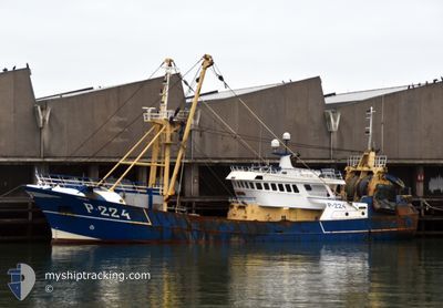
F/V MIRANDA
Trawler
Current Trip
| Trip Time | 4 days |
|---|---|
| Trip Distance | 317.80 морская миля |
| AVG Speed | 4.7 Узлы |
| MAX Speed | 11.2 Узлы |
| Осадка | 4.8 м |
| AVG Wind | 14.4 knots |
| MAX Wind | 24.2 knots |
| MIN Temp | 5.3°C / 41.54°F |
| MAX Temp | 8.7°C / 47.66°F |
| Позиция Получена | Сейчас |
Current Position
| Долгота | --- |
|---|---|
| Широта | --- |
| Статус | Engaged in Fishing |
| Скорость | |
| Курс | 192° |
| Район | North Sea |
| Станция | T-AIS |
| Позиция Получена | Сейчас |
Info
Information
The current position of F/V MIRANDA is in North Sea with coordinates 51.44496° / 3.59101° as reported on 2025-03-01 06:58 by AIS to our vessel tracker app. The vessel's current speed is 0 Узлы and is currently inside the port of VLISSINGEN STATION.
The vessel F/V MIRANDA (IMO: 8619948, MMSI: 232006030) is a Trawler that was built in 1987 ( 38 лет ). It's sailing under the flag of [GB] United Kingdom.
In this page you can find informations about the vessels current position, last detected port calls, and current voyage information. If the vessels is not in coverage by AIS you will find the latest position.
The current position of F/V MIRANDA is detected by our AIS receivers and we are not responsible for the reliability of the data. The last position was recorded while the vessel was in Coverage by the Ais receivers of our vessel tracking app.
The current draught of F/V MIRANDA as reported by AIS is 4.8 meters
Weather
| Temperature | 4.7°C / 40.46°F |
|---|---|
| Wind Speed | 8 knots |
| Direction | 40° NE |
| Pressure | 1031.4 hPa |
| Humidity | 89.4 % |
| Cloud Coverage | 5 % |
Featured Company
Last Port Calls
| Port | Arrival | Departure | Time In Port |
|---|---|---|---|
| 2025-02-28 21:32 | |||
| 2025-02-07 20:03 | 2025-02-24 16:15 | 16 d | |
| 2025-02-01 00:25 | 2025-02-03 00:17 | 1 d | |
| 2025-01-24 00:22 | 2025-01-27 21:16 | 3 d | |
| 2025-01-17 20:52 | 2025-01-20 00:46 | 2 d | |
| 2025-01-11 00:14 | 2025-01-13 00:59 | 2 d | |
| 2025-01-04 00:17 | 2025-01-06 20:48 | 2 d | |
| 2025-01-02 00:37 |
Most Visited Ports (Last year)
| Port | Arrivals | |
|---|---|---|
| 21 | ||
| 16 | ||
| 10 | ||
| 3 | ||
| 2 | ||
| 2 |
Last Trips
| Origin | Departure | Destination | Arrival | Distance | |
|---|---|---|---|---|---|
| 2025-02-24 17:15 | 2025-02-28 22:32 | 317.80 морская миля | |||
| 2025-02-03 01:17 | 2025-02-07 21:03 | 463.82 морская миля | |||
| 2025-01-27 22:16 | 2025-02-01 01:25 | 440.04 морская миля | |||
| 2025-01-20 01:46 | 2025-01-24 01:22 | 363.12 морская миля | |||
| 2025-01-13 01:59 | 2025-01-17 21:52 | 458.06 морская миля | |||
| 2025-01-06 21:48 | 2025-01-11 01:14 | 354.04 морская миля | |||
| 2025-01-02 01:37 | 2025-01-04 01:17 | 266.77 морская миля |
Events
| Время | Событие | Детали | Позиция / Направление | Информация |
|---|---|---|---|---|
| 2025-02-28 21:32 | Окончание движения |
51.44381 / 3.59094
[NL] VLISSINGEN STATION
|
Скорость: 0.3 kn Курс: 213° |
|
| 2025-02-28 21:32 | Порт |
|
51.44381 / 3.59094
[NL] VLISSINGEN STATION
|
Скорость: 0.6 kn Курс: 219° |
| 2025-02-28 21:30 | Начало движения | 0.26 nm, South of VLISSINGEN STATION |
51.44338 / 3.59316
|
Скорость: 3.8 kn Курс: 299° |
| 2025-02-28 21:09 | Окончание движения | 0.35 nm, South East of VLISSINGEN STATION |
51.44264 / 3.59597
|
Скорость: 0.1 kn Курс: 293° |
| 2025-02-28 20:01 | Изменение морского района | Dutch part of the North Sea Belgian part of the North Sea |
51.41436 / 3.33276
North Sea
|
Скорость: 9.7 kn Курс: 85.7° |
| 2025-02-28 16:52 | Изменение морского района | Belgian part of the North Sea United Kingdom part of the North Sea |
51.57117 / 2.56894
North Sea
|
Скорость: 10.3 kn Курс: 123° |
| 2025-02-28 16:51 | В покрытии |
51.57117 / 2.56894
North Sea
|
Скорость: 10.3 kn Курс: 123° |
|
| 2025-02-28 14:24 | Вне покрытия |
51.57301 / 2.23805
North Sea
|
Скорость: 4.8 kn Курс: 44° |
|
| 2025-02-28 13:51 | Изменение морского района | United Kingdom part of the North Sea French part of the North Sea |
51.53950 / 2.19105
North Sea
|
Скорость: 5 kn Курс: 39.8° |
| 2025-02-28 12:58 | Изменение морского района | French part of the North Sea United Kingdom part of the North Sea |
51.49585 / 2.11928
North Sea
|
Скорость: 4.5 kn Курс: 51.6° |