

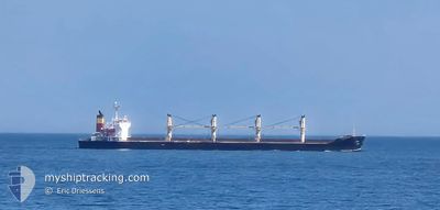
ETNA
Bulk Carrier

Current Trip
| Time Travelled | 12 days |
|---|---|
| Remaining Time | --- |
| Distance Travelled | 1626.75 морская миля |
| Remaining Distance | --- |
| AVG Speed | 8.4 Узлы |
| MAX Speed | 12.6 Узлы |
| AVG Wind | 10.6 knots |
| MAX Wind | 27 knots |
| MIN Temp | 1.4°C / 34.52°F |
| MAX Temp | 15.9°C / 60.62°F |
| Осадка | 6.3 м |
| Позиция Получена | 4 d тому назад |
Current Position
| Долгота | --- |
|---|---|
| Широта | --- |
| Статус | Under way using engine |
| Скорость | 11.6 Узлы |
| Курс | 9.5° |
| Район | Black Sea |
| Станция | T-AIS |
| Позиция Получена | 4 d тому назад |
Information
The current position of ETNA is in Black Sea with coordinates 41.49900° / 29.29418° as reported on 2025-03-22 13:14 by AIS to our vessel tracker app. The vessel's current speed is 11.6 Узлы
The vessel ETNA (IMO: 9393618, MMSI: 271052465) is a Bulk Carrier that was built in 2007 ( 18 лет ). It's sailing under the flag of [TR] Turkey.
In this page you can find informations about the vessels current position, last detected port calls, and current voyage information. If the vessels is not in coverage by AIS you will find the latest position.
The current position of ETNA is detected by our AIS receivers and we are not responsible for the reliability of the data. The last position was recorded while the vessel was in Coverage by the Ais receivers of our vessel tracking app.
The current draught of ETNA as reported by AIS is 6.3 meters
Weather
| Temperature | 8.3°C / 46.94°F |
|---|---|
| Wind Speed | 10 knots |
| Direction | 98° E |
| Pressure | 1024 hPa |
| Humidity | 61.4 % |
| Cloud Coverage | 14 % |


Featured Company
Last Trips
| Origin | Departure | Destination | Arrival | Distance | |
|---|---|---|---|---|---|
| 2025-02-18 09:24 | 2025-03-11 18:48 | 2292.39 морская миля | |||
| 2025-01-26 18:08 | 2025-02-12 08:08 | 1565.29 морская миля | |||
| 2025-01-22 12:56 | 2025-01-22 19:45 | 64.60 морская миля | |||
| 2025-01-12 00:24 | 2025-01-19 03:47 | 181.94 морская миля |
Events
| Время | Событие | Детали | Позиция / Направление | Информация |
|---|---|---|---|---|
| 2025-03-22 13:14 | Вне покрытия |
41.49900 / 29.29418
Black Sea
ROSUL
|
Скорость: 11.6 kn Курс: 9.5° |
|
| 2025-03-22 11:56 | ETA изменился | 2025/03/23 07:00 2025/03/22 10:00 |
41.26740 / 29.17876
ROSUL
|
Скорость: 11.4 kn Курс: 36.5° |
| 2025-03-22 11:41 | Изменение морского района | Turkish part of the Black Sea Turkish part of the Sea of Marmara |
41.23059 / 29.14138
Black Sea
ROSUL
|
Скорость: 10.9 kn Курс: 38.5° |
| 2025-03-22 07:48 | Начало движения | 10.54 nm, South of YESILKOY |
40.78320 / 28.87171
ROSUL
|
Скорость: 3.1 kn Курс: 297° |
| 2025-03-21 17:35 | Окончание движения | 10.64 nm, South West of MALTEPE |
40.78632 / 28.96796
ROSUL
|
Скорость: 0.3 kn Курс: 149° |
| 2025-03-21 15:17 | Начало движения | 8.86 nm, South West of MALTEPE |
40.80476 / 28.99930
ROSUL
|
Скорость: 3.1 kn Курс: 82° |
| 2025-03-21 12:57 | Окончание движения | 9.27 nm, South West of MALTEPE |
40.81700 / 28.97102
ROSUL
|
Скорость: 0.3 kn Курс: 103° |
| 2025-03-21 05:48 | В покрытии |
40.72207 / 27.64473
Sea of Marmara
ROSUL
|
Скорость: 11.8 kn Курс: 83.3° |
|
| 2025-03-21 04:40 | Вне покрытия |
40.63529 / 27.37653
Sea of Marmara
ROSUL
|
Скорость: 11.7 kn Курс: 67.6° |
|
| 2025-03-21 04:21 | В покрытии |
40.61153 / 27.30331
Sea of Marmara
ROSUL
|
Скорость: 12 kn Курс: 67.9° |