
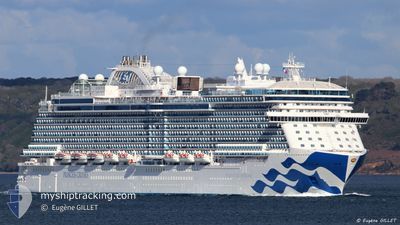
ENCHANTED PRINCESS
Passenger
Current Trip
| Time Travelled | 2 days |
|---|---|
| Remaining Time | 11 h, 50 mins |
| Distance Travelled | 968.48 морская миля |
| Remaining Distance | 201.46 морская миля |
| AVG Speed | 19.5 Узлы |
| MAX Speed | 21 Узлы |
| AVG Wind | 11 knots |
| MAX Wind | 18 knots |
| MIN Temp | 22.3°C / 72.14°F |
| MAX Temp | 26.6°C / 79.88°F |
| Осадка | 8.6 м |
| Позиция Получена | 2 m тому назад |
Current Position
| Долгота | --- |
|---|---|
| Широта | --- |
| Статус | Under way using engine |
| Скорость | 16.2 Узлы |
| Курс | 290.3° |
| Район | North Atlantic Ocean |
| Станция | T-AIS |
| Позиция Получена | 2 m тому назад |
Info
Information
The current position of ENCHANTED PRINCESS is in North Atlantic Ocean with coordinates 25.61964° / -76.48405° as reported on 2026-01-05 21:31 by AIS to our vessel tracker app. The vessel's current speed is 16.2 Узлы and is heading at the port of FORT LAUDERDALE. The estimated time of arrival as calculated by MyShipTracking vessel tracking app is 2026-01-06 04:24 LT
The vessel ENCHANTED PRINCESS (IMO: 9807126, MMSI: 310791000) is a Passenger It's sailing under the flag of [BM] Bermuda.
In this page you can find informations about the vessels current position, last detected port calls, and current voyage information. If the vessels is not in coverage by AIS you will find the latest position.
The current position of ENCHANTED PRINCESS is detected by our AIS receivers and we are not responsible for the reliability of the data. The last position was recorded while the vessel was in Coverage by the Ais receivers of our vessel tracking app.
The current draught of ENCHANTED PRINCESS as reported by AIS is 8.6 meters
Weather
| Temperature | 23.3°C / 73.94°F |
|---|---|
| Wind Speed | 18 knots |
| Direction | 81° E |
| Pressure | 1017.2 hPa |
| Humidity | 73.7 % |
| Cloud Coverage | 13 % |
Featured Company
Last Port Calls
| Port | Arrival | Departure | Time In Port |
|---|---|---|---|
| 2026-01-03 06:05 | 2026-01-03 16:05 | 9 h | |
| 2026-01-02 06:42 | 2026-01-02 17:23 | 10 h | |
| 2026-01-01 07:13 | 2026-01-01 18:01 | 10 h | |
| 2025-12-31 09:41 | 2025-12-31 18:50 | 9 h | |
| 2025-12-30 09:12 | 2025-12-30 18:11 | 8 h | |
| 2025-12-28 08:30 | 2025-12-28 16:07 | 7 h | |
| 2025-12-27 05:46 | 2025-12-27 15:13 | 9 h | |
| 2025-12-24 06:00 | 2025-12-24 16:11 | 10 h | |
| 2025-12-23 07:47 | 2025-12-23 17:42 | 9 h | |
| 2025-12-22 07:19 | 2025-12-22 17:49 | 10 h |
Most Visited Ports (Last year)
| Port | Arrivals | |
|---|---|---|
| 33 | ||
| 19 | ||
| 15 | ||
| 14 | ||
| 13 | ||
| 12 |
Last Trips
| Origin | Departure | Destination | Arrival | Distance | |
|---|---|---|---|---|---|
| 2026-01-02 17:23 | 2026-01-03 06:05 | 193.78 морская миля | |||
| 2026-01-01 18:01 | 2026-01-02 06:42 | 136.18 морская миля | |||
| 2025-12-31 18:50 | 2026-01-01 07:13 | 175.49 морская миля | |||
| 2025-12-30 18:11 | 2025-12-31 09:41 | 273.08 морская миля | |||
| 2025-12-28 16:07 | 2025-12-30 09:12 | 742.14 морская миля | |||
| 2025-12-27 15:13 | 2025-12-28 08:30 | 280.38 морская миля | |||
| 2025-12-24 16:11 | 2025-12-27 05:46 | 1171.27 морская миля | |||
| 2025-12-23 17:42 | 2025-12-24 06:00 | 176.16 морская миля | |||
| 2025-12-22 17:49 | 2025-12-23 07:47 | 135.39 морская миля | |||
| 2025-12-21 17:58 | 2025-12-22 07:19 | 122.22 морская миля |
Events
| Время | Событие | Детали | Позиция / Направление | Информация |
|---|---|---|---|---|
| 2026-01-05 20:53 | Статус изменился | Under way using engine Default |
25.55894 / -76.30543
USFLL
|
Скорость: 16.4 kn Курс: 299° |
| 2026-01-05 20:47 | Статус изменился | Default Under way using engine |
25.54442 / -76.27647
USFLL
|
Скорость: 16.3 kn Курс: 307.2° |
| 2026-01-05 20:29 | Изменение морского района | Bahamas part of the North Atlantic Ocean Anguilla part of the Caribbean Sea |
25.49442 / -76.20571
North Atlantic Ocean
USFLL
|
Скорость: 16.5 kn Курс: 310.4° |
| 2026-01-05 20:27 | Статус изменился | Under way using engine Default |
25.49082 / -76.20106
USFLL
|
Скорость: 16.6 kn Курс: 311° |
| 2026-01-05 20:19 | В покрытии |
25.49442 / -76.20571
North Atlantic Ocean
USFLL
|
Скорость: 16.5 kn Курс: 310.4° |
|
| 2026-01-04 02:50 | Статус изменился | Default Under way using engine |
18.36968 / -63.69454
USFLL
|
Скорость: 20 kn Курс: 329° |
| 2026-01-04 02:30 | Вне покрытия |
18.27681 / -63.63588
Caribbean Sea
USFLL
|
Скорость: 20 kn Курс: 329° |
|
| 2026-01-04 01:40 | Изменение морского района | Anguilla part of the Caribbean Sea Saint-Martin part of the Caribbean Sea |
18.03704 / -63.48415
Caribbean Sea
USFLL
|
Скорость: 20 kn Курс: 328.3° |
| 2026-01-04 01:10 | Изменение морского района | Saint-Martin part of the Caribbean Sea Saba part of the Caribbean Sea |
17.89625 / -63.39599
Caribbean Sea
USFLL
|
Скорость: 19.6 kn Курс: 329° |
| 2026-01-04 00:01 | Изменение морского района | Saba part of the Caribbean Sea Sint-Eustasius part of the Caribbean Sea |
17.71986 / -63.03946
Caribbean Sea
USFLL
|
Скорость: 20.1 kn Курс: 290.5° |