
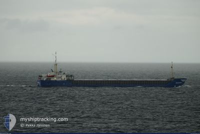
EMS LEADER
Cargo
Current Trip
| Time Travelled | 2 days |
|---|---|
| Remaining Time | 2 days |
| Distance Travelled | 397.60 морская миля |
| Remaining Distance | 854.64 морская миля |
| AVG Speed | 8.8 Узлы |
| MAX Speed | 10.1 Узлы |
| AVG Wind | 10.1 knots |
| MAX Wind | 20 knots |
| MIN Temp | 15.1°C / 59.18°F |
| MAX Temp | 16.4°C / 61.52°F |
| Осадка | 5.3 м |
| Позиция Получена | 1 d тому назад |
Current Position
| Долгота | --- |
|---|---|
| Широта | --- |
| Статус | Under way using engine |
| Скорость | 8.7 Узлы |
| Курс | 88° |
| Район | Balearic Sea |
| Станция | T-AIS |
| Позиция Получена | 1 d тому назад |
Info
Information
The current position of EMS LEADER is in Balearic Sea with coordinates 40.89887° / 1.85783° as reported on 2025-12-11 03:12 by AIS to our vessel tracker app. The vessel's current speed is 8.7 Узлы and is heading at the port of MISURATA. The estimated time of arrival as calculated by MyShipTracking vessel tracking app is 2025-12-15 11:34 LT
The vessel EMS LEADER (IMO: 1022304, MMSI: 305335000) is a Cargo It's sailing under the flag of [AG] Antigua Barbuda.
In this page you can find informations about the vessels current position, last detected port calls, and current voyage information. If the vessels is not in coverage by AIS you will find the latest position.
The current position of EMS LEADER is detected by our AIS receivers and we are not responsible for the reliability of the data. The last position was recorded while the vessel was in Coverage by the Ais receivers of our vessel tracking app.
The current draught of EMS LEADER as reported by AIS is 5.3 meters
Weather
| Temperature | 16.7°C / 62.06°F |
|---|---|
| Wind Speed | 18 knots |
| Direction | 102° ESE |
| Pressure | 1021.1 hPa |
| Humidity | 80.9 % |
| Cloud Coverage | 100 % |
Featured Company
Last Port Calls
| Port | Arrival | Departure | Time In Port |
|---|---|---|---|
| 2025-12-09 16:08 | 2025-12-10 23:37 | 1 d | |
| 2025-12-03 14:25 | 2025-12-08 11:33 | 4 d | |
| 2025-11-23 15:54 | 2025-11-23 20:21 | 4 h | |
| 2025-11-01 06:55 | 2025-11-01 20:11 | 13 h | |
| 2025-10-17 10:08 | 2025-10-17 16:35 | 6 h |
Most Visited Ports (Last year)
| Port | Arrivals | |
|---|---|---|
| 1 | ||
| 1 | ||
| 1 | ||
| 1 | ||
| 1 |
Last Trips
| Origin | Departure | Destination | Arrival | Distance | |
|---|---|---|---|---|---|
| 2025-12-08 11:33 | 2025-12-09 16:08 | 285.46 морская миля | |||
| 2025-11-23 20:21 | 2025-12-03 14:25 | 456.59 морская миля | |||
| 2025-11-01 20:11 | 2025-11-23 15:54 | 4611.10 морская миля | |||
| 2025-10-17 16:35 | 2025-11-01 06:55 | 3063.54 морская миля |
Events
| Время | Событие | Детали | Позиция / Направление | Информация |
|---|---|---|---|---|
| 2025-12-11 03:26 | Статус изменился | Default Under way using engine |
40.89974 / 1.90247
LYMRA
|
Скорость: 8.7 kn Курс: 88° |
| 2025-12-11 03:12 | Вне покрытия |
40.89887 / 1.85783
Balearic Sea
LYMRA
|
Скорость: 8.7 kn Курс: 88° |
|
| 2025-12-11 02:26 | Статус изменился | Under way using engine Default |
40.85541 / 1.80206
LYMRA
|
Скорость: 9.1 kn Курс: 173° |
| 2025-12-11 02:09 | Статус изменился | Default Under way using engine |
40.88285 / 1.83803
LYMRA
|
Скорость: 9 kn Курс: 142° |
| 2025-12-11 01:28 | Статус изменился | Under way using engine Default |
40.90868 / 1.71729
LYMRA
|
Скорость: 9.1 kn Курс: 97° |
| 2025-12-11 01:21 | Статус изменился | Default Under way using engine |
40.91069 / 1.69364
LYMRA
|
Скорость: 9 kn Курс: 97° |
| 2025-12-11 01:04 | Статус изменился | Under way using engine Default |
40.92679 / 1.64324
LYMRA
|
Скорость: 9.4 kn Курс: 127° |
| 2025-12-11 00:51 | Статус изменился | Default Under way using engine |
40.94714 / 1.60821
LYMRA
|
Скорость: 9.4 kn Курс: 127° |
| 2025-12-10 23:21 | ETA изменился | 2025/12/15 06:00 2025/12/09 15:00 |
41.00865 / 1.32497
LYMRA
|
Скорость: 9.3 kn Курс: 140° |
| 2025-12-10 22:39 | Статус изменился | Under way using engine Default |
41.05940 / 1.20409
LYMRA
|
Скорость: 8.9 kn Курс: 176° |