
DIAMOND GAS ROSE
Tanker
Current Trip
| Time Travelled | --- |
|---|---|
| Remaining Time | --- |
| Distance Travelled | 16039.76 морская миля |
| Remaining Distance | --- |
| AVG Speed | 16.1 Узлы |
| MAX Speed | 20.4 Узлы |
| AVG Wind | 12.9 knots |
| MAX Wind | 26 knots |
| MIN Temp | 15.3°C / 59.54°F |
| MAX Temp | 29.1°C / 84.38°F |
| Осадка | 11.5 м |
| Позиция Получена | 6 d тому назад |
Current Position
| Долгота | --- |
|---|---|
| Широта | --- |
| Статус | Under way using engine |
| Скорость | 14.2 Узлы |
| Курс | 135° |
| Район | North Atlantic Ocean |
| Станция | T-AIS |
| Позиция Получена | 6 d тому назад |
Info
Information
The current position of DIAMOND GAS ROSE is in North Atlantic Ocean with coordinates 36.27883° / -23.76622° as reported on 2024-12-06 13:24 by AIS to our vessel tracker app. The vessel's current speed is 14.2 Узлы and is heading at the port of DUNKERQUE. The estimated time of arrival as calculated by MyShipTracking vessel tracking app is 2024-12-13 22:00 LT
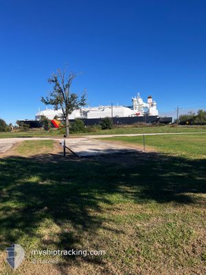
The vessel DIAMOND GAS ROSE (IMO: 9779238, MMSI: 563189500) is a Tanker It's sailing under the flag of [SG] Singapore.
In this page you can find informations about the vessels current position, last detected port calls, and current voyage information. If the vessels is not in coverage by AIS you will find the latest position.
The current position of DIAMOND GAS ROSE is detected by our AIS receivers and we are not responsible for the reliability of the data. The last position was recorded while the vessel was in Coverage by the Ais receivers of our vessel tracking app.
The current draught of DIAMOND GAS ROSE as reported by AIS is 11.5 meters
Weather
| Temperature | 27.4°C / 81.32°F |
|---|---|
| Wind Speed | 6 knots |
| Direction | 78° ENE |
| Pressure | 1011.7 hPa |
| Humidity | 70.6 % |
| Cloud Coverage | 37 % |
Featured Company
Last Trips
| Origin | Departure | Destination | Arrival | Distance |
|---|
Events
| Время | Событие | Детали | Позиция / Направление | Информация |
|---|---|---|---|---|
| 2024-12-06 13:59 | Статус изменился | Default Under way using engine |
36.14306 / -23.74987
FR_DKK
|
Скорость: 14.2 kn Курс: 135° |
| 2024-12-06 13:24 | Статус изменился | Under way using engine Default |
36.27883 / -23.76622
FR_DKK
|
Скорость: 14.1 kn Курс: 112° |
| 2024-12-06 13:24 | Вне покрытия |
36.27883 / -23.76622
North Atlantic Ocean
FR_DKK
|
Скорость: 14.2 kn Курс: 135° |
|
| 2024-12-06 13:12 | Статус изменился | Default Under way using engine |
36.28765 / -23.82078
FR_DKK
|
Скорость: 15.1 kn Курс: 359.8° |
| 2024-12-06 12:05 | Статус изменился | Under way using engine Default |
36.01820 / -23.85405
FR_DKK
|
Скорость: 15.1 kn Курс: 0° |
| 2024-12-06 12:05 | В покрытии |
36.05629 / -23.85384
North Atlantic Ocean
FR_DKK
|
Скорость: 15.2 kn Курс: 0.1° |
|
| 2024-12-05 14:42 | Статус изменился | Default Under way using engine |
36.34166 / -23.74158
FR_DKK
|
Скорость: 14.6 kn Курс: 180.3° |
| 2024-12-05 14:35 | Статус изменился | Under way using engine Default |
36.37205 / -23.74127
FR_DKK
|
Скорость: 14.6 kn Курс: 179° |
| 2024-12-05 14:35 | Вне покрытия |
36.37205 / -23.74127
North Atlantic Ocean
FR_DKK
|
Скорость: 14.6 kn Курс: 180.3° |
|
| 2024-12-05 14:09 | Статус изменился | Default Under way using engine |
36.47408 / -23.74293
FR_DKK
|
Скорость: 14 kn Курс: 139.5° |