
DENIKI
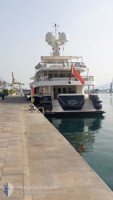
Yacht
Current Trip
| Trip Time | --- |
|---|---|
| Trip Distance | --- |
| AVG Speed | --- |
| MAX Speed | --- |
| Осадка | --- |
| AVG Wind | --- |
| MAX Wind | --- |
| MIN Temp | --- |
| MAX Temp | --- |
| Позиция Получена | 6 m тому назад |
Current Position
| Долгота | 14.22512° |
|---|---|
| Широта | 40.82698° |
| Статус | Moored |
| Скорость | |
| Курс | 335° |
| Район | Tyrrhenian Sea |
| Станция | T-AIS |
| Позиция Получена | 6 m тому назад |
Info
Information
The current position of DENIKI is in Tyrrhenian Sea with coordinates 40.82698° / 14.22512° as reported on 2024-06-30 21:07 by AIS to our vessel tracker app. The vessel's current speed is 0 Узлы and is currently inside the port of MERGELLINA.
The vessel DENIKI (IMO: 1009077, MMSI: 229852000) is a Yacht that was built in 2007 ( 17 лет ). It's sailing under the flag of [MT] Malta.
In this page you can find informations about the vessels current position, last detected port calls, and current voyage information. If the vessels is not in coverage by AIS you will find the latest position.
The current position of DENIKI is detected by our AIS receivers and we are not responsible for the reliability of the data. The last position was recorded while the vessel was in Coverage by the Ais receivers of our vessel tracking app.
The current draught of DENIKI as reported by AIS is 3.3 meters
Weather
| Temperature | 23.8°C / 74.84°F |
|---|---|
| Wind Speed | 4 knots |
| Direction | 166° SSE |
| Pressure | 1014.5 hPa |
| Humidity | 87 % |
| Cloud Coverage | 10 % |
Featured Company
Last Port Calls
| Port | Arrival | Departure | Time In Port |
|---|---|---|---|
| 2024-06-27 08:28 | |||
| 2024-06-07 14:15 | |||
| 2024-05-25 08:07 | 2024-06-05 22:41 | 11 d | |
| 2024-05-15 08:53 | 2024-05-15 14:41 | 5 h | |
| 2024-04-25 21:23 | 2024-04-30 06:20 | 4 d | |
| 2024-04-16 05:54 | 2024-04-19 10:14 | 3 d | |
| 2024-04-15 16:57 |
Last Trips
| Origin | Departure | Destination | Arrival | Distance | |
|---|---|---|---|---|---|
| 2024-06-06 00:41 | 2024-06-07 16:15 | 116.88 морская миля | |||
| 2024-05-15 16:41 | 2024-05-25 10:07 | 1312.32 морская миля | |||
| 2024-04-30 08:20 | 2024-05-15 10:53 | 85.41 морская миля | |||
| 2024-04-19 12:14 | 2024-04-25 23:23 | 406.10 морская миля | |||
| 2024-04-15 18:57 | 2024-04-16 07:54 | 69.90 морская миля |
Events
| Время | Событие | Детали | Позиция / Направление | Информация |
|---|---|---|---|---|
| 2024-06-27 08:40 | Статус изменился | Moored Under way using engine |
40.82698 / 14.22512
[IT] MERGELLINA
|
Скорость: Курс: 334° |
| 2024-06-27 08:32 | Окончание движения |
40.82774 / 14.22456
[IT] MERGELLINA
|
Скорость: Курс: 313° |
|
| 2024-06-27 08:28 | Порт |
|
40.82756 / 14.22674
[IT] MERGELLINA
|
Скорость: 3.2 kn Курс: 300° |
| 2024-06-27 07:07 | В покрытии |
40.55326 / 14.26820
Tyrrhenian Sea
IT NAP
|
Скорость: 7.4 kn Курс: 45.3° |
|
| 2024-06-27 06:06 | Вне покрытия |
40.55021 / 14.26185
Tyrrhenian Sea
IT NAP
|
Скорость: 0.1 kn Курс: 23.3° |
|
| 2024-06-27 05:38 | Окончание движения | 0.99 nm, South East of CAPRI |
40.55007 / 14.26203
IT NAP
|
Скорость: 0.3 kn Курс: 33° |
| 2024-06-27 03:40 | В покрытии |
40.24505 / 14.47288
Tyrrhenian Sea
IT NAP
|
Скорость: 11.2 kn Курс: 330.6° |
|
| 2024-06-26 20:01 | Вне покрытия |
38.90257 / 15.22084
Tyrrhenian Sea
IT NAP
|
Скорость: 11.8 kn Курс: 359.2° |
|
| 2024-06-26 19:57 | В покрытии |
38.89411 / 15.22071
Tyrrhenian Sea
IT NAP
|
Скорость: 7.7 kn Курс: 353.9° |
|
| 2024-06-26 17:17 | Вне покрытия |
38.67221 / 15.47008
Tyrrhenian Sea
IT NAP
|
Скорость: 6.4 kn Курс: 326.5° |