
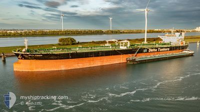
DELTA KANARIS
Crude Oil Tanker
Current Trip
| Time Travelled | --- |
|---|---|
| Remaining Time | 1 day |
| Distance Travelled | 5804.97 морская миля |
| Remaining Distance | 353.96 морская миля |
| AVG Speed | 11.4 Узлы |
| MAX Speed | 11.4 Узлы |
| AVG Wind | 10.1 knots |
| MAX Wind | 29.7 knots |
| MIN Temp | 15.6°C / 60.08°F |
| MAX Temp | 38.4°C / 101.12°F |
| Осадка | 15.6 м |
| Позиция Получена | Сейчас |
Current Position
| Долгота | -3.73467° |
|---|---|
| Широта | 49.49733° |
| Статус | Under way using engine |
| Скорость | 14.4 Узлы |
| Курс | 58° |
| Район | English Channel |
| Станция | T-AIS |
| Позиция Получена | Сейчас |
Info
Information
The current position of DELTA KANARIS is in English Channel with coordinates 49.49733° / -3.73467° as reported on 2024-09-21 19:35 by AIS to our vessel tracker app. The vessel's current speed is 14.4 Узлы and is heading at the port of ROTTERDAM. The estimated time of arrival as calculated by MyShipTracking vessel tracking app is 2024-09-22 19:59 LT
The vessel DELTA KANARIS (IMO: 9429015, MMSI: 636020072) is a Crude Oil Tanker that was built in 2010 ( 14 лет ). It's sailing under the flag of [LR] Liberia.
In this page you can find informations about the vessels current position, last detected port calls, and current voyage information. If the vessels is not in coverage by AIS you will find the latest position.
The current position of DELTA KANARIS is detected by our AIS receivers and we are not responsible for the reliability of the data. The last position was recorded while the vessel was in Coverage by the Ais receivers of our vessel tracking app.
The current draught of DELTA KANARIS as reported by AIS is 15.6 meters
Weather
| Temperature | 16.4°C / 61.52°F |
|---|---|
| Wind Speed | 9 knots |
| Direction | 81° E |
| Pressure | 1012.9 hPa |
| Humidity | 92.3 % |
| Cloud Coverage | 100 % |
Featured Company
Last Port Calls
| Port | Arrival | Departure | Time In Port |
|---|---|---|---|
| 2024-08-04 06:10 | 2024-08-04 15:42 | 9 h |
Most Visited Ports (Last year)
| Port | Arrivals | |
|---|---|---|
| 3 | ||
| 3 | ||
| 3 | ||
| 2 | ||
| 1 | ||
| 1 |
Last Trips
| Origin | Departure | Destination | Arrival | Distance | |
|---|---|---|---|---|---|
| 2024-06-30 17:27 | 2024-08-04 08:10 | 7284.39 морская миля |
Events
| Время | Событие | Детали | Позиция / Направление | Информация |
|---|---|---|---|---|
| 2024-09-21 18:47 | Статус изменился | Under way using engine Default |
49.40500 / -3.99378
NLRTM
|
Скорость: 14.5 kn Курс: 60° |
| 2024-09-21 18:39 | Статус изменился | Default Under way using engine |
49.38878 / -4.03763
NLRTM
|
Скорость: 14.6 kn Курс: 61° |
| 2024-09-21 18:16 | Статус изменился | Under way using engine Default |
49.34303 / -4.16287
NLRTM
|
Скорость: 14.3 kn Курс: 60° |
| 2024-09-21 18:15 | Статус изменился | Default Under way using engine |
49.34125 / -4.16767
NLRTM
|
Скорость: 14.3 kn Курс: 61° |
| 2024-09-21 17:25 | ETA изменился | 2024/09/22 23:30 2024/09/22 23:00 |
49.24333 / -4.42997
NLRTM
|
Скорость: 14.2 kn Курс: 59° |
| 2024-09-21 17:11 | Статус изменился | Under way using engine Default |
49.21508 / -4.50402
NLRTM
|
Скорость: 14 kn Курс: 57° |
| 2024-09-21 17:07 | Статус изменился | Default Under way using engine |
49.20677 / -4.52400
NLRTM
|
Скорость: 14 kn Курс: 57° |
| 2024-09-21 17:07 | Статус изменился | Under way using engine Default |
49.20615 / -4.52550
NLRTM
|
Скорость: 14 kn Курс: 57° |
| 2024-09-21 17:07 | Изменение морского района | French part of the English Channel Portuguese part of the North Atlantic Ocean |
49.20615 / -4.52550
English Channel
NLRTM
|
Скорость: 14 kn Курс: 57° |
| 2024-09-21 17:03 | Статус изменился | Default Under way using engine |
49.19783 / -4.54530
NLRTM
|
Скорость: 13.9 kn Курс: 56° |