
COSGRACE LAKE
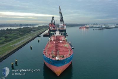
Crude Oil Tanker
Current Trip
| Time Travelled | --- |
|---|---|
| Remaining Time | --- |
| Distance Travelled | 10960.55 морская миля |
| Remaining Distance | --- |
| AVG Speed | 10.5 Узлы |
| MAX Speed | 15.7 Узлы |
| AVG Wind | 8.4 knots |
| MAX Wind | 29.3 knots |
| MIN Temp | 20°C / 68°F |
| MAX Temp | 33.7°C / 92.66°F |
| Осадка | 20.2 м |
| Позиция Получена | 7 d тому назад |
Current Position
| Долгота | 57.26568° |
|---|---|
| Широта | 24.77458° |
| Статус | Under way using engine |
| Скорость | 11.8 Узлы |
| Курс | 124° |
| Район | Gulf of Oman |
| Станция | T-AIS |
| Позиция Получена | 7 d тому назад |
Info
Information
The current position of COSGRACE LAKE is in Gulf of Oman with coordinates 24.77458° / 57.26568° as reported on 2024-05-06 10:26 by AIS to our vessel tracker app. The vessel's current speed is 11.8 Узлы and is heading at the port of MELAKA. The estimated time of arrival as calculated by MyShipTracking vessel tracking app is 2024-05-17 20:00 LT
The vessel COSGRACE LAKE (IMO: 9294587, MMSI: 354433000) is a Crude Oil Tanker that was built in 2006 ( 18 лет ). It's sailing under the flag of [PA] Panama.
In this page you can find informations about the vessels current position, last detected port calls, and current voyage information. If the vessels is not in coverage by AIS you will find the latest position.
The current position of COSGRACE LAKE is detected by our AIS receivers and we are not responsible for the reliability of the data. The last position was recorded while the vessel was in Coverage by the Ais receivers of our vessel tracking app.
The current draught of COSGRACE LAKE as reported by AIS is 20.2 meters
Weather
| Temperature | 29.8°C / 85.64°F |
|---|---|
| Wind Speed | 3 knots |
| Direction | 120° ESE |
| Pressure | 1008.3 hPa |
| Humidity | 68.4 % |
| Cloud Coverage | 86 % |
Featured Company
Last Port Calls
Most Visited Ports (Last year)
| Port | Arrivals |
|---|
Last Trips
| Origin | Departure | Destination | Arrival | Distance |
|---|
Events
| Время | Событие | Детали | Позиция / Направление | Информация |
|---|---|---|---|---|
| 2024-05-06 10:33 | Статус изменился | Default Under way using engine |
24.76233 / 57.28643
TANJUNG BRUAS
|
Скорость: 11.8 kn Курс: 124° |
| 2024-05-06 10:26 | Вне покрытия |
24.77458 / 57.26568
Gulf of Oman
TANJUNG BRUAS
|
Скорость: 11.8 kn Курс: 124° |
|
| 2024-05-06 08:13 | Изменение морского района | Omani part of the Gulf of Oman United Arab Emirates part of the Gulf of Oman |
25.06863 / 56.92105
Gulf of Oman
TANJUNG BRUAS
|
Скорость: 11.7 kn Курс: 120° |
| 2024-05-06 05:46 | Пункт назначения изменился | TANJUNG BRUAS TANJUNGBRUASMALAYSIA |
25.31400 / 56.53797
TANJUNG BRUAS
|
Скорость: 8.1 kn Курс: 90° |
| 2024-05-06 05:46 | ETA изменился | 2024/05/17 20:00 2024/05/17 09:00 |
25.31400 / 56.53797
TANJUNG BRUAS
|
Скорость: 8.1 kn Курс: 90° |
| 2024-05-06 04:23 | Начало движения | 6.42 nm, North East of FUJAIRAH |
25.24487 / 56.41752
TANJUNGBRUASMALAYSIA
|
Скорость: 3.1 kn Курс: 25° |
| 2024-05-06 03:59 | ETA изменился | 2024/05/17 09:00 2024/05/04 22:01 |
25.24137 / 56.41457
TANJUNGBRUASMALAYSIA
|
Скорость: 0.8 kn Курс: 138° |
| 2024-05-06 03:56 | Статус изменился | Under way using engine Moored |
25.24073 / 56.41503
TANJUNGBRUASMALAYSIA
|
Скорость: Курс: 182° |
| 2024-05-06 03:34 | Осадка изменилась | 20.2 11.8 |
25.24023 / 56.41440
TANJUNGBRUASMALAYSIA
|
Скорость: Курс: 175° |
| 2024-05-06 03:34 | Пункт назначения изменился | TANJUNGBRUASMALAYSIA FUJAIRAH |
25.24023 / 56.41440
TANJUNGBRUASMALAYSIA
|
Скорость: Курс: 175° |