
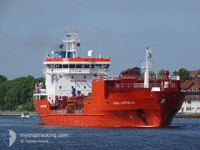
CORAL LOPHELIA
Lpg Tanker
Current Trip
| Time Travelled | 1 day |
|---|---|
| Remaining Time | 15 h, 13 mins |
| Distance Travelled | 340.71 морская миля |
| Remaining Distance | 246.09 морская миля |
| AVG Speed | 13.2 Узлы |
| MAX Speed | 15.2 Узлы |
| AVG Wind | 15.9 knots |
| MAX Wind | 21.3 knots |
| MIN Temp | 8.1°C / 46.58°F |
| MAX Temp | 11.2°C / 52.16°F |
| Осадка | 6.7 м |
| Позиция Получена | 4 h, 39 m тому назад |
Current Position
| Долгота | 6.04135° |
|---|---|
| Широта | 55.32978° |
| Статус | Under way using engine |
| Скорость | 15.1 Узлы |
| Курс | 207° |
| Район | North Sea |
| Станция | T-AIS |
| Позиция Получена | 4 h, 39 m тому назад |
Info
Information
The current position of CORAL LOPHELIA is in North Sea with coordinates 55.32978° / 6.04135° as reported on 2024-04-29 20:17 by AIS to our vessel tracker app. The vessel's current speed is 15.1 Узлы and is heading at the port of ANTWERP. The estimated time of arrival as calculated by MyShipTracking vessel tracking app is 2024-04-30 16:09 LT
The vessel CORAL LOPHELIA (IMO: 9350886, MMSI: 636016683) is a Lpg Tanker that was built in 2006 ( 18 лет ). It's sailing under the flag of [LR] Liberia.
In this page you can find informations about the vessels current position, last detected port calls, and current voyage information. If the vessels is not in coverage by AIS you will find the latest position.
The current position of CORAL LOPHELIA is detected by our AIS receivers and we are not responsible for the reliability of the data. The last position was recorded while the vessel was in Coverage by the Ais receivers of our vessel tracking app.
The current draught of CORAL LOPHELIA as reported by AIS is 6.7 meters
Weather
| Temperature | 11.3°C / 52.34°F |
|---|---|
| Wind Speed | 10 knots |
| Direction | 145° SE |
| Pressure | 1018.2 hPa |
| Humidity | 80.8 % |
| Cloud Coverage | 56 % |
Featured Company
Last Port Calls
| Port | Arrival | Departure | Time In Port |
|---|---|---|---|
| 2024-04-28 09:59 | 2024-04-29 00:10 | 14 h | |
| 2024-04-18 18:08 | 2024-04-21 17:28 | 2 d | |
| 2024-04-01 05:19 | 2024-04-01 22:21 | 17 h | |
| 2024-03-25 06:56 | 2024-03-27 04:16 | 1 d | |
| 2024-03-17 17:55 | 2024-03-18 15:40 | 21 h | |
| 2024-03-16 14:50 | 2024-03-17 07:47 | 16 h | |
| 2024-03-11 00:57 | 2024-03-12 12:11 | 1 d | |
| 2024-03-08 08:33 | 2024-03-09 07:09 | 22 h | |
| 2024-03-04 10:36 | 2024-03-04 20:04 | 9 h | |
| 2024-02-27 04:52 | 2024-02-27 23:32 | 18 h |
Most Visited Ports (Last year)
| Port | Arrivals | |
|---|---|---|
| 12 | ||
| 8 | ||
| 6 | ||
| 5 | ||
| 4 | ||
| 3 |
Last Trips
| Origin | Departure | Destination | Arrival | Distance | |
|---|---|---|---|---|---|
| 2024-04-21 19:28 | 2024-04-28 11:59 | 1793.52 морская миля | |||
| 2024-04-02 00:21 | 2024-04-18 20:08 | 5042.39 морская миля | |||
| 2024-03-27 05:16 | 2024-04-01 07:19 | 627.82 морская миля | |||
| 2024-03-18 16:40 | 2024-03-25 07:56 | 1838.91 морская миля | |||
| 2024-03-17 08:47 | 2024-03-17 18:55 | 118.37 морская миля | |||
| 2024-03-12 13:11 | 2024-03-16 15:50 | 594.78 морская миля | |||
| 2024-03-09 08:09 | 2024-03-11 01:57 | 598.04 морская миля | |||
| 2024-03-04 21:04 | 2024-03-08 09:33 | 28.15 морская миля | |||
| 2024-02-28 00:32 | 2024-03-04 11:36 | 610.37 морская миля | |||
| 2024-02-26 07:57 | 2024-02-27 05:52 | 152.38 морская миля |
Events
| Время | Событие | Детали | Позиция / Направление | Информация |
|---|---|---|---|---|
| 2024-04-29 20:24 | Статус изменился | Default Under way using engine |
55.30167 / 6.01667
BE ANR
|
Скорость: 15.1 kn Курс: 207° |
| 2024-04-29 20:17 | Вне покрытия |
55.32978 / 6.04135
North Sea
BE ANR
|
Скорость: 15.1 kn Курс: 207° |
|
| 2024-04-29 19:59 | Изменение морского района | German part of the North Sea Danish part of the North Sea |
55.39712 / 6.10053
North Sea
BE ANR
|
Скорость: 15.1 kn Курс: 207° |
| 2024-04-29 19:56 | Статус изменился | Under way using engine Default |
55.40752 / 6.10985
BE ANR
|
Скорость: 15 kn Курс: 204° |
| 2024-04-29 19:48 | Статус изменился | Default Under way using engine |
55.44034 / 6.13598
BE ANR
|
Скорость: 14.9 kn Курс: 203° |
| 2024-04-29 15:42 | Статус изменился | Under way using engine Default |
56.34015 / 6.89081
BE ANR
|
Скорость: 14.3 kn Курс: 208° |
| 2024-04-29 15:31 | Статус изменился | Default Under way using engine |
56.38005 / 6.92811
BE ANR
|
Скорость: 14.3 kn Курс: 208° |
| 2024-04-29 15:02 | Статус изменился | Under way using engine Default |
56.47870 / 7.01993
BE ANR
|
Скорость: 14 kn Курс: 207° |
| 2024-04-29 14:57 | Статус изменился | Default Under way using engine |
56.49500 / 7.03500
BE ANR
|
Скорость: 14.3 kn Курс: 207° |
| 2024-04-29 10:05 | Изменение морского района | Danish part of the North Sea Danish part of the Skaggerak |
57.36809 / 8.13730
North Sea
BE ANR
|
Скорость: 12.7 kn Курс: 243° |