
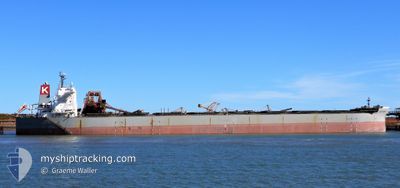
CAPE MIDORI
Bulk Carrier
Current Trip
| Time Travelled | 4 days |
|---|---|
| Remaining Time | --- |
| Distance Travelled | 1080.07 морская миля |
| Remaining Distance | --- |
| AVG Speed | 11.1 Узлы |
| MAX Speed | 12.6 Узлы |
| AVG Wind | 21.9 knots |
| MAX Wind | 26.9 knots |
| MIN Temp | 15°C / 59°F |
| MAX Temp | 24.5°C / 76.1°F |
| Осадка | 15.5 м |
| Позиция Получена | 2 d тому назад |
Current Position
| Долгота | 154.09804° |
|---|---|
| Широта | -27.43264° |
| Статус | Under way using engine |
| Скорость | 10.2 Узлы |
| Курс | 356.9° |
| Район | Coral Sea |
| Станция | T-AIS |
| Позиция Получена | 2 d тому назад |
Info
Information
The current position of CAPE MIDORI is in Coral Sea with coordinates -27.43264° / 154.09804° as reported on 2024-07-03 20:11 by AIS to our vessel tracker app. The vessel's current speed is 10.2 Узлы and is heading at the port of OITA. The estimated time of arrival as calculated by MyShipTracking vessel tracking app is 2024-07-18 18:00 LT
The vessel CAPE MIDORI (IMO: 9531868, MMSI: 373615000) is a Bulk Carrier that was built in 2014 ( 10 лет ). It's sailing under the flag of [PA] Panama.
In this page you can find informations about the vessels current position, last detected port calls, and current voyage information. If the vessels is not in coverage by AIS you will find the latest position.
The current position of CAPE MIDORI is detected by our AIS receivers and we are not responsible for the reliability of the data. The last position was recorded while the vessel was in Coverage by the Ais receivers of our vessel tracking app.
The current draught of CAPE MIDORI as reported by AIS is 15.5 meters
Weather
| Temperature | 24.4°C / 75.92°F |
|---|---|
| Wind Speed | 24 knots |
| Direction | 116° ESE |
| Pressure | 1017 hPa |
| Humidity | 69.5 % |
| Cloud Coverage | 66 % |
Featured Company
Events
| Время | Событие | Детали | Позиция / Направление | Информация |
|---|---|---|---|---|
| 2024-07-03 20:17 | Статус изменился | Default Under way using engine |
-27.41791 / 154.09729
JP OIT
|
Скорость: 10.2 kn Курс: 356.9° |
| 2024-07-03 20:11 | Изменение морского района | Australian part of the Coral Sea Australian part of the Tasman Sea |
-27.43264 / 154.09804
Coral Sea
JP OIT
|
Скорость: 10.2 kn Курс: 356.9° |
| 2024-07-03 20:11 | Вне покрытия |
-27.43264 / 154.09804
Coral Sea
JP OIT
|
Скорость: 10.2 kn Курс: 356.9° |
|
| 2024-07-03 20:11 | Статус изменился | Under way using engine Default |
-27.43312 / 154.09806
JP OIT
|
Скорость: 10.2 kn Курс: 357° |
| 2024-07-03 19:57 | В покрытии |
-27.43264 / 154.09804
Coral Sea
JP OIT
|
Скорость: 10.2 kn Курс: 356.9° |
|
| 2024-07-02 15:29 | Статус изменился | Default Under way using engine |
-32.46843 / 152.80611
JP OIT
|
Скорость: 11.5 kn Курс: 39.1° |
| 2024-07-02 15:20 | Вне покрытия |
-32.48928 / 152.78657
Tasman Sea
JP OIT
|
Скорость: 11.5 kn Курс: 39.1° |
|
| 2024-07-02 09:06 | ПОРТ ОТПРАВЛЕНИЯ |
|
-32.91151 / 151.80579
JP OIT
|
Скорость: 6.6 kn Курс: 88° |
| 2024-07-02 08:23 | Начало движения |
-32.89626 / 151.77117
[AU] NEWCASTLE
|
Скорость: 3.1 kn Курс: 174° |
|
| 2024-07-02 08:01 | Статус изменился | Under way using engine Default |
-32.88882 / 151.76999
[AU] NEWCASTLE
|
Скорость: Курс: 110° |