
Unkown Name
Cable Layer
Current Trip
SUBIC BAY
| Time Travelled | 8 days |
|---|---|
| Remaining Time | --- |
| Distance Travelled | 542.30 морская миля |
| Remaining Distance | --- |
| AVG Speed | 10.7 Узлы |
| MAX Speed | 11.6 Узлы |
| AVG Wind | 8.5 knots |
| MAX Wind | 9.6 knots |
| MIN Temp | 27°C / 80.6°F |
| MAX Temp | 31.2°C / 88.16°F |
| Осадка | 5.9 м |
| Позиция Получена | 5 d тому назад |
Current Position
| Долгота | 114.80810° |
|---|---|
| Широта | 22.01775° |
| Статус | Restricted manoeuverability |
| Скорость | 0.5 Узлы |
| Курс | 189° |
| Район | South China Sea |
| Станция | T-AIS |
| Позиция Получена | 5 d тому назад |
Info
Information
The current position of Unkown Name is in South China Sea with coordinates 22.01775° / 114.80810° as reported on 2024-05-26 20:44 by AIS to our vessel tracker app. The vessel's current speed is 0.5 Узлы
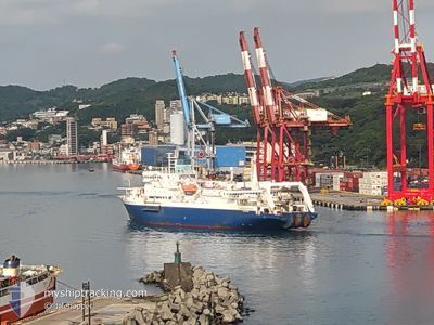
The vessel Unkown Name (IMO: 9063287, MMSI: 564428000) is a Cable Layer that was built in 1997 ( 27 лет ). It's sailing under the flag of [SG] Singapore.
In this page you can find informations about the vessels current position, last detected port calls, and current voyage information. If the vessels is not in coverage by AIS you will find the latest position.
The current position of Unkown Name is detected by our AIS receivers and we are not responsible for the reliability of the data. The last position was recorded while the vessel was in Coverage by the Ais receivers of our vessel tracking app.
The current draught of Unkown Name as reported by AIS is 5.9 meters
Weather
| Temperature | 27.1°C / 80.78°F |
|---|---|
| Wind Speed | 9 knots |
| Direction | 191° S |
| Pressure | 1004.2 hPa |
| Humidity | 89.4 % |
| Cloud Coverage | 99 % |
Featured Company
Last Port Calls
| Port | Arrival | Departure | Time In Port |
|---|---|---|---|
| 2024-05-24 14:26 | |||
| 2024-04-01 18:42 |
Most Visited Ports (Last year)
| Port | Arrivals | |
|---|---|---|
| 9 | ||
| 3 | ||
| 2 | ||
| 1 |
Last Trips
| Origin | Departure | Destination | Arrival | Distance |
|---|
Events
| Время | Событие | Детали | Позиция / Направление | Информация |
|---|---|---|---|---|
| 2024-05-26 20:44 | Вне покрытия |
22.01775 / 114.80810
South China Sea
|
Скорость: 0.5 kn Курс: 358° |
|
| 2024-05-26 20:44 | Обнаружено в море | Chinese part of the South China Sea |
22.01775 / 114.80810
South China Sea
|
Скорость: 0.5 kn Курс: 358° |
| 2024-05-26 20:44 | В покрытии |
22.01775 / 114.80810
South China Sea
|
Скорость: 0.5 kn Курс: 358° |
|
| 2024-05-24 07:28 | Вне покрытия |
14.72360 / 120.14881
South China Sea
|
Скорость: 11.6 kn Курс: 263.9° |
|
| 2024-05-24 06:26 | ПОРТ ОТПРАВЛЕНИЯ |
|
14.81182 / 120.28356
SUBIC BAY
|
Скорость: 4.2 kn Курс: 278° |
| 2024-05-24 06:24 | Изменение морского района | Philippines part of the South China Sea Taiwanese part of the South China Sea |
14.81122 / 120.28672
South China Sea
|
Скорость: 4.2 kn Курс: 276.7° |
| 2024-05-24 06:24 | Начало движения |
14.81113 / 120.28743
[PH] GRANDE ISLAND
|
Скорость: 3.3 kn Курс: 277° |
|
| 2024-05-24 06:09 | Статус изменился | Under way using engine Moored |
14.81215 / 120.28998
[PH] GRANDE ISLAND
|
Скорость: 0.1 kn Курс: 359° |
| 2024-05-24 02:31 | В покрытии |
14.81358 / 120.28935
South China Sea
[PH] GRANDE ISLAND
|
Скорость: 0.1 kn Курс: 224.3° |
|
| 2024-05-24 01:25 | Вне покрытия |
14.81357 / 120.28938
South China Sea
[PH] GRANDE ISLAND
|
Скорость: 0.1 kn Курс: 89.2° |