
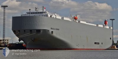
BRASILIA HIGHWAY
Vehicles Carrier
Current Trip
| Time Travelled | 20 days |
|---|---|
| Remaining Time | 12 days |
| Distance Travelled | 7435.66 морская миля |
| Remaining Distance | 4848.16 морская миля |
| AVG Speed | 15.1 Узлы |
| MAX Speed | 18.4 Узлы |
| AVG Wind | 13 knots |
| MAX Wind | 29.6 knots |
| MIN Temp | 10.8°C / 51.44°F |
| MAX Temp | 27.7°C / 81.86°F |
| Осадка | 9.5 м |
| Позиция Получена | Сейчас |
Current Position
| Долгота | 32.89793° |
|---|---|
| Широта | -32.13973° |
| Статус | Under way using engine |
| Скорость | 15.4 Узлы |
| Курс | 64° |
| Район | Indian Ocean |
| Станция | T-AIS |
| Позиция Получена | Сейчас |
Info
Information
The current position of BRASILIA HIGHWAY is in Indian Ocean with coordinates -32.13973° / 32.89793° as reported on 2024-07-03 08:30 by AIS to our vessel tracker app. The vessel's current speed is 15.4 Узлы and is heading at the port of SINGAPORE. The estimated time of arrival as calculated by MyShipTracking vessel tracking app is 2024-07-15 20:04 LT
The vessel BRASILIA HIGHWAY (IMO: 9519119, MMSI: 356073000) is a Vehicles Carrier that was built in 2009 ( 15 лет ). It's sailing under the flag of [PA] Panama.
In this page you can find informations about the vessels current position, last detected port calls, and current voyage information. If the vessels is not in coverage by AIS you will find the latest position.
The current position of BRASILIA HIGHWAY is detected by our AIS receivers and we are not responsible for the reliability of the data. The last position was recorded while the vessel was in Coverage by the Ais receivers of our vessel tracking app.
The current draught of BRASILIA HIGHWAY as reported by AIS is 9.5 meters
Weather
| Temperature | 21.8°C / 71.24°F |
|---|---|
| Wind Speed | 18 knots |
| Direction | 7° N |
| Pressure | 1015.2 hPa |
| Humidity | 81.9 % |
| Cloud Coverage | 100 % |
Featured Company
Events
| Время | Событие | Детали | Позиция / Направление | Информация |
|---|---|---|---|---|
| 2024-07-03 08:23 | Статус изменился | Under way using engine Default |
-32.15277 / 32.86515
SG SIN
|
Скорость: 15.5 kn Курс: 65° |
| 2024-07-03 08:16 | Статус изменился | Default Under way using engine |
-32.16630 / 32.83013
SG SIN
|
Скорость: 15.6 kn Курс: 67° |
| 2024-07-03 08:09 | Статус изменился | Under way using engine Default |
-32.17838 / 32.79793
SG SIN
|
Скорость: 15.5 kn Курс: 67° |
| 2024-07-03 07:56 | Статус изменился | Default Under way using engine |
-32.19883 / 32.73960
SG SIN
|
Скорость: 15.5 kn Курс: 68° |
| 2024-07-03 07:50 | Обнаружено в море | South African part of the Indian Ocean |
-32.20857 / 32.71150
Indian Ocean
SG SIN
|
Скорость: 15.5 kn Курс: 68° |
| 2024-07-03 07:50 | Статус изменился | Under way using engine Default |
-32.20900 / 32.71023
SG SIN
|
Скорость: 15.5 kn Курс: 67° |
| 2024-07-03 07:32 | В покрытии |
-32.20857 / 32.71150
Indian Ocean
SG SIN
|
Скорость: 15.5 kn Курс: 68° |
|
| 2024-07-01 08:29 | Статус изменился | Default Under way using engine |
-34.86803 / 19.11282
SG SIN
|
Скорость: 15.6 kn Курс: 112° |
| 2024-07-01 08:28 | Вне покрытия |
-34.86558 / 19.10537
South Atlantic Ocean
SG SIN
|
Скорость: 15.6 kn Курс: 112° |
|
| 2024-07-01 07:52 | Статус изменился | Under way using engine Default |
-34.80558 / 18.93047
SG SIN
|
Скорость: 15.8 kn Курс: 114° |