
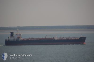
BENTLEY I
Oil/Chemical Tanker
Current Trip
| Time Travelled | 4 days |
|---|---|
| Remaining Time | --- |
| Distance Travelled | 855.35 морская миля |
| Remaining Distance | --- |
| AVG Speed | 11.4 Узлы |
| MAX Speed | 14.3 Узлы |
| AVG Wind | 6.9 knots |
| MAX Wind | 18 knots |
| MIN Temp | 18.3°C / 64.94°F |
| MAX Temp | 23.1°C / 73.58°F |
| Осадка | 8.5 м |
| Позиция Получена | 2 d тому назад |
Current Position
| Долгота | --- |
|---|---|
| Широта | --- |
| Статус | Under way using engine |
| Скорость | 12.6 Узлы |
| Курс | 107.7° |
| Район | Gulf of Oman |
| Станция | T-AIS |
| Позиция Получена | 2 d тому назад |
Info
Information
The current position of BENTLEY I is in Gulf of Oman with coordinates 25.10723° / 56.87344° as reported on 2025-01-11 07:16 by AIS to our vessel tracker app. The vessel's current speed is 12.6 Узлы
The vessel BENTLEY I (IMO: 9253129, MMSI: 373259000) is a Oil/Chemical Tanker that was built in 2004 ( 21 лет ). It's sailing under the flag of [PA] Panama.
In this page you can find informations about the vessels current position, last detected port calls, and current voyage information. If the vessels is not in coverage by AIS you will find the latest position.
The current position of BENTLEY I is detected by our AIS receivers and we are not responsible for the reliability of the data. The last position was recorded while the vessel was in Coverage by the Ais receivers of our vessel tracking app.
The current draught of BENTLEY I as reported by AIS is 8.5 meters
Weather
| Temperature | 18.8°C / 65.84°F |
|---|---|
| Wind Speed | 12 knots |
| Direction | 65° ENE |
| Pressure | 1018 hPa |
| Humidity | 53 % |
| Cloud Coverage | --- |
Featured Company
Last Port Calls
| Port | Arrival | Departure | Time In Port |
|---|---|---|---|
| 2025-01-07 23:30 | 2025-01-10 00:15 | 2 d | |
| 2025-01-02 05:24 | 2025-01-04 05:48 | 2 d | |
| 2024-12-21 14:57 | 2024-12-22 11:21 | 20 h | |
| 2024-12-07 18:57 | 2024-12-09 00:33 | 1 d | |
| 2024-11-15 02:36 | 2024-11-16 16:06 | 1 d | |
| 2024-11-07 02:30 | 2024-11-09 16:38 | 2 d | |
| 2024-11-01 16:35 | 2024-11-03 10:39 | 1 d |
Last Trips
| Origin | Departure | Destination | Arrival | Distance | |
|---|---|---|---|---|---|
| 2025-01-04 05:48 | 2025-01-07 23:30 | 1022.56 морская миля | |||
| 2024-12-22 11:21 | 2025-01-02 05:24 | 3009.48 морская миля | |||
| 2024-12-09 00:33 | 2024-12-21 14:57 | 1856.59 морская миля | |||
| 2024-11-16 16:06 | 2024-12-07 18:57 | 4483.36 морская миля | |||
| 2024-11-09 16:38 | 2024-11-15 02:36 | 889.29 морская миля | |||
| 2024-11-03 10:39 | 2024-11-07 02:30 | 1068.69 морская миля | |||
| 2024-09-26 07:43 | 2024-11-01 16:35 | 6114.72 морская миля |
Events
| Время | Событие | Детали | Позиция / Направление | Информация |
|---|---|---|---|---|
| 2025-01-13 05:20 | Окончание движения | 13.66 nm, South of SALEHAABAD ISLAND |
24.57662 / 66.97289
PKBQM
|
Скорость: 0.1 kn Курс: 56° |
| 2025-01-11 07:23 | Статус изменился | Default Under way using engine |
25.09975 / 56.89857
PKBQM
|
Скорость: 12.6 kn Курс: 107.7° |
| 2025-01-11 07:16 | Вне покрытия |
25.10723 / 56.87344
Gulf of Oman
PKBQM
|
Скорость: 12.6 kn Курс: 107.7° |
|
| 2025-01-11 05:29 | Пункт назначения изменился | PKBQM AEFJR |
25.18875 / 56.54283
PKBQM
|
Скорость: 5.7 kn Курс: 87.2° |
| 2025-01-11 05:25 | ETA изменился | 2025/01/13 09:00 2025/01/10 22:30 |
25.18838 / 56.53735
AEFJR
|
Скорость: 5.1 kn Курс: 78.4° |
| 2025-01-11 05:20 | Начало движения | 9.34 nm, East of FUJAIRAH |
25.18741 / 56.53045
AEFJR
|
Скорость: 3.1 kn Курс: 90° |
| 2025-01-11 05:14 | Статус изменился | Under way using engine At anchor |
25.18719 / 56.52723
AEFJR
|
Скорость: 0.3 kn Курс: 122° |
| 2025-01-10 19:16 | Окончание движения | 9.18 nm, East of FUJAIRAH |
25.18930 / 56.52687
AEFJR
|
Скорость: Курс: 188° |
| 2025-01-10 18:54 | Статус изменился | At anchor Under way using engine |
25.18973 / 56.53185
AEFJR
|
Скорость: 5.2 kn Курс: 274.9° |
| 2025-01-10 15:52 | Изменение морского района | United Arab Emirates part of the Gulf of Oman Omani part of the Gulf of Oman |
25.67426 / 56.69011
Gulf of Oman
AEFJR
|
Скорость: 13 kn Курс: 183° |