
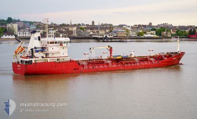
AZRA THERESA
Oil/Chemical Tanker
Current Trip
| Time Travelled | 4 days |
|---|---|
| Remaining Time | 7 days |
| Distance Travelled | 992.71 морская миля |
| Remaining Distance | 1647.11 морская миля |
| AVG Speed | 10.3 Узлы |
| MAX Speed | 14.7 Узлы |
| AVG Wind | 12.7 knots |
| MAX Wind | 22.3 knots |
| MIN Temp | -3.4°C / 25.88°F |
| MAX Temp | 13.9°C / 57.02°F |
| Осадка | 6.9 м |
| Позиция Получена | 1 d тому назад |
Current Position
| Долгота | --- |
|---|---|
| Широта | --- |
| Статус | Under way using engine |
| Скорость | 8.8 Узлы |
| Курс | 240° |
| Район | Celtic Sea |
| Станция | T-AIS |
| Позиция Получена | 1 d тому назад |
Info
Information
The current position of AZRA THERESA is in Celtic Sea with coordinates 49.18122° / -5.10390° as reported on 2025-02-16 17:00 by AIS to our vessel tracker app. The vessel's current speed is 8.8 Узлы and is heading at the port of GENOVA. The estimated time of arrival as calculated by MyShipTracking vessel tracking app is 2025-02-25 10:42 LT
The vessel AZRA THERESA (IMO: 9403918, MMSI: 215241000) is a Oil/Chemical Tanker that was built in 2007 ( 18 лет ). It's sailing under the flag of [MT] Malta.
In this page you can find informations about the vessels current position, last detected port calls, and current voyage information. If the vessels is not in coverage by AIS you will find the latest position.
The current position of AZRA THERESA is detected by our AIS receivers and we are not responsible for the reliability of the data. The last position was recorded while the vessel was in Coverage by the Ais receivers of our vessel tracking app.
The current draught of AZRA THERESA as reported by AIS is 6.9 meters
Weather
| Temperature | 14°C / 57.2°F |
|---|---|
| Wind Speed | 22 knots |
| Direction | 172° S |
| Pressure | 1005.4 hPa |
| Humidity | 83.4 % |
| Cloud Coverage | 100 % |
Featured Company
Last Port Calls
| Port | Arrival | Departure | Time In Port |
|---|---|---|---|
| 2025-02-12 22:50 | 2025-02-14 03:33 | 1 d | |
| 2025-02-08 08:45 | 2025-02-12 13:54 | 4 d | |
| 2025-02-02 22:41 | 2025-02-03 23:08 | 1 d | |
| 2025-01-29 08:18 | 2025-01-30 13:33 | 1 d | |
| 2025-01-23 16:14 | 2025-01-24 04:40 | 12 h | |
| 2025-01-22 15:32 | 2025-01-23 00:25 | 8 h | |
| 2025-01-19 01:15 | 2025-01-19 23:54 | 22 h | |
| 2025-01-13 08:44 | 2025-01-15 10:11 | 2 d | |
| 2025-01-05 18:53 | 2025-01-07 21:22 | 2 d | |
| 2025-01-01 11:27 | 2025-01-02 12:24 | 1 d |
Most Visited Ports (Last year)
| Port | Arrivals | |
|---|---|---|
| 5 | ||
| 4 | ||
| 4 | ||
| 3 | ||
| 2 | ||
| 2 |
Last Trips
| Origin | Departure | Destination | Arrival | Distance | |
|---|---|---|---|---|---|
| 2025-02-12 14:54 | 2025-02-12 23:50 | 50.02 морская миля | |||
| 2025-02-04 00:08 | 2025-02-08 09:45 | 464.92 морская миля | |||
| 2025-01-30 14:33 | 2025-02-02 23:41 | 792.00 морская миля | |||
| 2025-01-24 05:40 | 2025-01-29 09:18 | 621.68 морская миля | |||
| 2025-01-23 01:25 | 2025-01-23 17:14 | 167.43 морская миля | |||
| 2025-01-20 00:54 | 2025-01-22 16:32 | 701.02 морская миля | |||
| 2025-01-15 11:11 | 2025-01-19 02:15 | 600.01 морская миля | |||
| 2025-01-07 22:22 | 2025-01-13 09:44 | 869.24 морская миля | |||
| 2025-01-02 13:24 | 2025-01-05 19:53 | 799.10 морская миля | |||
| 2024-12-28 11:56 | 2025-01-01 12:27 | 800.82 морская миля |
Events
| Время | Событие | Детали | Позиция / Направление | Информация |
|---|---|---|---|---|
| 2025-02-16 17:07 | Статус изменился | Default Under way using engine |
49.17220 / -5.12755
IT GOA
|
Скорость: 8.8 kn Курс: 240° |
| 2025-02-16 17:00 | Статус изменился | Under way using engine Default |
49.18122 / -5.10390
IT GOA
|
Скорость: 8.7 kn Курс: 239° |
| 2025-02-16 17:00 | Вне покрытия |
49.18122 / -5.10390
Celtic Sea
IT GOA
|
Скорость: 8.8 kn Курс: 240° |
|
| 2025-02-16 16:59 | Статус изменился | Default Under way using engine |
49.18222 / -5.10133
IT GOA
|
Скорость: 8.9 kn Курс: 239° |
| 2025-02-16 16:49 | Статус изменился | Under way using engine Default |
49.19500 / -5.06700
IT GOA
|
Скорость: 8.9 kn Курс: 240° |
| 2025-02-16 16:47 | Статус изменился | Default Under way using engine |
49.19667 / -5.06250
IT GOA
|
Скорость: 9.2 kn Курс: 239° |
| 2025-02-16 16:40 | Обнаружено в море | French part of the Celtic Sea |
49.20617 / -5.03702
Celtic Sea
IT GOA
|
Скорость: 9.2 kn Курс: 239° |
| 2025-02-16 16:33 | Обнаружено в море | French part of the English Channel |
49.21475 / -5.01357
English Channel
IT GOA
|
Скорость: 9 kn Курс: 241° |
| 2025-02-16 16:33 | Статус изменился | Under way using engine Default |
49.21475 / -5.01357
IT GOA
|
Скорость: 9.1 kn Курс: 240° |
| 2025-02-16 16:31 | В покрытии |
49.21475 / -5.01357
English Channel
IT GOA
|
Скорость: 9 kn Курс: 241° |