
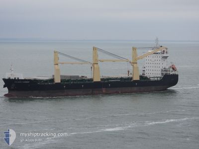
ATLANTIC HARMONY
Cargo
Current Trip
| Time Travelled | 11 h, 38 mins |
|---|---|
| Remaining Time | --- |
| Distance Travelled | 63.70 морская миля |
| Remaining Distance | --- |
| AVG Speed | 10.9 Узлы |
| MAX Speed | 11.9 Узлы |
| AVG Wind | 5.2 knots |
| MAX Wind | 8.2 knots |
| MIN Temp | 16.4°C / 61.52°F |
| MAX Temp | 18.1°C / 64.58°F |
| Осадка | 8.5 м |
| Позиция Получена | 7 h, 54 m тому назад |
Current Position
| Долгота | --- |
|---|---|
| Широта | --- |
| Статус | Under way using engine |
| Скорость | 11.7 Узлы |
| Курс | 219.7° |
| Район | Mediterranean Sea - Eastern Basin |
| Станция | T-AIS |
| Позиция Получена | 7 h, 54 m тому назад |
Info
Information
The current position of ATLANTIC HARMONY is in Mediterranean Sea - Eastern Basin with coordinates 36.18722° / 34.30257° as reported on 2025-03-06 19:10 by AIS to our vessel tracker app. The vessel's current speed is 11.7 Узлы and is heading at the port of BENGHAZI. The estimated time of arrival as calculated by MyShipTracking vessel tracking app is 2025-03-10 00:00 LT
The vessel ATLANTIC HARMONY (IMO: 9613812, MMSI: 477045900) is a Cargo It's sailing under the flag of [HK] Hong Kong.
In this page you can find informations about the vessels current position, last detected port calls, and current voyage information. If the vessels is not in coverage by AIS you will find the latest position.
The current position of ATLANTIC HARMONY is detected by our AIS receivers and we are not responsible for the reliability of the data. The last position was recorded while the vessel was in Coverage by the Ais receivers of our vessel tracking app.
The current draught of ATLANTIC HARMONY as reported by AIS is 8.5 meters
Weather
| Temperature | 17.2°C / 62.96°F |
|---|---|
| Wind Speed | 6 knots |
| Direction | 328° NNW |
| Pressure | 1017.8 hPa |
| Humidity | 62.7 % |
| Cloud Coverage | --- |
Featured Company
Last Port Calls
| Port | Arrival | Departure | Time In Port |
|---|---|---|---|
| 2025-03-05 16:48 | 2025-03-06 18:27 | 1 d | |
| 2025-02-09 08:04 | 2025-02-14 00:51 | 4 d | |
| 2025-01-20 14:12 | 2025-01-27 12:43 | 6 d | |
| 2025-01-15 01:08 | 2025-01-15 20:08 | 19 h |
Last Trips
| Origin | Departure | Destination | Arrival | Distance | |
|---|---|---|---|---|---|
| 2025-02-14 00:51 | 2025-03-05 16:48 | 3468.92 морская миля | |||
| 2025-01-27 12:43 | 2025-02-09 08:04 | 2758.69 морская миля | |||
| 2024-12-30 12:12 | 2025-01-20 14:12 | 3750.42 морская миля | |||
| 2024-12-30 12:12 | 2025-01-15 01:08 | 2973.68 морская миля |
Events
| Время | Событие | Детали | Позиция / Направление | Информация |
|---|---|---|---|---|
| 2025-03-06 19:28 | Статус изменился | Default Under way using engine |
36.14424 / 34.26217
LY BEN
|
Скорость: 11.7 kn Курс: 219.7° |
| 2025-03-06 19:10 | Вне покрытия |
36.18722 / 34.30257
Mediterranean Sea - Eastern Basin
LY BEN
|
Скорость: 11.7 kn Курс: 219.7° |
|
| 2025-03-06 17:52 | ETA изменился | 2025/03/09 22:00 2025/03/09 18:00 |
36.40249 / 34.46613
LY BEN
|
Скорость: 11.4 kn Курс: 205.3° |
| 2025-03-06 17:05 | Статус изменился | Under way using engine Under way sailing |
36.52249 / 34.56144
LY BEN
|
Скорость: 11 kn Курс: 216.7° |
| 2025-03-06 15:31 | Статус изменился | Under way sailing Moored |
36.77546 / 34.65693
LY BEN
|
Скорость: 7.6 kn Курс: 137.2° |
| 2025-03-06 15:27 | ПОРТ ОТПРАВЛЕНИЯ |
|
36.78097 / 34.65017
LY BEN
|
Скорость: 7.3 kn Курс: 136° |
| 2025-03-06 15:21 | Начало движения |
36.78983 / 34.64081
[TR] MERSIN
|
Скорость: 5.3 kn Курс: 162° |
|
| 2025-03-06 15:06 | Статус изменился | Moored Default |
36.80082 / 34.64430
[TR] MERSIN
|
Скорость: Курс: 270° |
| 2025-03-06 14:40 | Осадка изменилась | 8.5 8.4 |
36.80144 / 34.64714
[TR] MERSIN
|
Скорость: Курс: 270° |
| 2025-03-06 14:40 | Пункт назначения изменился | LY BEN TR MER |
36.80144 / 34.64714
[TR] MERSIN
|
Скорость: Курс: 270° |