

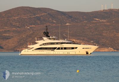
ARKADIA
Pleasure Craft

Current Trip
| Time Travelled | 8 days |
|---|---|
| Remaining Time | --- |
| Distance Travelled | 83.14 морская миля |
| Remaining Distance | --- |
| AVG Speed | 9.8 Узлы |
| MAX Speed | 11.5 Узлы |
| AVG Wind | 12.4 knots |
| MAX Wind | 13.8 knots |
| MIN Temp | 21.3°C / 70.34°F |
| MAX Temp | 26.1°C / 78.98°F |
| Осадка | 2.6 м |
| Позиция Получена | 5 m тому назад |
Current Position
| Долгота | --- |
|---|---|
| Широта | --- |
| Статус | At anchor |
| Скорость | |
| Курс | 132° |
| Район | North Atlantic Ocean |
| Станция | T-AIS |
| Позиция Получена | 5 m тому назад |
Information
The current position of ARKADIA is in North Atlantic Ocean with coordinates 26.48804° / -78.67738° as reported on 2025-03-26 21:10 by AIS to our vessel tracker app. The vessel's current speed is 0 Узлы and is heading at the port of PALM BEACH. The estimated time of arrival as calculated by MyShipTracking vessel tracking app is 2025-03-18 11:01 LT
The vessel ARKADIA (IMO: 9845300, MMSI: 319178800) is a Pleasure Craft It's sailing under the flag of [KY] Cayman Is.
In this page you can find informations about the vessels current position, last detected port calls, and current voyage information. If the vessels is not in coverage by AIS you will find the latest position.
The current position of ARKADIA is detected by our AIS receivers and we are not responsible for the reliability of the data. The last position was recorded while the vessel was in Coverage by the Ais receivers of our vessel tracking app.
The current draught of ARKADIA as reported by AIS is 2.6 meters
Weather
| Temperature | 23.8°C / 74.84°F |
|---|---|
| Wind Speed | 13 knots |
| Direction | 14° NNE |
| Pressure | 1018.1 hPa |
| Humidity | 67.9 % |
| Cloud Coverage | --- |


Featured Company
Last Port Calls
| Port | Arrival | Departure | Time In Port |
|---|---|---|---|
| 2025-03-18 14:59 | 2025-03-18 15:19 | 19 m | |
| 2025-01-26 17:06 | 2025-03-18 10:04 | ||
| 2025-01-26 16:42 | |||
| 2025-01-20 16:29 | 2025-01-21 20:12 | 1 d | |
| 2025-01-09 10:11 | 2025-01-17 13:22 | 8 d |
Most Visited Ports (Last year)
| Port | Arrivals | |
|---|---|---|
| 4 | ||
| 4 | ||
| 3 | ||
| 3 | ||
| 3 | ||
| 2 |
Last Trips
| Origin | Departure | Destination | Arrival | Distance | |
|---|---|---|---|---|---|
| 2025-03-18 06:04 | 2025-03-18 10:59 | 47.81 морская миля | |||
| 2025-01-21 15:12 | 2025-01-26 12:06 | 428.13 морская миля | |||
| 2025-01-21 15:12 | 2025-01-26 11:42 | 427.75 морская миля | |||
| 2025-01-17 08:22 | 2025-01-20 11:29 | 75.66 морская миля | |||
| 2024-12-20 16:05 | 2025-01-09 05:11 | 1506.12 морская миля |
Events
| Время | Событие | Детали | Позиция / Направление | Информация |
|---|---|---|---|---|
| 2025-03-26 21:10 | В покрытии |
26.48804 / -78.67738
North Atlantic Ocean
|
Скорость: Курс: 199° |
|
| 2025-03-26 18:31 | Вне покрытия |
26.48813 / -78.67725
North Atlantic Ocean
|
Скорость: Курс: 272° |
|
| 2025-03-26 17:13 | В покрытии |
26.48798 / -78.67735
North Atlantic Ocean
|
Скорость: Курс: 177° |
|
| 2025-03-26 16:10 | Вне покрытия |
26.48708 / -78.67689
North Atlantic Ocean
|
Скорость: Курс: 162° |
|
| 2025-03-26 15:52 | Статус изменился | At anchor Under way using engine |
26.48704 / -78.67699
WEST PALM BEACH
|
Скорость: 2 kn Курс: 19° |
| 2025-03-26 15:52 | Окончание движения | 5.66 nm, East of FREEPORT (BS) |
26.48704 / -78.67699
WEST PALM BEACH
|
Скорость: Курс: 29° |
| 2025-03-26 15:28 | В покрытии |
26.48453 / -78.69540
North Atlantic Ocean
|
Скорость: 5 kn Курс: 43° |
|
| 2025-03-25 16:26 | Вне покрытия |
26.70047 / -78.99741
North Atlantic Ocean
|
Скорость: Курс: 172.6° |
|
| 2025-03-25 15:38 | Обнаружено в море | Bahamas part of the North Atlantic Ocean |
26.70065 / -78.99759
North Atlantic Ocean
|
Скорость: Курс: 222.7° |
| 2025-03-25 15:38 | В покрытии |
26.70065 / -78.99759
North Atlantic Ocean
|
Скорость: Курс: 222.7° |