
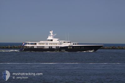
AIR
Yacht
Current Trip
ST TROPEZ
| Time Travelled | 3 days |
|---|---|
| Remaining Time | --- |
| Distance Travelled | 83.89 морская миля |
| Remaining Distance | --- |
| AVG Speed | 9.9 Узлы |
| MAX Speed | 13.7 Узлы |
| AVG Wind | 13 knots |
| MAX Wind | 20 knots |
| MIN Temp | 14.2°C / 57.56°F |
| MAX Temp | 19.5°C / 67.1°F |
| Осадка | 3.5 м |
| Позиция Получена | 6 m тому назад |
Current Position
| Долгота | 6.62765° |
|---|---|
| Широта | 43.27815° |
| Статус | At anchor |
| Скорость | |
| Курс | 76° |
| Район | Mediterranean Sea - Western Basin |
| Станция | T-AIS |
| Позиция Получена | 6 m тому назад |
Info
Information
The current position of AIR is in Mediterranean Sea - Western Basin with coordinates 43.27815° / 6.62765° as reported on 2024-05-18 06:46 by AIS to our vessel tracker app. The vessel's current speed is 0 Узлы
The vessel AIR (IMO: 1011472, MMSI: 248879000) is a Yacht that was built in 2011 ( 13 лет ). It's sailing under the flag of [MT] Malta.
In this page you can find informations about the vessels current position, last detected port calls, and current voyage information. If the vessels is not in coverage by AIS you will find the latest position.
The current position of AIR is detected by our AIS receivers and we are not responsible for the reliability of the data. The last position was recorded while the vessel was in Coverage by the Ais receivers of our vessel tracking app.
The current draught of AIR as reported by AIS is 3.5 meters
Weather
| Temperature | 16.9°C / 62.42°F |
|---|---|
| Wind Speed | 11 knots |
| Direction | 58° ENE |
| Pressure | 1012.5 hPa |
| Humidity | 84.9 % |
| Cloud Coverage | 7 % |
Featured Company
Last Port Calls
| Port | Arrival | Departure | Time In Port |
|---|---|---|---|
| 2024-05-14 09:37 | |||
| 2024-04-27 07:40 | 2024-04-27 12:35 | 4 h | |
| 2024-04-22 08:46 | 2024-04-25 14:29 | 3 d | |
| 2024-04-15 10:57 | 2024-04-15 14:04 | 3 h |
Last Trips
| Origin | Departure | Destination | Arrival | Distance | |
|---|---|---|---|---|---|
| 2024-04-25 14:29 | 2024-04-27 07:40 | 174.76 морская миля | |||
| 2024-04-15 14:04 | 2024-04-22 08:46 | 336.85 морская миля |
Events
| Время | Событие | Детали | Позиция / Направление | Информация |
|---|---|---|---|---|
| 2024-05-16 09:50 | Статус изменился | At anchor Under way using engine |
43.27667 / 6.62766
ST TROPEZ
|
Скорость: 2.1 kn Курс: 358° |
| 2024-05-16 09:50 | Окончание движения | 0.4 nm, North West of SAINT TROPEZ |
43.27667 / 6.62766
ST TROPEZ
|
Скорость: Курс: 4° |
| 2024-05-16 07:29 | Пункт назначения изменился | ST TROPEZ IMPERIA |
43.44479 / 6.98668
ST TROPEZ
|
Скорость: 13.1 kn Курс: 233° |
| 2024-05-16 07:23 | ETA изменился | 2024/05/16 08:30 2024/05/03 16:00 |
43.45810 / 7.01143
IMPERIA
|
Скорость: 13 kn Курс: 233.5° |
| 2024-05-16 06:44 | Начало движения | 1.61 nm, South East of GOLFE JUAN |
43.54825 / 7.10823
IMPERIA
|
Скорость: 3.1 kn Курс: 241° |
| 2024-05-16 06:27 | Статус изменился | Under way using engine At anchor |
43.54819 / 7.10825
IMPERIA
|
Скорость: Курс: 49° |
| 2024-05-14 11:45 | Статус изменился | At anchor Under way using engine |
43.54875 / 7.10943
IMPERIA
|
Скорость: 0.8 kn Курс: 49° |
| 2024-05-14 11:36 | Окончание движения | 1.6 nm, South East of GOLFE JUAN |
43.54642 / 7.10581
IMPERIA
|
Скорость: 0.3 kn Курс: 52° |
| 2024-05-14 10:14 | Обнаружено в море | French part of the Mediterranean Sea - Western Basin |
43.60264 / 7.37110
Mediterranean Sea - Western Basin
|
Скорость: 13.3 kn Курс: 244.2° |
| 2024-05-14 09:49 | Изменение морского района | Mon�gasque part of the Mediterranean Sea - Western Basin French part of the Mediterranean Sea - Western Basin |
43.64042 / 7.48313
Mediterranean Sea - Western Basin
|
Скорость: 13.6 kn Курс: 245.7° |