
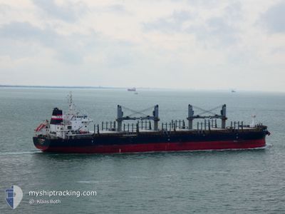
AFRICAN LOGRUNNER
Cargo
Current Trip
| Time Travelled | 19 days |
|---|---|
| Remaining Time | 5 h, 22 mins |
| Distance Travelled | 5303.09 морская миля |
| Remaining Distance | 76.65 морская миля |
| AVG Speed | 11.6 Узлы |
| MAX Speed | 15 Узлы |
| AVG Wind | 13.2 knots |
| MAX Wind | 29.5 knots |
| MIN Temp | 11.9°C / 53.42°F |
| MAX Temp | 29.6°C / 85.28°F |
| Осадка | 6.7 м |
| Позиция Получена | 3 d тому назад |
Current Position
| Долгота | 118.83070° |
|---|---|
| Широта | -35.27573° |
| Статус | Under way using engine |
| Скорость | 12.6 Узлы |
| Курс | 74.7° |
| Район | Great Australian Bight |
| Станция | T-AIS |
| Позиция Получена | 3 d тому назад |
Info
Information
The current position of AFRICAN LOGRUNNER is in Great Australian Bight with coordinates -35.27573° / 118.83070° as reported on 2024-06-27 13:15 by AIS to our vessel tracker app. The vessel's current speed is 12.6 Узлы and is heading at the port of ADELAIDE. The estimated time of arrival as calculated by MyShipTracking vessel tracking app is 2024-07-01 13:40 LT
The vessel AFRICAN LOGRUNNER (IMO: 9733258, MMSI: 311001205) is a Cargo It's sailing under the flag of [BS] Bahamas.
In this page you can find informations about the vessels current position, last detected port calls, and current voyage information. If the vessels is not in coverage by AIS you will find the latest position.
The current position of AFRICAN LOGRUNNER is detected by our AIS receivers and we are not responsible for the reliability of the data. The last position was recorded while the vessel was in Coverage by the Ais receivers of our vessel tracking app.
The current draught of AFRICAN LOGRUNNER as reported by AIS is 6.7 meters
Weather
| Temperature | 11.6°C / 52.88°F |
|---|---|
| Wind Speed | 11 knots |
| Direction | 151° SSE |
| Pressure | 1030.9 hPa |
| Humidity | 64.4 % |
| Cloud Coverage | 7 % |
Featured Company
Last Port Calls
| Port | Arrival | Departure | Time In Port |
|---|---|---|---|
| 2024-06-06 02:45 | 2024-06-12 08:17 | 6 d |
Last Trips
| Origin | Departure | Destination | Arrival | Distance | |
|---|---|---|---|---|---|
| 2024-04-25 02:13 | 2024-06-06 08:45 | 7591.57 морская миля |
Events
| Время | Событие | Детали | Позиция / Направление | Информация |
|---|---|---|---|---|
| 2024-06-27 13:18 | Статус изменился | Default Under way using engine |
-35.27282 / 118.84567
AU ADL
|
Скорость: 12.6 kn Курс: 74.7° |
| 2024-06-27 13:15 | Вне покрытия |
-35.27573 / 118.83070
Great Australian Bight
AU ADL
|
Скорость: 12.6 kn Курс: 74.7° |
|
| 2024-06-27 11:37 | Обнаружено в море | Australian part of the Great Australian Bight |
-35.36386 / 118.38679
Great Australian Bight
AU ADL
|
Скорость: 13.8 kn Курс: 78.4° |
| 2024-06-27 07:10 | Пункт назначения изменился | AU ADL SG SIN |
-35.51933 / 117.15848
AU ADL
|
Скорость: 12.7 kn Курс: 85.7° |
| 2024-06-27 07:10 | ETA изменился | 2024/07/01 21:00 2024/06/17 22:00 |
-35.51933 / 117.15848
AU ADL
|
Скорость: 12.7 kn Курс: 85.7° |
| 2024-06-27 06:57 | Статус изменился | Under way using engine Default |
-35.52173 / 117.10426
SG SIN
|
Скорость: 12.3 kn Курс: 86° |
| 2024-06-27 06:48 | Статус изменился | Default Under way using engine |
-35.52402 / 117.06674
SG SIN
|
Скорость: 12.4 kn Курс: 91.3° |
| 2024-06-27 06:43 | Изменение морского района | Australian part of the Indian Ocean Malaysian part of the Singapore Strait |
-35.52557 / 117.04261
Indian Ocean
|
Скорость: 12.4 kn Курс: 91.3° |
| 2024-06-27 06:43 | Статус изменился | Under way using engine Default |
-35.52557 / 117.04261
SG SIN
|
Скорость: 12.4 kn Курс: 90° |
| 2024-06-27 06:35 | В покрытии |
-35.52557 / 117.04261
Indian Ocean
|
Скорость: 12.4 kn Курс: 91.3° |