

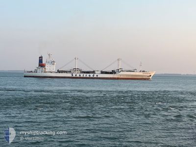
ACONCAGUA BAY
Reefer

Current Trip
| Time Travelled | 1 day |
|---|---|
| Remaining Time | --- |
| Distance Travelled | 450.38 морская миля |
| Remaining Distance | --- |
| AVG Speed | 14 Узлы |
| MAX Speed | 17.8 Узлы |
| AVG Wind | 14.9 knots |
| MAX Wind | 23 knots |
| MIN Temp | 0.4°C / 32.72°F |
| MAX Temp | 11.9°C / 53.42°F |
| Осадка | 7.3 м |
| Позиция Получена | 8 h, 0 m тому назад |
Current Position
| Долгота | --- |
|---|---|
| Широта | --- |
| Статус | Under way using engine |
| Скорость | 12.1 Узлы |
| Курс | 237.9° |
| Район | English Channel |
| Станция | T-AIS |
| Позиция Получена | 8 h, 0 m тому назад |
Information
The current position of ACONCAGUA BAY is in English Channel with coordinates 49.24993° / -4.77264° as reported on 2025-02-16 21:43 by AIS to our vessel tracker app. The vessel's current speed is 12.1 Узлы and is heading at the port of BANANA. The estimated time of arrival as calculated by MyShipTracking vessel tracking app is 2025-03-02 07:00 LT
The vessel ACONCAGUA BAY (IMO: 9019652, MMSI: 636013146) is a Reefer that was built in 1992 ( 33 лет ). It's sailing under the flag of [LR] Liberia.
In this page you can find informations about the vessels current position, last detected port calls, and current voyage information. If the vessels is not in coverage by AIS you will find the latest position.
The current position of ACONCAGUA BAY is detected by our AIS receivers and we are not responsible for the reliability of the data. The last position was recorded while the vessel was in Coverage by the Ais receivers of our vessel tracking app.
The current draught of ACONCAGUA BAY as reported by AIS is 7.3 meters
Weather
| Temperature | 11.9°C / 53.42°F |
|---|---|
| Wind Speed | 11 knots |
| Direction | 213° SSW |
| Pressure | 1013.5 hPa |
| Humidity | 94.4 % |
| Cloud Coverage | 91 % |


Featured Company
Last Port Calls
| Port | Arrival | Departure | Time In Port |
|---|---|---|---|
| 2025-02-15 04:43 | 2025-02-15 19:41 | 14 h | |
| 2025-01-23 18:36 | 2025-02-12 14:26 | 19 d | |
| 2024-12-27 00:59 | 2025-01-04 09:00 | 8 d | |
| 2024-12-04 18:16 | 2024-12-15 06:14 | 10 d |
Most Visited Ports (Last year)
| Port | Arrivals | |
|---|---|---|
| 3 | ||
| 2 | ||
| 2 | ||
| 1 | ||
| 1 | ||
| 1 |
Last Trips
| Origin | Departure | Destination | Arrival | Distance | |
|---|---|---|---|---|---|
| 2025-02-12 15:26 | 2025-02-15 05:43 | 929.39 морская миля | |||
| 2025-01-04 04:00 | 2025-01-23 19:36 | 6708.70 морская миля | |||
| 2024-12-15 02:14 | 2024-12-26 19:59 | 1656.30 морская миля | |||
| 2024-11-15 23:06 | 2024-12-04 14:16 | 4402.71 морская миля |
Events
| Время | Событие | Детали | Позиция / Направление | Информация |
|---|---|---|---|---|
| 2025-02-16 21:47 | Статус изменился | Default Under way using engine |
49.24338 / -4.78958
CD BNW
|
Скорость: 12.1 kn Курс: 237.9° |
| 2025-02-16 21:43 | Статус изменился | Under way using engine Default |
49.24993 / -4.77264
CD BNW
|
Скорость: 11.7 kn Курс: 239° |
| 2025-02-16 21:43 | Вне покрытия |
49.24993 / -4.77264
English Channel
CD BNW
|
Скорость: 12.1 kn Курс: 237.9° |
|
| 2025-02-16 21:25 | Статус изменился | Default Under way using engine |
49.28213 / -4.69109
CD BNW
|
Скорость: 11.6 kn Курс: 236.6° |
| 2025-02-16 21:19 | Статус изменился | Under way using engine Default |
49.29194 / -4.66710
CD BNW
|
Скорость: 11.5 kn Курс: 237° |
| 2025-02-16 21:02 | В покрытии |
49.29075 / -4.66998
English Channel
CD BNW
|
Скорость: 11.6 kn Курс: 236.6° |
|
| 2025-02-16 20:19 | Статус изменился | Default Under way using engine |
49.39526 / -4.40787
CD BNW
|
Скорость: 12.5 kn Курс: 237.7° |
| 2025-02-16 20:14 | Вне покрытия |
49.40448 / -4.38471
English Channel
CD BNW
|
Скорость: 12.5 kn Курс: 237.7° |
|
| 2025-02-16 20:09 | Статус изменился | Under way using engine Default |
49.41497 / -4.35921
CD BNW
|
Скорость: 12.2 kn Курс: 239° |
| 2025-02-16 19:43 | Статус изменился | Default Under way using engine |
49.45558 / -4.24246
CD BNW
|
Скорость: 12.3 kn Курс: 245.5° |