

XIN PU DONG
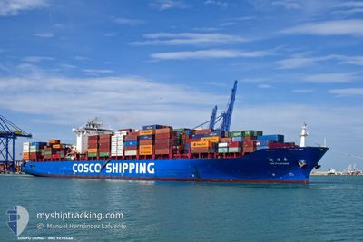
Container Ship

Current Trip
| Time Travelled | 4 days |
|---|---|
| Remaining Time | --- |
| Distance Travelled | 1187.66 nm |
| Remaining Distance | --- |
| AVG Speed | 13.1 Knopen |
| MAX Speed | 17.9 Knopen |
| AVG Wind | 10.2 knots |
| MAX Wind | 18.7 knots |
| MIN Temp | 13.3°C / 55.94°F |
| MAX Temp | 26.7°C / 80.06°F |
| Diepgang | 14.2 M |
| Positie ontvangen | 1 d geleden |
Current Position
| Lengtegraad | --- |
|---|---|
| Breedtegraat | --- |
| Status | Under way using engine |
| Snelheid | 14.7 Knopen |
| Koers | 149.4° |
| Gebied | South China Sea |
| Station | T-AIS |
| Positie ontvangen | 1 d geleden |
Information
The current position of XIN PU DONG is in South China Sea with coordinates 22.17993° / 114.18789° as reported on 2025-03-27 15:38 by AIS to our vessel tracker app. The vessel's current speed is 14.7 Knopen and is heading at the port of NHAVA SHEVA. The estimated time of arrival as calculated by MyShipTracking vessel tracking app is 2025-04-07 21:00 LT
The vessel XIN PU DONG (IMO: 9270440, MMSI: 413060000) is a Container Ship that was built in 2003 ( 22 Jaar oud ). It's sailing under the flag of [CN] China.
In this page you can find informations about the vessels current position, last detected port calls, and current voyage information. If the vessels is not in coverage by AIS you will find the latest position.
The current position of XIN PU DONG is detected by our AIS receivers and we are not responsible for the reliability of the data. The last position was recorded while the vessel was in Coverage by the Ais receivers of our vessel tracking app.
The current draught of XIN PU DONG as reported by AIS is 14.2 meters
Weather
| Temperature | 27.6°C / 81.68°F |
|---|---|
| Wind Speed | 8 knots |
| Direction | 51° NE |
| Pressure | 1009.5 hPa |
| Humidity | 77.5 % |
| Cloud Coverage | 68 % |


Featured Company
Last Port Calls
| Port | Arrival | Departure | Time In Port |
|---|---|---|---|
| 2025-03-24 09:10 | 2025-03-24 22:30 | 13 h | |
| 2025-03-20 18:48 | 2025-03-22 03:35 | 1 d | |
| 2025-03-19 16:08 | 2025-03-20 10:29 | 18 h | |
| 2025-03-16 23:37 | 2025-03-17 21:58 | 22 h | |
| 2025-03-11 10:09 | 2025-03-11 22:48 | 12 h | |
| 2025-02-24 03:54 | 2025-02-25 00:31 | 20 h | |
| 2025-02-22 07:47 | 2025-02-22 21:31 | 13 h | |
| 2025-02-19 23:19 | 2025-02-20 22:19 | 22 h | |
| 2025-02-12 13:29 | 2025-02-12 20:09 | 6 h | |
| 2025-02-10 05:02 | 2025-02-10 14:49 | 9 h |
Most Visited Ports (Last year)
| Port | Arrivals | |
|---|---|---|
| 9 | ||
| 8 | ||
| 8 | ||
| 8 | ||
| 8 | ||
| 7 |
Last Trips
| Origin | Departure | Destination | Arrival | Distance | |
|---|---|---|---|---|---|
| 2025-03-22 03:35 | 2025-03-24 09:10 | 520.75 nm | |||
| 2025-03-20 10:29 | 2025-03-20 18:48 | 101.58 nm | |||
| 2025-03-17 21:58 | 2025-03-19 16:08 | 471.17 nm | |||
| 2025-03-11 22:48 | 2025-03-16 23:37 | 1181.98 nm | |||
| 2025-02-25 00:31 | 2025-03-11 10:09 | 4652.26 nm | |||
| 2025-02-22 21:31 | 2025-02-24 03:54 | 15.37 nm | |||
| 2025-02-20 22:19 | 2025-02-22 07:47 | 423.24 nm | |||
| 2025-02-12 20:09 | 2025-02-19 23:19 | 2334.24 nm | |||
| 2025-02-10 14:49 | 2025-02-12 13:29 | 239.44 nm | |||
| 2025-01-29 19:33 | 2025-02-10 05:02 | 2270.56 nm |
Events
| Tijd | Evenement | Details | Positie / Bestemming | Info |
|---|---|---|---|---|
| 2025-03-27 15:46 | Status Changed | Default Under way using engine |
22.15306 / 114.20368
INNVA
|
Snelheid: 14.7 kn Koers: 149.4° |
| 2025-03-27 15:38 | Status Changed | Under way using engine Default |
22.17993 / 114.18789
INNVA
|
Snelheid: 14.2 kn Koers: 151° |
| 2025-03-27 15:38 | Buitenbereik |
22.17993 / 114.18789
South China Sea
INNVA
|
Snelheid: 14.7 kn Koers: 149.4° |
|
| 2025-03-27 15:14 | Status Changed | Default Under way using engine |
22.23384 / 114.13512
INNVA
|
Snelheid: 13.5 kn Koers: 132.5° |
| 2025-03-27 13:34 | Status Changed | Under way using engine Moored |
22.44847 / 113.87983
INNVA
|
Snelheid: 8 kn Koers: 169.5° |
| 2025-03-27 13:29 | Start beweging | 0.44 nm, South West of CHIWAN |
22.45545 / 113.87826
INNVA
|
Snelheid: 3.1 kn Koers: 168° |
| 2025-03-27 13:23 | ETA Changed | 2025/04/07 15:30 2025/04/07 16:00 |
22.45643 / 113.87682
INNVA
|
Snelheid: 1.6 kn Koers: 72° |
| 2025-03-27 12:09 | Draught Changed | 14.2 13.7 |
22.45858 / 113.87968
INNVA
|
Snelheid: 0.1 kn Koers: 334° |
| 2025-03-27 12:09 | Destination Changed | INNVA CNSHK |
22.45858 / 113.87968
INNVA
|
Snelheid: 0.1 kn Koers: 334° |
| 2025-03-27 12:09 | ETA Changed | 2025/04/07 16:00 2025/03/27 06:00 |
22.45858 / 113.87968
INNVA
|
Snelheid: 0.1 kn Koers: 334° |