
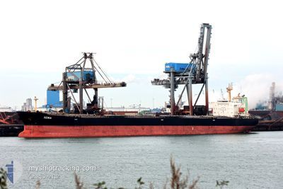
XENIA
Bulk Carrier
Current Trip
| Time Travelled | 8 days |
|---|---|
| Remaining Time | --- |
| Distance Travelled | 1840.06 nm |
| Remaining Distance | --- |
| AVG Speed | 9.5 Knopen |
| MAX Speed | 14.6 Knopen |
| AVG Wind | 14.1 knots |
| MAX Wind | 33 knots |
| MIN Temp | 5.5°C / 41.9°F |
| MAX Temp | 12.5°C / 54.5°F |
| Diepgang | 12.7 M |
| Positie ontvangen | 8 d geleden |
Current Position
| Lengtegraad | -125.75527° |
|---|---|
| Breedtegraat | 48.23562° |
| Status | Under way using engine |
| Snelheid | 10.5 Knopen |
| Koers | 234° |
| Gebied | North Pacific Ocean |
| Station | T-AIS |
| Positie ontvangen | 8 d geleden |
Info
Information
The current position of XENIA is in North Pacific Ocean with coordinates 48.23562° / -125.75527° as reported on 2024-06-02 00:28 by AIS to our vessel tracker app. The vessel's current speed is 10.5 Knopen and is heading at the port of ONAHAMA. The estimated time of arrival as calculated by MyShipTracking vessel tracking app is 2024-06-16 21:00 LT
The vessel XENIA (IMO: 9317834, MMSI: 209889000) is a Bulk Carrier that was built in 2006 ( 18 Jaar oud ). It's sailing under the flag of [CY] Cyprus.
In this page you can find informations about the vessels current position, last detected port calls, and current voyage information. If the vessels is not in coverage by AIS you will find the latest position.
The current position of XENIA is detected by our AIS receivers and we are not responsible for the reliability of the data. The last position was recorded while the vessel was in Coverage by the Ais receivers of our vessel tracking app.
The current draught of XENIA as reported by AIS is 12.7 meters
Weather
| Temperature | 5.4°C / 41.72°F |
|---|---|
| Wind Speed | 14 knots |
| Direction | 344° NNW |
| Pressure | 997.3 hPa |
| Humidity | 97.3 % |
| Cloud Coverage | 100 % |
Featured Company
Last Port Calls
| Port | Arrival | Departure | Time In Port |
|---|---|---|---|
| 2024-05-30 18:16 | 2024-06-01 03:18 | 1 d | |
| 2024-05-13 07:29 | 2024-05-15 21:38 | 2 d |
Last Trips
| Origin | Departure | Destination | Arrival | Distance | |
|---|---|---|---|---|---|
| 2024-05-15 21:38 | 2024-05-30 18:16 | 4441.30 nm |
Events
| Tijd | Evenement | Details | Positie / Bestemming | Info |
|---|---|---|---|---|
| 2024-06-02 00:35 | Status Changed | Default Under way using engine |
48.22278 / -125.78152
JP ONA
|
Snelheid: 10.5 kn Koers: 234° |
| 2024-06-02 00:28 | Status Changed | Under way using engine Default |
48.23562 / -125.75527
JP ONA
|
Snelheid: 10.5 kn Koers: 233° |
| 2024-06-02 00:28 | Buitenbereik |
48.23562 / -125.75527
North Pacific Ocean
JP ONA
|
Snelheid: 10.5 kn Koers: 234° |
|
| 2024-06-02 00:22 | Status Changed | Default Under way using engine |
48.24540 / -125.73500
JP ONA
|
Snelheid: 10.5 kn Koers: 233° |
| 2024-06-01 21:27 | Status Changed | Under way using engine Default |
48.51805 / -125.07617
JP ONA
|
Snelheid: 11.7 kn Koers: 271° |
| 2024-06-01 21:22 | Status Changed | Default Under way using engine |
48.51769 / -125.05431
JP ONA
|
Snelheid: 11.7 kn Koers: 271° |
| 2024-06-01 21:14 | Status Changed | Under way using engine Default |
48.51673 / -125.01237
JP ONA
|
Snelheid: 11.8 kn Koers: 271° |
| 2024-06-01 20:59 | Status Changed | Default Under way using engine |
48.51584 / -124.93973
JP ONA
|
Snelheid: 11.4 kn Koers: 269° |
| 2024-06-01 20:54 | Gevonden in zee | Canadian part of the North Pacific Ocean |
48.51578 / -124.91800
North Pacific Ocean
JP ONA
|
Snelheid: 11.4 kn Koers: 269° |
| 2024-06-01 20:54 | Status Changed | Under way using engine Default |
48.51578 / -124.91800
JP ONA
|
Snelheid: 11.3 kn Koers: 268° |