

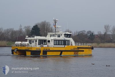
WINDCAT 42
High speed craft

Current Trip
| Time Travelled | 5 h, 37 mins |
|---|---|
| Remaining Time | --- |
| Distance Travelled | 34.22 nm |
| Remaining Distance | --- |
| AVG Speed | 22.7 Knopen |
| MAX Speed | 25.8 Knopen |
| AVG Wind | 12.4 knots |
| MAX Wind | 13 knots |
| MIN Temp | 5°C / 41°F |
| MAX Temp | 6.6°C / 43.88°F |
| Diepgang | 2.2 M |
| Positie ontvangen | Nu |
Current Position
| Lengtegraad | --- |
|---|---|
| Breedtegraat | --- |
| Status | Under way using engine |
| Snelheid | 1.2 Knopen |
| Koers | 50° |
| Gebied | Baltic Sea |
| Station | T-AIS |
| Positie ontvangen | Nu |
Information
The current position of WINDCAT 42 is in Baltic Sea with coordinates 54.84125° / 13.82314° as reported on 2025-03-28 12:04 by AIS to our vessel tracker app. The vessel's current speed is 1.2 Knopen
The vessel WINDCAT 42 (MMSI: 211156470) is a High speed craft It's sailing under the flag of [DE] Germany.
In this page you can find informations about the vessels current position, last detected port calls, and current voyage information. If the vessels is not in coverage by AIS you will find the latest position.
The current position of WINDCAT 42 is detected by our AIS receivers and we are not responsible for the reliability of the data. The last position was recorded while the vessel was in Coverage by the Ais receivers of our vessel tracking app.
The current draught of WINDCAT 42 as reported by AIS is 2.2 meters
Weather
| Temperature | 6.6°C / 43.88°F |
|---|---|
| Wind Speed | 12 knots |
| Direction | 165° SSE |
| Pressure | 1013 hPa |
| Humidity | 80.3 % |
| Cloud Coverage | 12 % |


Featured Company
Last Port Calls
| Port | Arrival | Departure | Time In Port |
|---|---|---|---|
| 2025-03-26 11:49 | 2025-03-28 07:27 | 1 d | |
| 2025-03-21 17:20 | 2025-03-26 07:20 | 4 d | |
| 2025-03-20 16:01 | 2025-03-21 07:26 | 15 h | |
| 2025-03-18 10:32 | 2025-03-20 07:13 | 1 d | |
| 2025-03-17 09:28 | 2025-03-18 07:48 | 22 h | |
| 2025-03-16 17:48 | 2025-03-17 08:38 | 14 h | |
| 2025-03-14 17:59 | 2025-03-16 07:20 | 1 d | |
| 2025-03-13 17:19 | 2025-03-14 07:45 | 14 h | |
| 2025-03-12 18:10 | 2025-03-13 07:18 | 13 h | |
| 2025-03-11 18:04 | 2025-03-12 07:18 | 13 h |
Last Trips
| Origin | Departure | Destination | Arrival | Distance | |
|---|---|---|---|---|---|
| 2025-03-26 07:20 | 2025-03-26 11:49 | 50.50 nm | |||
| 2025-03-21 07:26 | 2025-03-21 17:20 | 61.87 nm | |||
| 2025-03-20 07:13 | 2025-03-20 16:01 | 79.06 nm | |||
| 2025-03-18 07:48 | 2025-03-18 10:32 | 47.38 nm | |||
| 2025-03-17 08:38 | 2025-03-17 09:28 | 9.23 nm | |||
| 2025-03-16 07:20 | 2025-03-16 17:48 | 80.62 nm | |||
| 2025-03-14 07:45 | 2025-03-14 17:59 | 61.91 nm | |||
| 2025-03-13 07:18 | 2025-03-13 17:19 | 71.88 nm | |||
| 2025-03-12 07:18 | 2025-03-12 18:10 | 78.24 nm | |||
| 2025-03-11 07:12 | 2025-03-11 18:04 | 67.38 nm |
Events
| Tijd | Evenement | Details | Positie / Bestemming | Info |
|---|---|---|---|---|
| 2025-03-28 10:00 | Start beweging |
54.86783 / 13.84163
MUKRAN<->BE OWF
|
Snelheid: 3.3 kn Koers: 300° |
|
| 2025-03-28 08:09 | Stop beweging | 20.51 nm, North of SASSNITZ |
54.83500 / 13.82046
MUKRAN<->BE OWF
|
Snelheid: 0.3 kn Koers: 193° |
| 2025-03-28 07:40 | Start beweging | 20.79 nm, North of SASSNITZ |
54.84000 / 13.81937
MUKRAN<->BE OWF
|
Snelheid: 16.8 kn Koers: 202.5° |
| 2025-03-28 07:28 | Stop beweging | 20.92 nm, North of SASSNITZ |
54.84231 / 13.81993
MUKRAN<->BE OWF
|
Snelheid: 0.3 kn Koers: 211° |
| 2025-03-28 06:46 | ETA Changed | 2025/03/28 18:00 2025/03/26 18:00 |
54.57737 / 13.74823
MUKRAN<->BE OWF
|
Snelheid: 25.6 kn Koers: 20.7° |
| 2025-03-28 06:27 | Vertrekhaven |
|
54.47677 / 13.60290
MUKRAN<->BE OWF
|
Snelheid: 10.2 kn Koers: 64° |
| 2025-03-28 06:23 | Start beweging |
54.47844 / 13.58911
[DE] MUKRAN
|
Snelheid: 8.2 kn Koers: 99° |
|
| 2025-03-28 06:22 | Status Changed | Under way using engine Default |
54.47895 / 13.58309
[DE] MUKRAN
|
Snelheid: Koers: 16° |
| 2025-03-28 06:22 | Binnenbereik |
54.47895 / 13.58309
Baltic Sea
[DE] MUKRAN
|
Snelheid: 7.1 kn Koers: 112.2° |
|
| 2025-03-26 10:05 | Buitenbereik |
54.60711 / 13.76248
Baltic Sea
[DE] MUKRAN
|
Snelheid: 25.1 kn Koers: 198.5° |