
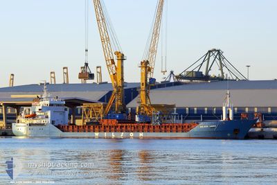
WILSON HAWK
General Cargo
Current Trip
| Time Travelled | 4 days |
|---|---|
| Remaining Time | --- |
| Distance Travelled | 681.73 nm |
| Remaining Distance | --- |
| AVG Speed | 7.9 Knopen |
| MAX Speed | 15.2 Knopen |
| AVG Wind | 9.8 knots |
| MAX Wind | 21 knots |
| MIN Temp | 12.2°C / 53.96°F |
| MAX Temp | 21.3°C / 70.34°F |
| Diepgang | 4 M |
| Positie ontvangen | 12 m geleden |
Current Position
| Lengtegraad | -2.71210° |
|---|---|
| Breedtegraat | 48.53276° |
| Status | Moored |
| Snelheid | |
| Koers | 251° |
| Gebied | English Channel |
| Station | T-AIS |
| Positie ontvangen | 12 m geleden |
Info
Information
The current position of WILSON HAWK is in English Channel with coordinates 48.53276° / -2.71210° as reported on 2024-06-06 05:53 by AIS to our vessel tracker app. The vessel's current speed is 0 Knopen
The vessel WILSON HAWK (IMO: 9064906, MMSI: 314222000) is a General Cargo that was built in 1994 ( 30 Jaar oud ). It's sailing under the flag of [BB] Barbados.
In this page you can find informations about the vessels current position, last detected port calls, and current voyage information. If the vessels is not in coverage by AIS you will find the latest position.
The current position of WILSON HAWK is detected by our AIS receivers and we are not responsible for the reliability of the data. The last position was recorded while the vessel was in Coverage by the Ais receivers of our vessel tracking app.
The current draught of WILSON HAWK as reported by AIS is 4 meters
Weather
| Temperature | 7.3°C / 45.14°F |
|---|---|
| Wind Speed | 5 knots |
| Direction | 288° WNW |
| Pressure | 1018.5 hPa |
| Humidity | 86.3 % |
| Cloud Coverage | 20 % |
Featured Company
Last Port Calls
| Port | Arrival | Departure | Time In Port |
|---|---|---|---|
| 2024-06-01 15:12 | 2024-06-01 18:44 | 3 h | |
| 2024-05-24 13:46 | 2024-05-27 20:08 | 3 d | |
| 2024-05-13 12:09 | 2024-05-14 21:13 | 1 d | |
| 2024-05-04 15:16 | 2024-05-07 16:57 | 3 d | |
| 2024-04-13 15:57 | 2024-04-16 17:20 | 3 d | |
| 2024-04-10 18:46 | 2024-04-12 21:08 | 2 d |
Last Trips
| Origin | Departure | Destination | Arrival | Distance | |
|---|---|---|---|---|---|
| 2024-05-27 20:08 | 2024-06-01 15:12 | 936.51 nm | |||
| 2024-05-14 21:13 | 2024-05-24 13:46 | 2302.84 nm | |||
| 2024-05-07 16:57 | 2024-05-13 12:09 | 454.96 nm | |||
| 2024-04-16 17:20 | 2024-05-04 15:16 | 1868.72 nm | |||
| 2024-04-12 21:08 | 2024-04-13 15:57 | 218.99 nm | |||
| 2024-03-29 08:26 | 2024-04-10 18:46 | 1740.84 nm |
Events
| Tijd | Evenement | Details | Positie / Bestemming | Info |
|---|---|---|---|---|
| 2024-06-06 05:53 | Status Changed | Moored Default |
48.53276 / -2.71210
FRSBK VIA KIEL
|
Snelheid: Koers: 251° |
| 2024-06-06 05:20 | Status Changed | Default Moored |
48.53276 / -2.71202
FRSBK VIA KIEL
|
Snelheid: Koers: 251° |
| 2024-06-06 03:53 | Status Changed | Moored Default |
48.53284 / -2.71209
FRSBK VIA KIEL
|
Snelheid: Koers: 251° |
| 2024-06-06 03:08 | Status Changed | Default Moored |
48.53281 / -2.71209
FRSBK VIA KIEL
|
Snelheid: Koers: 251° |
| 2024-06-05 23:53 | Status Changed | Moored Default |
48.53283 / -2.71201
FRSBK VIA KIEL
|
Snelheid: Koers: 250° |
| 2024-06-05 23:53 | Binnenbereik |
48.53283 / -2.71201
English Channel
|
Snelheid: Koers: 83.1° |
|
| 2024-06-05 23:29 | Status Changed | Default Moored |
48.53289 / -2.71195
FRSBK VIA KIEL
|
Snelheid: Koers: 251° |
| 2024-06-05 22:38 | Buitenbereik |
48.53284 / -2.71197
English Channel
|
Snelheid: Koers: 83.1° |
|
| 2024-06-05 21:38 | Status Changed | Moored Default |
48.53287 / -2.71208
FRSBK VIA KIEL
|
Snelheid: Koers: 250° |
| 2024-06-05 20:44 | Status Changed | Default Moored |
48.53294 / -2.71209
FRSBK VIA KIEL
|
Snelheid: Koers: 251° |