
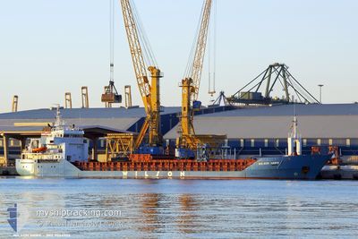
WILSON HAWK
General Cargo
Current Trip
| Trip Time | 5 days |
|---|---|
| Trip Distance | 454.96 nm |
| AVG Speed | 9.9 Noeuds |
| MAX Speed | 13.4 Noeuds |
| Tirant d eau | 4.1 m |
| AVG Wind | 12.8 knots |
| MAX Wind | 25 knots |
| MIN Temp | 15.4°C / 59.72°F |
| MAX Temp | 25.5°C / 77.9°F |
| Position reçue | 4 m depuis |
Current Position
| Longitude | -6.25633° |
|---|---|
| Latitude | 36.52127° |
| Etat | Moored |
| Vitesse | |
| Parcours | 161° |
| Zone | North Atlantic Ocean |
| Station | T-AIS |
| Position reçue | 4 m depuis |
Info
Information
The current position of WILSON HAWK is in North Atlantic Ocean with coordinates 36.52127° / -6.25633° as reported on 2024-05-13 11:40 by AIS to our vessel tracker app. The vessel's current speed is 0 Noeuds and is currently inside the port of CADIZ.
The vessel WILSON HAWK (IMO: 9064906, MMSI: 314222000) is a General Cargo that was built in 1994 ( 30 Age ). It's sailing under the flag of [BB] Barbados.
In this page you can find informations about the vessels current position, last detected port calls, and current voyage information. If the vessels is not in coverage by AIS you will find the latest position.
The current position of WILSON HAWK is detected by our AIS receivers and we are not responsible for the reliability of the data. The last position was recorded while the vessel was in Coverage by the Ais receivers of our vessel tracking app.
The current draught of WILSON HAWK as reported by AIS is 4.1 meters
Weather
| Temperature | 19.7°C / 67.46°F |
|---|---|
| Wind Speed | 8 knots |
| Direction | 252° WSW |
| Pressure | 1014.6 hPa |
| Humidity | 65.9 % |
| Cloud Coverage | 98 % |
Featured Company
Last Port Calls
| Port | Arrival | Departure | Time In Port |
|---|---|---|---|
| 2024-05-13 10:09 | |||
| 2024-05-04 14:16 | 2024-05-07 15:57 | 3 d | |
| 2024-04-13 14:57 | 2024-04-16 16:20 | 3 d | |
| 2024-04-10 17:46 | 2024-04-12 20:08 | 2 d | |
| 2024-03-23 06:53 | 2024-03-29 08:26 | 6 d | |
| 2024-03-15 15:42 | 2024-03-18 00:53 | 2 d | |
| 2024-03-15 01:03 |
Last Trips
| Origin | Departure | Destination | Arrival | Distance | |
|---|---|---|---|---|---|
| 2024-05-07 16:57 | 2024-05-13 12:09 | 454.96 nm | |||
| 2024-04-16 17:20 | 2024-05-04 15:16 | 1868.72 nm | |||
| 2024-04-12 21:08 | 2024-04-13 15:57 | 218.99 nm | |||
| 2024-03-29 08:26 | 2024-04-10 18:46 | 1740.84 nm | |||
| 2024-03-18 02:53 | 2024-03-23 06:53 | 1296.06 nm | |||
| 2024-03-15 02:03 | 2024-03-15 17:42 | 167.85 nm |
Events
| Heure | Evenement | Détails | Position/ Destination | Info |
|---|---|---|---|---|
| 2024-05-13 10:31 | Etat Changé | Moored Under way using engine |
36.52130 / -6.25636
[ES] CADIZ
|
Vitesse: Parcours: 162° |
| 2024-05-13 10:28 | Arret |
36.52130 / -6.25637
[ES] CADIZ
|
Vitesse: 0.3 kn Parcours: 159° |
|
| 2024-05-13 10:09 | Port d'arrivée |
|
36.53662 / -6.26622
[ES] CADIZ
|
Vitesse: 6.3 kn Parcours: 144.7° |
| 2024-05-13 09:47 | Démarrage | 2.54 nm, North West of CADIZ |
36.56618 / -6.31784
ESCAD
|
Vitesse: 3.2 kn Parcours: 195° |
| 2024-05-13 09:47 | Changement d'ETA | 2024/05/13 10:00 2024/05/09 09:00 |
36.56634 / -6.31773
ESCAD
|
Vitesse: 2.5 kn Parcours: 199° |
| 2024-05-13 09:46 | Etat Changé | Under way using engine At anchor |
36.56653 / -6.31761
ESCAD
|
Vitesse: 0.9 kn Parcours: 188° |
| 2024-05-13 05:08 | Etat Changé | At anchor Default |
36.56795 / -6.31750
ESCAD
|
Vitesse: 0.2 kn Parcours: 210° |
| 2024-05-13 04:56 | Etat Changé | Default At anchor |
36.56802 / -6.31753
ESCAD
|
Vitesse: 0.2 kn Parcours: 204° |
| 2024-05-13 04:41 | Etat Changé | At anchor Default |
36.56803 / -6.31756
ESCAD
|
Vitesse: 0.1 kn Parcours: 218° |
| 2024-05-13 04:32 | Etat Changé | Default At anchor |
36.56802 / -6.31754
ESCAD
|
Vitesse: Parcours: 213° |