

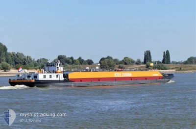
VOLHARDING 9
Tanker

Current Trip
| Time Travelled | 12 h, 45 mins |
|---|---|
| Remaining Time | 1 h, 1 mins |
| Distance Travelled | 66.69 nm |
| Remaining Distance | 43.50 nm |
| AVG Speed | 7.8 Knopen |
| MAX Speed | 10.8 Knopen |
| AVG Wind | 8 knots |
| MAX Wind | 11 knots |
| MIN Temp | 4.5°C / 40.1°F |
| MAX Temp | 7.5°C / 45.5°F |
| Diepgang | 2.7 M |
| Positie ontvangen | 4 m geleden |
Current Position
| Lengtegraad | --- |
|---|---|
| Breedtegraat | --- |
| Status | Moored |
| Snelheid | |
| Koers | --- |
| Gebied | North Sea |
| Station | T-AIS |
| Positie ontvangen | 4 m geleden |
Information
The current position of VOLHARDING 9 is in North Sea with coordinates 52.52128° / 5.43510° as reported on 2025-03-12 21:13 by AIS to our vessel tracker app. The vessel's current speed is 0 Knopen and is heading at the port of NIEUWEGEIN. The estimated time of arrival as calculated by MyShipTracking vessel tracking app is 2025-03-12 22:19 LT
The vessel VOLHARDING 9 (MMSI: 244710874) is a Tanker It's sailing under the flag of [NL] Netherlands.
In this page you can find informations about the vessels current position, last detected port calls, and current voyage information. If the vessels is not in coverage by AIS you will find the latest position.
The current position of VOLHARDING 9 is detected by our AIS receivers and we are not responsible for the reliability of the data. The last position was recorded while the vessel was in Coverage by the Ais receivers of our vessel tracking app.
The current draught of VOLHARDING 9 as reported by AIS is 2.7 meters
Weather
| Temperature | 3.5°C / 38.3°F |
|---|---|
| Wind Speed | 7 knots |
| Direction | 313° NW |
| Pressure | 999.9 hPa |
| Humidity | 87.3 % |
| Cloud Coverage | 8 % |


Featured Company
Last Port Calls
| Port | Arrival | Departure | Time In Port |
|---|---|---|---|
| 2025-03-12 07:30 | 2025-03-12 08:33 | 1 h | |
| 2025-03-11 07:34 | 2025-03-12 05:40 | 22 h | |
| 2025-03-10 23:29 | 2025-03-11 00:02 | 32 m | |
| 2025-03-10 04:43 | 2025-03-10 05:22 | 39 m | |
| 2025-03-09 11:39 | 2025-03-10 00:35 | 12 h | |
| 2025-03-08 17:48 | 2025-03-09 11:07 | 17 h | |
| 2025-03-08 09:42 | 2025-03-08 09:56 | 13 m | |
| 2025-03-08 07:27 | 2025-03-08 08:26 | 59 m | |
| 2025-03-07 20:27 | 2025-03-08 06:12 | 9 h | |
| 2025-03-06 08:33 | 2025-03-06 10:32 | 1 h |
Most Visited Ports (Last year)
| Port | Arrivals | |
|---|---|---|
| 62 | ||
| 46 | ||
| 45 | ||
| 42 | ||
| 36 | ||
| 35 |
Last Trips
| Origin | Departure | Destination | Arrival | Distance | |
|---|---|---|---|---|---|
| 2025-03-12 06:40 | 2025-03-12 08:30 | 10.98 nm | |||
| 2025-03-11 01:02 | 2025-03-11 08:34 | 9.85 nm | |||
| 2025-03-10 06:22 | 2025-03-11 00:29 | 113.33 nm | |||
| 2025-03-10 01:35 | 2025-03-10 05:43 | 31.54 nm | |||
| 2025-03-09 12:07 | 2025-03-09 12:39 | 3.87 nm | |||
| 2025-03-08 10:56 | 2025-03-08 18:48 | 56.86 nm | |||
| 2025-03-08 09:26 | 2025-03-08 10:42 | 10.32 nm | |||
| 2025-03-08 07:12 | 2025-03-08 08:27 | 9.92 nm | |||
| 2025-03-06 11:32 | 2025-03-07 21:27 | 38.80 nm | |||
| 2025-03-06 08:29 | 2025-03-06 09:33 | 8.05 nm |
Events
| Tijd | Evenement | Details | Positie / Bestemming | Info |
|---|---|---|---|---|
| 2025-03-12 18:30 | Status Changed | Moored Under way using engine |
52.52127 / 5.43511
AMSTERDAM NLAMS
|
Snelheid: Koers: 511° |
| 2025-03-12 18:11 | Stop beweging | 0.33 nm, South West of LELYSTAD |
52.52127 / 5.43506
AMSTERDAM NLAMS
|
Snelheid: 0.2 kn Koers: 511° |
| 2025-03-12 18:06 | Start beweging | 0.16 nm, West of LELYSTAD |
52.52647 / 5.43456
AMSTERDAM NLAMS
|
Snelheid: 4.2 kn Koers: 184.7° |
| 2025-03-12 17:56 | Stop beweging | 0.2 nm, North West of LELYSTAD |
52.52841 / 5.43474
AMSTERDAM NLAMS
|
Snelheid: 0.3 kn Koers: 511° |
| 2025-03-12 15:36 | Start beweging | 0.9 nm, West of LEMMER |
52.85034 / 5.67579
AMSTERDAM NLAMS
|
Snelheid: 4 kn Koers: 199° |
| 2025-03-12 15:24 | Stop beweging | 0.89 nm, West of LEMMER |
52.85218 / 5.67680
AMSTERDAM NLAMS
|
Snelheid: 0.3 kn Koers: 511° |
| 2025-03-12 15:21 | Start beweging | 0.88 nm, West of LEMMER |
52.85402 / 5.67789
AMSTERDAM NLAMS
|
Snelheid: 3.1 kn Koers: 197.5° |
| 2025-03-12 15:17 | Stop beweging | 0.89 nm, North West of LEMMER |
52.85582 / 5.67898
AMSTERDAM NLAMS
|
Snelheid: 0.3 kn Koers: 511° |
| 2025-03-12 14:54 | Status Changed | Under way using engine Default |
52.88094 / 5.69224
AMSTERDAM NLAMS
|
Snelheid: 6.9 kn Koers: 200° |
| 2025-03-12 14:54 | Status Changed | Default Under way using engine |
52.88252 / 5.69320
AMSTERDAM NLAMS
|
Snelheid: 6.9 kn Koers: 199.6° |