
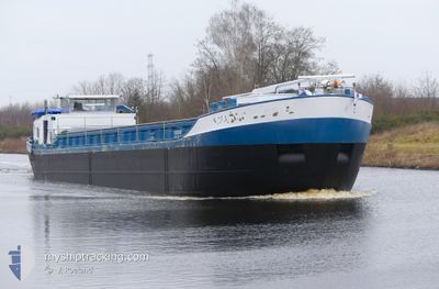
VIGILANT
Not available
Current Trip
SPIJK A/D LINGE
Unknown Port
ETA*
2025-08-31 00:00 UTC
| Time Travelled | 1 day |
|---|---|
| Remaining Time | --- |
| Distance Travelled | 0.06 nm |
| Remaining Distance | --- |
| AVG Speed | --- |
| MAX Speed | --- |
| AVG Wind | 6 knots |
| MAX Wind | 6 knots |
| MIN Temp | 2.7°C / 36.86°F |
| MAX Temp | 2.7°C / 36.86°F |
| Diepgang | 0 M |
| Positie ontvangen | 1 m geleden |
Current Position
| Lengtegraad | --- |
|---|---|
| Breedtegraat | --- |
| Status | Under way using engine |
| Snelheid | |
| Koers | --- |
| Gebied | North Sea |
| Station | T-AIS |
| Positie ontvangen | 1 m geleden |
Info
info
Information
The current position of VIGILANT is in North Sea with coordinates 51.84777° / 4.99461° as reported on 2025-03-02 03:12 by AIS to our vessel tracker app. The vessel's current speed is 0 Knopen
The vessel VIGILANT (MMSI: 244700602) is a Not available It's sailing under the flag of [NL] Netherlands.
In this page you can find informations about the vessels current position, last detected port calls, and current voyage information. If the vessels is not in coverage by AIS you will find the latest position.
The current position of VIGILANT is detected by our AIS receivers and we are not responsible for the reliability of the data. The last position was recorded while the vessel was in Coverage by the Ais receivers of our vessel tracking app.
Weather
| Temperature | 1.5°C / 34.7°F |
|---|---|
| Wind Speed | 3 knots |
| Direction | 18° NNE |
| Pressure | 1035.6 hPa |
| Humidity | 92.3 % |
| Cloud Coverage | 100 % |
Featured Company
Limited time offer - Install a base station receiver to your area and list your company on MyShipTracking Free forever!
Last Port Calls
| Port | Arrival | Departure | Time In Port |
|---|---|---|---|
| 2025-02-28 19:21 | 2025-02-28 19:59 | 37 m | |
| 2025-02-28 07:46 | 2025-02-28 13:11 | 5 h | |
| 2025-02-27 10:19 | 2025-02-27 11:15 | 56 m | |
| 2025-02-26 17:18 | 2025-02-26 18:33 | 1 h | |
| 2025-02-26 12:03 | 2025-02-26 12:30 | 26 m | |
| 2025-02-24 05:09 | 2025-02-24 05:41 | 31 m | |
| 2025-02-21 11:57 | 2025-02-21 12:50 | 53 m | |
| 2025-02-21 08:58 | 2025-02-21 09:19 | 20 m | |
| 2025-02-20 11:23 | 2025-02-20 12:20 | 56 m | |
| 2025-02-19 18:35 | 2025-02-19 19:34 | 58 m |
Most Visited Ports (Last year)
| Port | Arrivals | |
|---|---|---|
| 86 | ||
| 50 | ||
| 37 | ||
| 34 | ||
| 11 | ||
| 9 |
Last Trips
| Origin | Departure | Destination | Arrival | Distance | |
|---|---|---|---|---|---|
| 2025-02-28 14:11 | 2025-02-28 20:21 | 36.68 nm | |||
| 2025-02-27 12:15 | 2025-02-28 08:46 | 49.73 nm | |||
| 2025-02-26 19:33 | 2025-02-27 11:19 | 2.46 nm | |||
| 2025-02-26 13:30 | 2025-02-26 18:18 | 32.42 nm | |||
| 2025-02-24 06:41 | 2025-02-26 13:03 | 147.29 nm | |||
| 2025-02-21 13:50 | 2025-02-24 06:09 | 42.65 nm | |||
| 2025-02-21 10:19 | 2025-02-21 12:57 | 20.51 nm | |||
| 2025-02-20 13:20 | 2025-02-21 09:58 | 53.04 nm | |||
| 2025-02-19 20:34 | 2025-02-20 12:23 | 2.88 nm | |||
| 2025-02-17 08:20 | 2025-02-19 19:35 | 154.87 nm |
Events
| Tijd | Evenement | Details | Positie / Bestemming | Info |
|---|---|---|---|---|
| 2025-02-28 20:02 | Stop beweging | 1.04 nm, South of ARKEL |
51.84774 / 4.99448
SPIJK A/D LINGE
|
Snelheid: 0.3 kn Koers: 511° |
| 2025-02-28 19:59 | Vertrekhaven |
|
51.84713 / 4.99341
SPIJK A/D LINGE
|
Snelheid: 1.7 kn Koers: 511° |
| 2025-02-28 19:32 | Start beweging |
51.83172 / 4.96864
[NL] GORINCHEM
|
Snelheid: 3.4 kn Koers: 39.4° |
|
| 2025-02-28 19:24 | Stop beweging |
51.83031 / 4.96671
[NL] GORINCHEM
|
Snelheid: 0.3 kn Koers: 511° |
|
| 2025-02-28 19:21 | Aankomsthaven |
|
51.82924 / 4.96534
[NL] GORINCHEM
|
Snelheid: 3.2 kn Koers: 37.5° |
| 2025-02-28 15:30 | Destination Changed | SPIJK A/D LINGE DEEST |
51.89947 / 5.60610
SPIJK A/D LINGE
|
Snelheid: 7.9 kn Koers: 268.8° |
| 2025-02-28 15:07 | Start beweging | 0.34 nm, East of DEEST |
51.89440 / 5.68146
DEEST
|
Snelheid: 3.9 kn Koers: 324.5° |
| 2025-02-28 14:11 | Stop beweging | 0.38 nm, East of DEEST |
51.89270 / 5.68244
DEEST
|
Snelheid: 0.3 kn Koers: 511° |
| 2025-02-28 13:11 | Vertrekhaven |
|
51.89773 / 5.54039
DEEST
|
Snelheid: 4.3 kn Koers: 116.8° |
| 2025-02-28 13:06 | Start beweging |
51.90223 / 5.54735
[NL] OCHTEN
|
Snelheid: 6.2 kn Koers: 257.7° |