

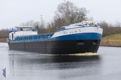
VIGILANT
Not available

Current Trip
LELYSTAD
Unknown Port
ETA*
2025-08-31 00:00 UTC
| Time Travelled | 1 day |
|---|---|
| Remaining Time | --- |
| Distance Travelled | 36.55 nm |
| Remaining Distance | --- |
| AVG Speed | 7.4 Noeuds |
| MAX Speed | 10.2 Noeuds |
| AVG Wind | 11.8 knots |
| MAX Wind | 13 knots |
| MIN Temp | 12.4°C / 54.32°F |
| MAX Temp | 17.3°C / 63.14°F |
| Tirant d eau | 0 m |
| Position reçue | 1 m depuis |
Current Position
| Longitude | --- |
|---|---|
| Latitude | --- |
| Etat | Under way using engine |
| Vitesse | |
| Parcours | --- |
| Zone | North Sea |
| Station | T-AIS |
| Position reçue | 1 m depuis |
Information
The current position of VIGILANT is in North Sea with coordinates 51.90581° / 5.45082° as reported on 2025-02-22 19:32 by AIS to our vessel tracker app. The vessel's current speed is 0 Noeuds
The vessel VIGILANT (MMSI: 244700602) is a Not available It's sailing under the flag of [NL] Netherlands.
In this page you can find informations about the vessels current position, last detected port calls, and current voyage information. If the vessels is not in coverage by AIS you will find the latest position.
The current position of VIGILANT is detected by our AIS receivers and we are not responsible for the reliability of the data. The last position was recorded while the vessel was in Coverage by the Ais receivers of our vessel tracking app.
Weather
| Temperature | 9.3°C / 48.74°F |
|---|---|
| Wind Speed | 7 knots |
| Direction | 265° W |
| Pressure | 1017.8 hPa |
| Humidity | 95.1 % |
| Cloud Coverage | 100 % |


Featured Company
Limited time offer - Install a base station receiver to your area and list your company on MyShipTracking Free forever!
Last Port Calls
| Port | Arrival | Departure | Time In Port |
|---|---|---|---|
| 2025-02-21 12:57 | 2025-02-21 13:50 | 53 m | |
| 2025-02-21 09:58 | 2025-02-21 10:19 | 20 m | |
| 2025-02-20 12:23 | 2025-02-20 13:20 | 56 m | |
| 2025-02-19 19:35 | 2025-02-19 20:34 | 58 m | |
| 2025-02-17 03:29 | 2025-02-17 08:20 | 4 h | |
| 2025-02-14 10:02 | 2025-02-14 10:35 | 33 m | |
| 2025-02-13 15:52 | 2025-02-13 16:11 | 18 m | |
| 2025-02-11 16:47 | 2025-02-11 17:23 | 36 m | |
| 2025-02-11 09:59 | 2025-02-11 11:04 | 1 h | |
| 2025-02-10 17:16 | 2025-02-10 17:52 | 35 m |
Most Visited Ports (Last year)
| Port | Arrivals | |
|---|---|---|
| 84 | ||
| 50 | ||
| 37 | ||
| 32 | ||
| 11 | ||
| 9 |
Last Trips
| Origin | Departure | Destination | Arrival | Distance | |
|---|---|---|---|---|---|
| 2025-02-21 10:19 | 2025-02-21 12:57 | 20.51 nm | |||
| 2025-02-20 13:20 | 2025-02-21 09:58 | 53.04 nm | |||
| 2025-02-19 20:34 | 2025-02-20 12:23 | 2.88 nm | |||
| 2025-02-17 08:20 | 2025-02-19 19:35 | 154.87 nm | |||
| 2025-02-14 10:35 | 2025-02-17 03:29 | 43.19 nm | |||
| 2025-02-13 16:11 | 2025-02-14 10:02 | 3.48 nm | |||
| 2025-02-11 17:23 | 2025-02-13 15:52 | 136.98 nm | |||
| 2025-02-11 11:04 | 2025-02-11 16:47 | 36.81 nm | |||
| 2025-02-10 17:52 | 2025-02-11 09:59 | 1.71 nm | |||
| 2025-02-05 15:27 | 2025-02-10 17:16 | 156.88 nm |
Events
| Heure | Evenement | Détails | Position/ Destination | Info |
|---|---|---|---|---|
| 2025-02-21 19:11 | Arret | 1.17 nm, North of TIEL |
51.90581 / 5.45082
LELYSTAD
|
Vitesse: 0.2 kn Parcours: 511° |
| 2025-02-21 19:08 | Démarrage | 1.26 nm, North of TIEL |
51.90744 / 5.45035
LELYSTAD
|
Vitesse: 3.3 kn Parcours: 170.6° |
| 2025-02-21 18:56 | Arret | 1.38 nm, North of TIEL |
51.90946 / 5.45030
LELYSTAD
|
Vitesse: Parcours: 511° |
| 2025-02-21 18:48 | Démarrage | 1.03 nm, North East of TIEL |
51.90275 / 5.45390
LELYSTAD
|
Vitesse: 4.5 kn Parcours: 340.2° |
| 2025-02-21 18:40 | Arret | 0.94 nm, North East of TIEL |
51.90072 / 5.45499
LELYSTAD
|
Vitesse: Parcours: 511° |
| 2025-02-21 16:43 | Démarrage | 0.53 nm, North of NIJMEGEN |
51.85602 / 5.82478
LELYSTAD
|
Vitesse: 4.9 kn Parcours: 26° |
| 2025-02-21 16:21 | Arret | 0.43 nm, North of NIJMEGEN |
51.85430 / 5.82329
LELYSTAD
|
Vitesse: 0.3 kn Parcours: 511° |
| 2025-02-21 13:56 | Démarrage | 1.77 nm, South East of BOXMEER |
51.64245 / 5.97836
LELYSTAD
|
Vitesse: 5.1 kn Parcours: 295.8° |
| 2025-02-21 13:41 | Arret | 1.91 nm, South East of BOXMEER |
51.64112 / 5.98193
LELYSTAD
|
Vitesse: 0.2 kn Parcours: 511° |
| 2025-02-21 13:38 | Changement de destination | LELYSTAD AAIJEN |
51.64043 / 5.98388
LELYSTAD
|
Vitesse: 3.3 kn Parcours: 300.9° |