
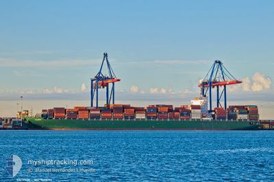
VALENCE
Cargo B
Current Trip
| Time Travelled | 9 days |
|---|---|
| Remaining Time | 6 h, 15 mins |
| Distance Travelled | 2892.35 nm |
| Remaining Distance | 69.41 nm |
| AVG Speed | 13.7 Knopen |
| MAX Speed | 20.7 Knopen |
| AVG Wind | 13.4 knots |
| MAX Wind | 33.5 knots |
| MIN Temp | 9.2°C / 48.56°F |
| MAX Temp | 17.2°C / 62.96°F |
| Diepgang | 14.5 M |
| Positie ontvangen | 2 m geleden |
Current Position
| Lengtegraad | --- |
|---|---|
| Breedtegraat | --- |
| Status | Under way using engine |
| Snelheid | 10.7 Knopen |
| Koers | 19° |
| Gebied | Aegean Sea |
| Station | T-AIS |
| Positie ontvangen | 2 m geleden |
Info
Information
The current position of VALENCE is in Aegean Sea with coordinates 36.87147° / 23.55777° as reported on 2025-03-18 01:36 by AIS to our vessel tracker app. The vessel's current speed is 10.7 Knopen and is heading at the port of PIRAEUS. The estimated time of arrival as calculated by MyShipTracking vessel tracking app is 2025-03-18 09:54 LT
The vessel VALENCE (IMO: 9628180, MMSI: 229548000) is a Cargo B It's sailing under the flag of [MT] Malta.
In this page you can find informations about the vessels current position, last detected port calls, and current voyage information. If the vessels is not in coverage by AIS you will find the latest position.
The current position of VALENCE is detected by our AIS receivers and we are not responsible for the reliability of the data. The last position was recorded while the vessel was in Coverage by the Ais receivers of our vessel tracking app.
The current draught of VALENCE as reported by AIS is 14.5 meters
Weather
| Temperature | 14.8°C / 58.64°F |
|---|---|
| Wind Speed | 9 knots |
| Direction | 318° NW |
| Pressure | 1013.9 hPa |
| Humidity | 53 % |
| Cloud Coverage | 5 % |
Featured Company
Last Port Calls
| Port | Arrival | Departure | Time In Port |
|---|---|---|---|
| 2025-03-06 19:12 | 2025-03-08 18:38 | 1 d | |
| 2025-03-04 03:18 | 2025-03-05 06:35 | 1 d | |
| 2025-02-28 04:41 | 2025-03-02 15:15 | 2 d | |
| 2025-02-16 08:17 | 2025-02-18 11:15 | 2 d | |
| 2025-02-14 19:48 | 2025-02-15 13:29 | 17 h | |
| 2025-02-13 02:30 | 2025-02-14 15:01 | 1 d | |
| 2025-02-10 18:33 | 2025-02-12 20:55 | 2 d | |
| 2025-02-07 22:30 | 2025-02-09 15:00 | 1 d | |
| 2025-01-24 18:59 | 2025-01-26 09:35 | 1 d | |
| 2025-01-21 01:24 | 2025-01-22 13:43 | 1 d |
Most Visited Ports (Last year)
| Port | Arrivals | |
|---|---|---|
| 3 | ||
| 3 | ||
| 2 | ||
| 2 | ||
| 2 | ||
| 2 |
Last Trips
| Origin | Departure | Destination | Arrival | Distance | |
|---|---|---|---|---|---|
| 2025-03-05 06:35 | 2025-03-06 19:12 | 428.03 nm | |||
| 2025-03-02 15:15 | 2025-03-04 03:18 | 370.29 nm | |||
| 2025-02-18 11:15 | 2025-02-28 04:41 | 3069.72 nm | |||
| 2025-02-15 13:29 | 2025-02-16 08:17 | 287.99 nm | |||
| 2025-02-14 15:01 | 2025-02-14 19:48 | 47.39 nm | |||
| 2025-02-12 20:55 | 2025-02-13 02:30 | 56.51 nm | |||
| 2025-02-09 15:00 | 2025-02-10 18:33 | 389.44 nm | |||
| 2025-01-26 09:35 | 2025-02-07 22:30 | 3204.50 nm | |||
| 2025-01-22 13:43 | 2025-01-24 18:59 | 482.70 nm | |||
| 2025-01-20 15:26 | 2025-01-21 01:24 | 123.18 nm |
Events
| Tijd | Evenement | Details | Positie / Bestemming | Info |
|---|---|---|---|---|
| 2025-03-18 01:12 | Status Changed | Under way using engine Default |
36.80214 / 23.53093
GRPIR
|
Snelheid: 10.7 kn Koers: 23° |
| 2025-03-18 00:37 | Status Changed | Default Under way using engine |
36.70658 / 23.48125
GRPIR
|
Snelheid: 10.5 kn Koers: 19.9° |
| 2025-03-18 00:29 | Wijzig zee gebeid | Greek part of the Aegean Sea Italian part of the Mediterranean Sea - Eastern Basin |
36.68550 / 23.47173
Aegean Sea
GRPIR
|
Snelheid: 10.5 kn Koers: 18° |
| 2025-03-18 00:29 | Status Changed | Under way using engine Default |
36.68550 / 23.47173
GRPIR
|
Snelheid: 10.5 kn Koers: 18° |
| 2025-03-18 00:22 | Binnenbereik |
36.68550 / 23.47173
Aegean Sea
GRPIR
|
Snelheid: 10.5 kn Koers: 18° |
|
| 2025-03-16 10:27 | Status Changed | Default Under way using engine |
36.33362 / 14.87353
GRPIR
|
Snelheid: 11.5 kn Koers: 88.8° |
| 2025-03-16 10:24 | Buitenbereik |
36.33364 / 14.85919
Mediterranean Sea - Eastern Basin
GRPIR
|
Snelheid: 11.5 kn Koers: 88.8° |
|
| 2025-03-16 09:49 | Status Changed | Under way using engine Default |
36.33866 / 14.72670
GRPIR
|
Snelheid: 11.2 kn Koers: 95° |
| 2025-03-16 09:43 | Status Changed | Default Under way using engine |
36.34022 / 14.70408
GRPIR
|
Snelheid: 11.2 kn Koers: 94.5° |
| 2025-03-16 09:26 | Wijzig zee gebeid | Italian part of the Mediterranean Sea - Eastern Basin Maltese part of the Mediterranean Sea - Eastern Basin |
36.34484 / 14.64067
Mediterranean Sea - Eastern Basin
GRPIR
|
Snelheid: 11.2 kn Koers: 96.7° |