
VALENCE
Cargo B
Current Trip
| Time Travelled | 2 days |
|---|---|
| Remaining Time | 1 h, 3 mins |
| Distance Travelled | 787.00 nm |
| Remaining Distance | 15.39 nm |
| AVG Speed | 12.8 Knots |
| MAX Speed | 16.8 Knots |
| AVG Wind | 8.6 knots |
| MAX Wind | 17 knots |
| MIN Temp | 11.8°C / 53.24°F |
| MAX Temp | 17.2°C / 62.96°F |
| Dybgang | 11.4 m |
| Position Modtaget | 8 m siden |
Current Position
| Longitude | --- |
|---|---|
| Latitude | --- |
| Status | Under way using engine |
| Fart | 2.2 Knots |
| Kurs | 2° |
| Område | Mediterranean Sea - Eastern Basin |
| Station | T-AIS |
| Position Modtaget | 8 m siden |
Info
Information
The current position of VALENCE is in Mediterranean Sea - Eastern Basin with coordinates 35.69252° / 14.82642° as reported on 2024-12-18 23:44 by AIS to our vessel tracker app. The vessel's current speed is 2.2 Knots and is heading at the port of MARSAXLOKK. The estimated time of arrival as calculated by MyShipTracking vessel tracking app is 2024-12-19 00:56 LT
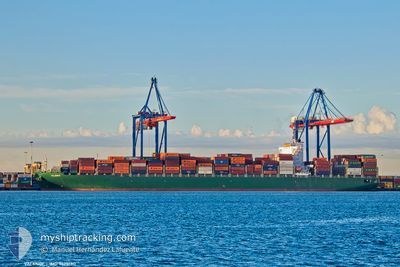
The vessel VALENCE (IMO: 9628180, MMSI: 229548000) is a Cargo B It's sailing under the flag of [MT] Malta.
In this page you can find informations about the vessels current position, last detected port calls, and current voyage information. If the vessels is not in coverage by AIS you will find the latest position.
The current position of VALENCE is detected by our AIS receivers and we are not responsible for the reliability of the data. The last position was recorded while the vessel was in Coverage by the Ais receivers of our vessel tracking app.
The current draught of VALENCE as reported by AIS is 11.4 meters
Weather
| Temperature | 16.6°C / 61.88°F |
|---|---|
| Wind Speed | 11 knots |
| Direction | 302° WNW |
| Pressure | 1025.9 hPa |
| Humidity | 73.4 % |
| Cloud Coverage | 1 % |
Featured Company
Last Port Calls
| Port | Arrival | Departure | Time In Port |
|---|---|---|---|
| 2024-12-15 12:33 | 2024-12-16 10:39 | 22 h | |
| 2024-11-15 18:56 | 2024-11-16 20:16 | 1 d | |
| 2024-11-12 22:16 | 2024-11-13 18:28 | 20 h | |
| 2024-11-10 13:52 | 2024-11-11 10:06 | 20 h | |
| 2024-11-06 21:19 | 2024-11-08 11:45 | 1 d | |
| 2024-10-10 22:19 | 2024-10-11 19:51 | 21 h | |
| 2024-10-07 07:27 | 2024-10-08 03:57 | 20 h | |
| 2024-10-05 17:54 | 2024-10-06 19:05 | 1 d | |
| 2024-10-03 06:55 | 2024-10-04 21:35 | 1 d |
Last Trips
| Origin | Departure | Destination | Arrival | Distance | |
|---|---|---|---|---|---|
| 2024-11-17 01:46 | 2024-12-15 13:33 | 10462.58 nm | |||
| 2024-11-13 23:58 | 2024-11-16 00:26 | 434.81 nm | |||
| 2024-11-11 15:06 | 2024-11-13 03:46 | 589.36 nm | |||
| 2024-11-08 15:45 | 2024-11-10 18:52 | 849.67 nm | |||
| 2024-10-11 21:51 | 2024-11-07 01:19 | 10642.85 nm | |||
| 2024-10-08 05:57 | 2024-10-11 00:19 | 256.17 nm | |||
| 2024-10-06 21:05 | 2024-10-07 09:27 | 191.02 nm | |||
| 2024-10-04 23:35 | 2024-10-05 19:54 | 249.32 nm | |||
| 2024-09-30 07:14 | 2024-10-03 08:55 | 671.56 nm |
Events
| Tid | Hændelsen | Detaljer | Position / Dest | Info |
|---|---|---|---|---|
| 2024-12-18 23:43 | Status er ændret | Under way using engine Default |
35.69161 / 14.82598
MTMAR
|
Fart: 2.9 kn Kurs: 12° |
| 2024-12-18 23:33 | Status er ændret | Default Under way using engine |
35.68299 / 14.81640
MTMAR
|
Fart: 10 kn Kurs: 48.9° |
| 2024-12-18 23:28 | Status er ændret | Under way using engine Default |
35.67607 / 14.80674
MTMAR
|
Fart: 13.5 kn Kurs: 51° |
| 2024-12-18 22:33 | Status er ændret | Default Under way using engine |
35.59802 / 14.61642
MTMAR
|
Fart: 11.4 kn Kurs: 78.6° |
| 2024-12-18 22:33 | Status er ændret | Under way using engine Default |
35.59791 / 14.61573
MTMAR
|
Fart: 11.3 kn Kurs: 77° |
| 2024-12-18 22:25 | Status er ændret | Default Under way using engine |
35.59300 / 14.58615
MTMAR
|
Fart: 10.9 kn Kurs: 91.4° |
| 2024-12-18 22:14 | Status er ændret | Under way using engine Default |
35.59130 / 14.54720
MTMAR
|
Fart: 11.6 kn Kurs: 120° |
| 2024-12-18 22:13 | Status er ændret | Default Under way using engine |
35.59318 / 14.54186
MTMAR
|
Fart: 12 kn Kurs: 125.3° |
| 2024-12-18 20:58 | Dybgangen er ændret | 11.4 11.7 |
35.67533 / 14.26606
MTMAR
|
Fart: 11.6 kn Kurs: 93.3° |
| 2024-12-18 20:37 | Status er ændret | Under way using engine Default |
35.68966 / 14.19089
MTMAR
|
Fart: 11.2 kn Kurs: 108° |