

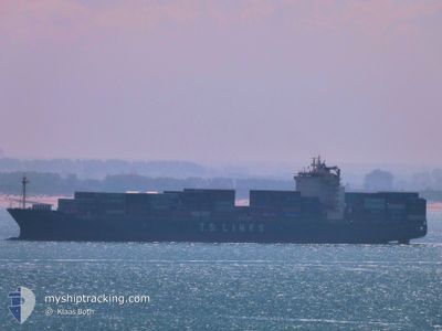
TS SINGAPORE
Container Ship

Current Trip
| Time Travelled | 16 days |
|---|---|
| Remaining Time | --- |
| Distance Travelled | 4590.56 nm |
| Remaining Distance | --- |
| AVG Speed | 12.2 Knopen |
| MAX Speed | 19.6 Knopen |
| AVG Wind | 15.1 knots |
| MAX Wind | 32 knots |
| MIN Temp | 11.6°C / 52.88°F |
| MAX Temp | 30°C / 86°F |
| Diepgang | 12.2 M |
| Positie ontvangen | Nu |
Current Position
| Lengtegraad | --- |
|---|---|
| Breedtegraat | --- |
| Status | Under way using engine |
| Snelheid | 5.8 Knopen |
| Koers | 257° |
| Gebied | Tasman Sea |
| Station | T-AIS |
| Positie ontvangen | Nu |
Information
The current position of TS SINGAPORE is in Tasman Sea with coordinates -33.99917° / 151.50118° as reported on 2025-02-24 02:45 by AIS to our vessel tracker app. The vessel's current speed is 5.8 Knopen
The vessel TS SINGAPORE (IMO: 9464687, MMSI: 538008845) is a Container Ship that was built in 2010 ( 15 Jaar oud ). It's sailing under the flag of [MH] Marshall Is.
In this page you can find informations about the vessels current position, last detected port calls, and current voyage information. If the vessels is not in coverage by AIS you will find the latest position.
The current position of TS SINGAPORE is detected by our AIS receivers and we are not responsible for the reliability of the data. The last position was recorded while the vessel was in Coverage by the Ais receivers of our vessel tracking app.
The current draught of TS SINGAPORE as reported by AIS is 12.2 meters
Weather
| Temperature | 22.8°C / 73.04°F |
|---|---|
| Wind Speed | 12 knots |
| Direction | 166° SSE |
| Pressure | 1018.5 hPa |
| Humidity | 83.3 % |
| Cloud Coverage | 16 % |


Featured Company
Last Port Calls
| Port | Arrival | Departure | Time In Port |
|---|---|---|---|
| 2025-02-07 03:45 | 2025-02-07 13:57 | 10 h | |
| 2025-02-05 04:57 | 2025-02-05 15:49 | 10 h | |
| 2025-02-02 07:33 | 2025-02-02 17:21 | 9 h | |
| 2025-01-30 16:45 | 2025-01-31 16:01 | 23 h | |
| 2025-01-16 01:46 | 2025-01-17 00:31 | 22 h | |
| 2025-01-12 16:59 | 2025-01-14 09:50 | 1 d | |
| 2025-01-09 02:00 | 2025-01-10 13:41 | 1 d | |
| 2024-12-24 05:52 | 2024-12-24 14:13 | 8 h | |
| 2024-12-22 14:41 | 2024-12-23 07:01 | 16 h | |
| 2024-12-18 07:13 | 2024-12-18 19:33 | 12 h |
Last Trips
| Origin | Departure | Destination | Arrival | Distance | |
|---|---|---|---|---|---|
| 2025-02-05 23:49 | 2025-02-07 11:45 | 100.39 nm | |||
| 2025-02-03 01:21 | 2025-02-05 12:57 | 956.64 nm | |||
| 2025-02-01 00:01 | 2025-02-02 15:33 | 420.88 nm | |||
| 2025-01-17 10:31 | 2025-01-31 00:45 | 4414.36 nm | |||
| 2025-01-14 20:50 | 2025-01-16 11:46 | 552.36 nm | |||
| 2025-01-11 00:41 | 2025-01-13 03:59 | 608.20 nm | |||
| 2024-12-24 22:13 | 2025-01-09 13:00 | 5111.93 nm | |||
| 2024-12-23 15:01 | 2024-12-24 13:52 | 143.76 nm | |||
| 2024-12-19 03:33 | 2024-12-22 22:41 | 1014.24 nm | |||
| 2024-12-16 02:08 | 2024-12-18 15:13 | 457.17 nm |
Events
| Tijd | Evenement | Details | Positie / Bestemming | Info |
|---|---|---|---|---|
| 2025-02-24 02:39 | Start beweging | 14.48 nm, South East of ROSE BAY |
-33.99663 / 151.50975
AUSYD
|
Snelheid: 3.1 kn Koers: 223° |
| 2025-02-24 01:04 | ETA Changed | 2025/02/24 04:00 2025/02/24 03:30 |
-34.02008 / 151.53937
AUSYD
|
Snelheid: 1 kn Koers: 261° |
| 2025-02-23 22:22 | Stop beweging | 16.99 nm, East of KURNELL |
-34.02532 / 151.55065
AUSYD
|
Snelheid: 0.3 kn Koers: 69° |
| 2025-02-23 21:15 | Start beweging | 12.85 nm, East of KURNELL |
-34.04818 / 151.46283
AUSYD
|
Snelheid: 3.1 kn Koers: 91° |
| 2025-02-23 17:59 | Stop beweging | 14.18 nm, East of KURNELL |
-34.04252 / 151.49128
AUSYD
|
Snelheid: 0.3 kn Koers: 89° |
| 2025-02-23 15:56 | ETA Changed | 2025/02/24 03:30 2025/02/24 02:00 |
-34.02622 / 151.52228
AUSYD
|
Snelheid: 1 kn Koers: 118° |
| 2025-02-23 05:27 | Start beweging | 19.13 nm, East of WATSONS BAY |
-33.93240 / 151.64713
AUSYD
|
Snelheid: 3.1 kn Koers: 322° |
| 2025-02-23 04:34 | Stop beweging | 19.29 nm, East of WATSONS BAY |
-33.92432 / 151.65302
AUSYD
|
Snelheid: 0.3 kn Koers: 23° |
| 2025-02-23 03:43 | Binnenbereik |
-33.96608 / 151.75320
Tasman Sea
AUSYD
|
Snelheid: 9.8 kn Koers: 290° |
|
| 2025-02-23 02:33 | Buitenbereik |
-34.00248 / 151.93017
Tasman Sea
AUSYD
|
Snelheid: 4.4 kn Koers: 138° |