
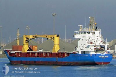
TRIO BUSE
General Cargo
Current Trip
ES LPA
| Time Travelled | 10 days |
|---|---|
| Remaining Time | --- |
| Distance Travelled | 1183.40 nm |
| Remaining Distance | --- |
| AVG Speed | 9.6 Knopen |
| MAX Speed | 12.3 Knopen |
| AVG Wind | 9.3 knots |
| MAX Wind | 19.2 knots |
| MIN Temp | 22.9°C / 73.22°F |
| MAX Temp | 42.8°C / 109.04°F |
| Diepgang | 4.4 M |
| Positie ontvangen | 5 d geleden |
Current Position
| Lengtegraad | -17.13088° |
|---|---|
| Breedtegraat | 13.10900° |
| Status | Under way using engine |
| Snelheid | 9.9 Knopen |
| Koers | 3° |
| Gebied | North Atlantic Ocean |
| Station | T-AIS |
| Positie ontvangen | 5 d geleden |
Info
Information
The current position of TRIO BUSE is in North Atlantic Ocean with coordinates 13.10900° / -17.13088° as reported on 2024-05-02 10:34 by AIS to our vessel tracker app. The vessel's current speed is 9.9 Knopen
The vessel TRIO BUSE (IMO: 9210048, MMSI: 314788000) is a General Cargo that was built in 2000 ( 24 Jaar oud ). It's sailing under the flag of [BB] Barbados.
In this page you can find informations about the vessels current position, last detected port calls, and current voyage information. If the vessels is not in coverage by AIS you will find the latest position.
The current position of TRIO BUSE is detected by our AIS receivers and we are not responsible for the reliability of the data. The last position was recorded while the vessel was in Coverage by the Ais receivers of our vessel tracking app.
The current draught of TRIO BUSE as reported by AIS is 4.4 meters
Weather
| Temperature | 27.6°C / 81.68°F |
|---|---|
| Wind Speed | 5 knots |
| Direction | 334° NNW |
| Pressure | 1010.6 hPa |
| Humidity | 38.8 % |
| Cloud Coverage | --- |
Featured Company
Events
| Tijd | Evenement | Details | Positie / Bestemming | Info |
|---|---|---|---|---|
| 2024-05-04 10:24 | Stop beweging | 5.52 nm, South East of KOBO TOKI |
14.13136 / -16.07884
ES LPA
|
Snelheid: Koers: 80° |
| 2024-05-04 07:29 | Start beweging | 6.51 nm, West of KOBO TOKI |
14.14720 / -16.27598
ES LPA
|
Snelheid: 5.5 kn Koers: 36° |
| 2024-05-03 19:41 | Stop beweging | 6.79 nm, West of KOBO TOKI |
14.14648 / -16.28064
ES LPA
|
Snelheid: Koers: 125° |
| 2024-05-03 15:22 | Start beweging |
13.89271 / -16.80074
ES LPA
|
Snelheid: 7.3 kn Koers: 75° |
|
| 2024-05-02 16:10 | Stop beweging |
13.89112 / -16.80870
ES LPA
|
Snelheid: 0.1 kn Koers: 319° |
|
| 2024-05-02 10:49 | Status Changed | Default Under way using engine |
13.16423 / -17.12579
ES LPA
|
Snelheid: 9.9 kn Koers: 3° |
| 2024-05-02 10:34 | Buitenbereik |
13.10900 / -17.13088
North Atlantic Ocean
|
Snelheid: 9.9 kn Koers: 3° |
|
| 2024-05-02 10:23 | Gevonden in zee | Gambian part of the North Atlantic Ocean |
13.07824 / -17.13332
North Atlantic Ocean
|
Snelheid: 9.7 kn Koers: 5.6° |
| 2024-05-02 08:06 | Status Changed | Under way using engine Default |
12.72065 / -17.17144
ES LPA
|
Snelheid: 9.5 kn Koers: 4° |
| 2024-05-02 07:54 | Status Changed | Default Under way using engine |
12.69392 / -17.17279
ES LPA
|
Snelheid: 10.2 kn Koers: 5.4° |