
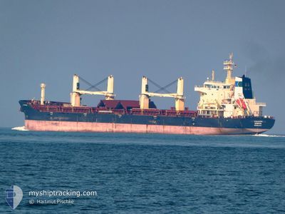
TRANSNORDIC
Bulk Carrier
Current Trip
MISSISSIPPI RIVER
| Time Travelled | 21 days |
|---|---|
| Remaining Time | --- |
| Distance Travelled | 5086.48 nm |
| Remaining Distance | --- |
| AVG Speed | 10.6 Knopen |
| MAX Speed | 13.8 Knopen |
| AVG Wind | 9.1 knots |
| MAX Wind | 29 knots |
| MIN Temp | 2.3°C / 36.14°F |
| MAX Temp | 24.7°C / 76.46°F |
| Diepgang | 10.5 M |
| Positie ontvangen | 7 h, 48 m geleden |
Current Position
| Lengtegraad | --- |
|---|---|
| Breedtegraat | --- |
| Status | Under way using engine |
| Snelheid | 8.4 Knopen |
| Koers | 251.9° |
| Gebied | North Atlantic Ocean |
| Station | T-AIS |
| Positie ontvangen | 7 h, 48 m geleden |
Information
The current position of TRANSNORDIC is in North Atlantic Ocean with coordinates 29.95577° / -90.15249° as reported on 2025-03-29 10:40 by AIS to our vessel tracker app. The vessel's current speed is 8.4 Knopen
The vessel TRANSNORDIC (IMO: 9602174, MMSI: 636023850) is a Bulk Carrier that was built in 2012 ( 13 Jaar oud ). It's sailing under the flag of [LR] Liberia.
In this page you can find informations about the vessels current position, last detected port calls, and current voyage information. If the vessels is not in coverage by AIS you will find the latest position.
The current position of TRANSNORDIC is detected by our AIS receivers and we are not responsible for the reliability of the data. The last position was recorded while the vessel was in Coverage by the Ais receivers of our vessel tracking app.
The current draught of TRANSNORDIC as reported by AIS is 10.5 meters
Weather
| Temperature | 18.9°C / 66.02°F |
|---|---|
| Wind Speed | 8 knots |
| Direction | 132° SE |
| Pressure | 1014.6 hPa |
| Humidity | 93.5 % |
| Cloud Coverage | 100 % |
Featured Company
Last Port Calls
| Port | Arrival | Departure | Time In Port |
|---|---|---|---|
| 2025-03-07 12:11 | 2025-03-08 14:46 | 1 d | |
| 2025-03-02 17:06 | 2025-03-06 18:43 | 4 d | |
| 2025-02-10 18:12 | 2025-02-12 08:01 | 1 d | |
| 2025-02-05 00:52 | 2025-02-07 10:57 | 2 d | |
| 2025-01-29 06:41 | 2025-02-01 11:14 | 3 d | |
| 2025-01-17 03:21 | 2025-01-22 08:22 | 5 d | |
| 2025-01-15 02:12 |
Most Visited Ports (Last year)
| Port | Arrivals | |
|---|---|---|
| 6 | ||
| 4 | ||
| 1 | ||
| 1 | ||
| 1 | ||
| 1 |
Last Trips
| Origin | Departure | Destination | Arrival | Distance | |
|---|---|---|---|---|---|
| 2025-03-06 19:43 | 2025-03-07 13:11 | 205.87 nm | |||
| 2025-02-12 09:01 | 2025-03-02 18:06 | 1039.14 nm | |||
| 2025-02-07 13:57 | 2025-02-10 19:12 | 559.08 nm | |||
| 2025-02-01 12:14 | 2025-02-05 03:52 | 634.99 nm | |||
| 2025-01-22 09:22 | 2025-01-29 07:41 | 1061.20 nm | |||
| 2025-01-15 05:12 | 2025-01-17 04:21 | 520.11 nm |
Events
| Tijd | Evenement | Details | Positie / Bestemming | Info |
|---|---|---|---|---|
| 2025-03-29 10:40 | Buitenbereik |
29.95577 / -90.15249
North Atlantic Ocean
|
Snelheid: 8.4 kn Koers: 251.9° |
|
| 2025-03-29 08:05 | ETA Changed | 2025/03/28 23:10 2025/03/27 10:00 |
29.85652 / -89.97759
MISSISSIPPI RIVER
|
Snelheid: 9.4 kn Koers: 7° |
| 2025-03-29 07:39 | Binnenbereik |
29.80447 / -90.00506
North Atlantic Ocean
|
Snelheid: 9.7 kn Koers: 16.8° |
|
| 2025-03-26 10:05 | Buitenbereik |
25.34230 / -79.55499
North Atlantic Ocean
MISSISSIPPI RIVER
|
Snelheid: 11 kn Koers: 201.8° |
|
| 2025-03-26 08:16 | ETA Changed | 2025/03/27 10:00 2025/03/25 16:00 |
25.66630 / -79.49998
MISSISSIPPI RIVER
|
Snelheid: 10.6 kn Koers: 193.8° |
| 2025-03-26 06:13 | Wijzig zee gebeid | Bahamas part of the North Atlantic Ocean United Kingdom part of the North Atlantic Ocean |
26.00448 / -79.33206
North Atlantic Ocean
|
Snelheid: 11.2 kn Koers: 218.3° |
| 2025-03-26 06:13 | Binnenbereik |
26.00448 / -79.33206
North Atlantic Ocean
|
Snelheid: 11.2 kn Koers: 218.3° |