
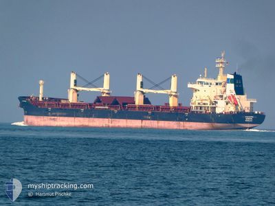
TRANSNORDIC
Bulk Carrier
Current Trip
| Time Travelled | 4 h, 55 mins |
|---|---|
| Remaining Time | 1 day |
| Distance Travelled | 39.36 nm |
| Remaining Distance | 303.75 nm |
| AVG Speed | 10.4 Knots |
| MAX Speed | 11.8 Knots |
| AVG Wind | 8.4 knots |
| MAX Wind | 14 knots |
| MIN Temp | 0.2°C / 32.36°F |
| MAX Temp | 3.9°C / 39.02°F |
| Dybgang | 6.4 m |
| Position Modtaget | 1 h, 15 m siden |
Current Position
| Longitude | --- |
|---|---|
| Latitude | --- |
| Status | Under way using engine |
| Fart | 11.6 Knots |
| Kurs | 319.8° |
| Område | North Sea |
| Station | T-AIS |
| Position Modtaget | 1 h, 15 m siden |
Info
Information
The current position of TRANSNORDIC is in North Sea with coordinates 53.91024° / 7.73216° as reported on 2026-01-03 11:22 by AIS to our vessel tracker app. The vessel's current speed is 11.6 Knots and is heading at the port of SKAGEN. The estimated time of arrival as calculated by MyShipTracking vessel tracking app is 2026-01-04 14:21 LT
The vessel TRANSNORDIC (IMO: 9602174, MMSI: 636023850) is a Bulk Carrier that was built in 2012 ( 14 år gamle ). It's sailing under the flag of [LR] Liberia.
In this page you can find informations about the vessels current position, last detected port calls, and current voyage information. If the vessels is not in coverage by AIS you will find the latest position.
The current position of TRANSNORDIC is detected by our AIS receivers and we are not responsible for the reliability of the data. The last position was recorded while the vessel was in Coverage by the Ais receivers of our vessel tracking app.
The current draught of TRANSNORDIC as reported by AIS is 6.4 meters
Weather
| Temperature | 4°C / 39.2°F |
|---|---|
| Wind Speed | 20 knots |
| Direction | 285° WNW |
| Pressure | 996.3 hPa |
| Humidity | 62.8 % |
| Cloud Coverage | 93 % |
Featured Company
Most Visited Ports (Last year)
| Port | Arrivals | |
|---|---|---|
| 3 | ||
| 1 | ||
| 1 | ||
| 1 | ||
| 1 | ||
| 1 |
Events
| Tid | Hændelsen | Detaljer | Position / Dest | Info |
|---|---|---|---|---|
| 2026-01-03 11:26 | Status er ændret | Default Under way using engine |
53.91936 / 7.72031
DKSKA
|
Fart: 11.6 kn Kurs: 319.8° |
| 2026-01-03 11:22 | Udenfor Dækning |
53.91024 / 7.73216
North Sea
DKSKA
|
Fart: 11.6 kn Kurs: 319.8° |
|
| 2026-01-03 11:19 | Status er ændret | Under way using engine Default |
53.90243 / 7.74425
DKSKA
|
Fart: 11.8 kn Kurs: 306° |
| 2026-01-03 11:16 | Status er ændret | Default Under way using engine |
53.89605 / 7.75444
DKSKA
|
Fart: 11.7 kn Kurs: 301.3° |
| 2026-01-03 11:01 | Status er ændret | Under way using engine Default |
53.87892 / 7.83259
DKSKA
|
Fart: 11.2 kn Kurs: 287° |
| 2026-01-03 10:33 | Status er ændret | Default Under way using engine |
53.85683 / 7.97411
DKSKA
|
Fart: 12 kn Kurs: 281.8° |
| 2026-01-03 10:15 | Status er ændret | Under way using engine Default |
53.83731 / 8.06646
DKSKA
|
Fart: 11.8 kn Kurs: 299° |
| 2026-01-03 10:09 | Status er ændret | Default Under way using engine |
53.82733 / 8.09820
DKSKA
|
Fart: 11.8 kn Kurs: 324.1° |
| 2026-01-03 07:42 | Afsejlet fra sidste havn |
|
53.52416 / 8.56044
DKSKA
|
Fart: 6.8 kn Kurs: 51° |
| 2026-01-03 07:26 | START Sejllads |
53.50388 / 8.51435
[DE] NORDENHAM
|
Fart: 4.8 kn Kurs: 51° |